
 Lesson 5.1
Lesson 5.1 · Housing & Neighbourhoods
Residential Urbanism
How housing typologies become the everyday fabric of the city
The city is mostly somebody's home
Strip away the monuments, the malls and the office towers and what remains is housing, block after block of it, covering most of the land in any city. The choices a designer makes about housing type, plot size and how dwellings meet the street decide, more than any landmark, whether a place feels alive or dead. This is where urban design does its quiet, vast work.
Fill your neighbourhood's buildings black. Is the white left over a street, or just leftover?
Housing is the city's connective tissue
Open any figure-ground plan, the black-and-white drawing that fills buildings solid and leaves streets and open space white, and one thing is instantly clear: the overwhelming majority of the black is housing. Monuments and civic buildings are the punctuation; housing is the sentence. Kevin Lynch taught us to read the city as paths, edges, districts, nodes and landmarks, but the districts, the parts you actually live in and move through daily, are made almost entirely of dwellings. This means that residential urbanism is not a specialised sub-topic tucked beside 'real' urban design; it is the main event. Get the housing fabric right and the streets, the squares, the shade and the street life largely follow. Get it wrong, as so much twentieth-century mass housing did, and no amount of decorative civic gesture can rescue the district. The crucial mental shift is to stop seeing a house as an object on a plot and start seeing it as a piece of city, one cell in a tissue whose collective pattern makes the block, the street and ultimately the neighbourhood. Aldo Rossi in The Architecture of the City argued that the 'residential district' is one of the primary elements through which a city persists and renews itself. The typology you choose, and the way many copies of it aggregate, is therefore an urban decision long before it is an architectural one. A thousand well-designed villas scattered on cul-de-sacs make a worse city than a thousand modest flats arranged as perimeter blocks along walkable streets, because the aggregation, not the individual dwelling, is what you live in.
The core residential typologies
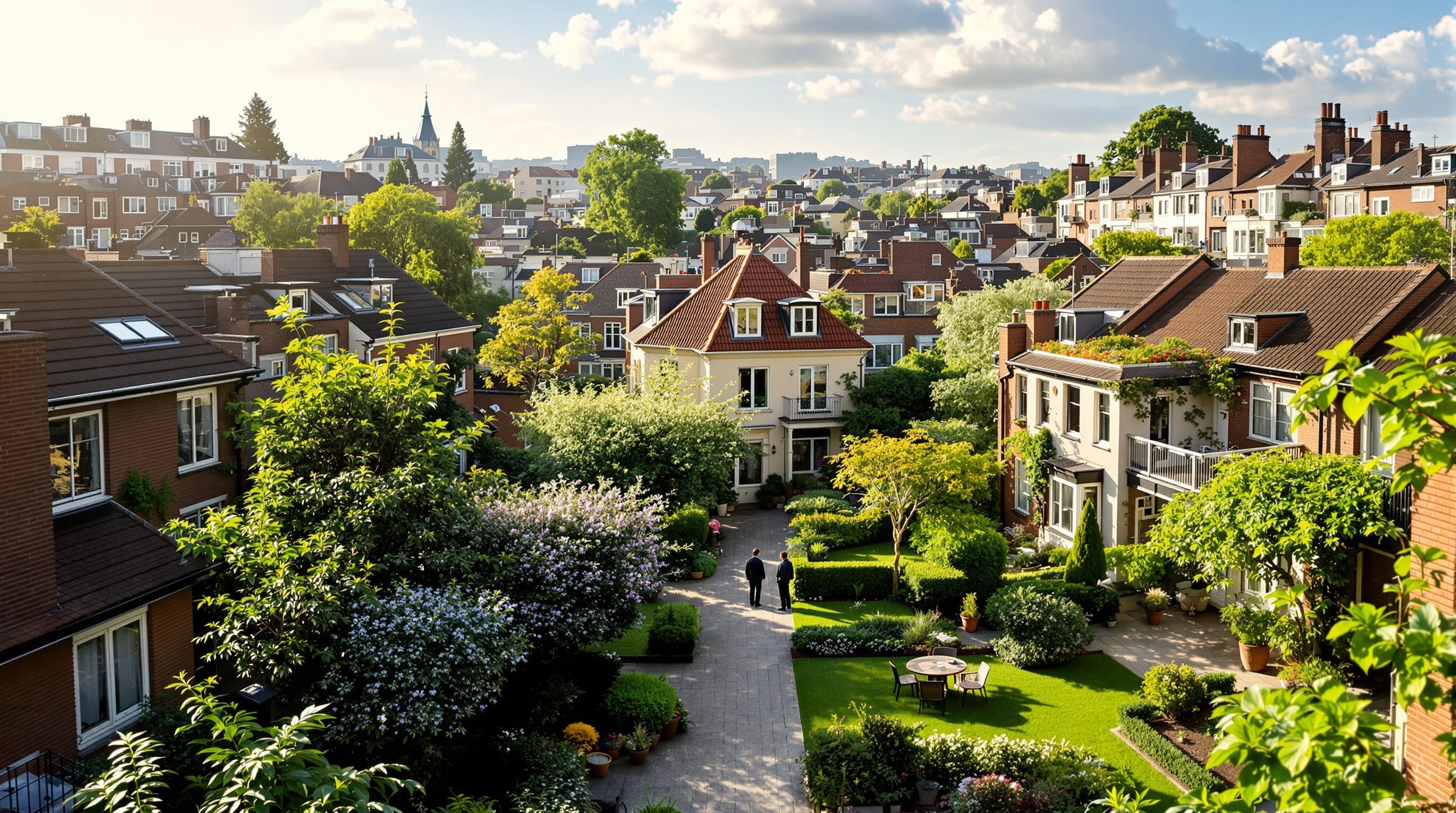
A working designer needs a clear vocabulary of housing types, because each aggregates into a different kind of city. The row house, or terrace, places narrow dwellings shoulder to shoulder, each with its own front door on the street and a private yard behind; it is the workhorse of London, the bylaw terraces of industrial England, and the shophouse rows of older Indian bazaars. The perimeter block wraps buildings around the edge of a block to enclose a shared courtyard, giving a hard, active street edge on the outside and calm green on the inside, the DNA of Barcelona's Eixample, Berlin, Amsterdam and Paris. Mat housing, sometimes called low-rise high-density or carpet housing, weaves single- and double-storey courtyard dwellings into a dense, ground-hugging mat threaded with lanes, echoing the traditional courtyard fabric of Jaisalmer, Ahmedabad's pols or a Moroccan medina. Point towers are slender free-standing blocks with a small footprint and few flats per floor, casting little shadow and preserving views; slab blocks are long, wide bars of flats served by a corridor, efficient but prone to creating dead ground and long shadows. Finally, plotted development, the default of most Indian city expansion, subdivides land into individual plots that owners build out incrementally, producing the familiar mixed, ever-changing streetscape of independent houses that grow floor by floor. Each type is a different bargain between privacy, density, cost, street life and the ground it leaves free. The figure lays the main types side by side so you can compare how each meets the street and the sky.
Density is not one number
The single most misunderstood word in residential urbanism is 'density'. People treat it as a single dial, low to high, and assume high density means towers and low density means bungalows. Both assumptions are wrong. Density has at least three distinct meanings that must never be confused: dwelling units per hectare (how many homes), population per hectare (how many people, which depends on household size), and floor space ratio, known in India as FSI or FAR (how much built floor area relative to plot area). These pull apart constantly. A slum can reach a population density that dwarfs a luxury high-rise, because the towers house small, wealthy households at low occupancy while the informal settlement packs large families into tiny rooms. Crucially, the same FSI can be delivered as a few tall towers on a mostly empty site, or as a continuous four-to-six-storey perimeter fabric that covers the ground and lines every street. The Spanish architect and the tradition behind Barcelona's Eixample show that a mid-rise perimeter block at six or seven storeys achieves very high density while keeping a human, walkable street; you do not need towers for density. Leslie Martin and Lionel March demonstrated this mathematically in the 1960s at Cambridge: for a given plot ratio, a perimeter court arrangement frees more usable open space and casts less overshadowing than an array of towers. This is the liberating insight of the module: liveable density is a question of form, not just of number. The designer's real question is never simply 'how dense?' but 'what form should this density take?'
Why the tower-in-the-park failed
No idea shaped twentieth-century housing more, or disappointed more thoroughly, than Le Corbusier's tower-in-the-park. The vision was seductive: lift housing into slender towers, free the ground for parkland and sunlight, separate people from cars, and repeat the type across the city. The Ville Radieuse promised light, air and greenery for the masses. In practice, from Pruitt-Igoe in St. Louis to countless housing estates worldwide, the model often produced the opposite of a good neighbourhood. Jane Jacobs diagnosed why: the 'park' between towers became nobody's land, unwatched, unloved and unsafe, precisely because it belonged to everyone and no one. Without the street-facing front doors and shopfronts that put 'eyes on the street', the ground plane died. Oscar Newman's study of 'defensible space' showed that residents naturally guard territory they can see and claim, and the anonymous shared voids of tower estates gave them nothing to claim. The lesson is not that tall buildings are evil, Singapore and Hong Kong show towers can house people superbly, but that towers scattered in undifferentiated open space break the fundamental grammar of the city: the clear line between public street and private home, and the active edge where the two meet. Much Indian redevelopment, when it demolishes low-rise fabric and rehouses residents in isolated tower clusters, risks importing this exact failure. The corrective, worked out over decades, is to keep the street, define the block, and put dwellings and their doors along the public edge, whatever the height.
Plotted development and the incremental city
The most common way Indian cities actually grow is plotted development: a development authority or private layout subdivides land into plots, provides roads and services, and individual owners build houses over years and decades, often adding a floor at a time as the family grows or a rental unit becomes affordable. This produces the characteristic Indian residential street, an irregular, lively terrace of independent houses of varying height, colour and completeness, with ground-floor shops appearing organically on corners and busier roads. It is easy to dismiss this as chaotic, but plotted development has real virtues: it spreads investment across thousands of small builders, adapts flexibly to family needs, allows mixed use to emerge naturally, and keeps ownership and maintenance in the hands of residents who care. Its vices are equally real: without design guidance it wastes land on setbacks that become nobody's space, produces poor street enclosure, and can sprawl inefficiently. The URDPFI Guidelines and local Development Control Regulations govern this through plot sizes, ground coverage, setbacks and permissible FSI. A thoughtful designer working in the Indian context does not fight plotted development but shapes it, using building lines, frontage rules and corner-shop permissions to nudge thousands of individual decisions toward a coherent, walkable street. The pol houses of the old walled city of Ahmedabad show how dense, sociable, climate-responsive residential fabric can emerge from many small plots bound by a shared culture of the street; the challenge is to achieve that coherence today through design codes rather than custom.
Making density feel generous
The deepest skill in residential urbanism is making density feel like abundance rather than crowding, because the difference is almost entirely a matter of design, not of numbers. High density feels generous when the public realm is generous: when streets are shaded and walkable, when there is a good park within a few minutes' walk, when the ground floor gives something back to the street, when daylight reaches into flats and courtyards, and when private, semi-private and public space are clearly graded so residents know what is theirs. Christopher Alexander's A Pattern Language catalogued dozens of these moves, from 'four-storey limit' to 'positive outdoor space', each a small rule for keeping density humane. Density feels grim, by contrast, when the same number of homes is delivered with no shade, no accessible green, dead frontages, deep dark flats and ambiguous leftover space. This is why the perimeter block endures: it delivers real density while guaranteeing an active street outside and a protected communal court inside, grading space clearly from public pavement to private balcony. The figure-ground test is a designer's quickest diagnostic: if the black (building) makes clear, positive white (streets and squares) you likely have good urban fabric; if the white is shapeless leftover around scattered black objects, you likely have failed housing. As you master the typologies, keep asking the only question that finally matters to a resident: on the walk from the street to my front door, does this place feel like it was designed for a person, or merely filled to a permitted number?
URDPFI Guidelines
National guidance on residential densities, plot standards and layout norms
Sets indicative dwelling-unit densities and layout principles that state and city plans adapt; treat as a reference, not a ceiling on good form.
Development Control Regulations / DCPR (city level)
FSI/FAR, ground coverage, setbacks, plot sizes, height limits
The statutory instrument that actually shapes residential form; always confirm the current DCR/DCPR with the local development authority before designing.
National Building Code (NBC) of India, BIS
Light, ventilation, open space, fire and habitability for dwellings
Governs the liveability minimums, room sizes, light and ventilation, that keep dense housing humane; the current edition is published by BIS.
CPHEEO manuals
Water supply, sewerage and services for residential layouts
Density decisions must be checked against the servicing capacity these manuals inform; density without services is not liveable.
Same density, four forms
Test the module's central claim by delivering one identical density in four different residential forms on the same site.
Tracing paper, scale rule, pencil; optional QGIS or OpenStreetMap for a real site
Take a square site of one hectare and a target of, say, an FSI of 2.0. Everything below must hit that same total floor area.
- 1Sketch the site built out as (a) point towers in open space, (b) a mid-rise perimeter block, (c) low-rise mat/courtyard housing, and (d) plotted development, each reaching the same total floor area.
- 2For each, draw the figure-ground and mark the public street edge, the private outdoor space and any leftover ambiguous space.
- 3Estimate ground coverage, usable open space and the length of active street frontage for each option.
- 4Write one paragraph on which form makes the density feel most generous, and why, referring to shade, frontage and the gradient from public to private.
You’ll walk away with
Four figure-ground sketches at the same density with a comparison note on liveability, frontage and open space.
Three altitudes on the same idea
Read the band that fits you — or all three.
Design each dwelling as a cell in a larger tissue, not a freestanding object. Fix how your building meets the street, the front door, the ground floor, the setback, before you resolve the plan, because that edge is what your neighbours and the public actually experience. Favour types, like the perimeter block or the row house, that give an active street edge and a clear gradient from public to private.
As the urban designer you choose the typology and the block structure that will be repeated hundreds of times, so you are really designing the street and the density at once. Specify the form of density, not just the FSI: decide whether a plot ratio arrives as towers-in-space or as a continuous mid-rise fabric, and write the building lines, frontage and ground-coverage rules that make thousands of individual buildings add up to a coherent, walkable neighbourhood.
Learn the handful of housing types by heart, row house, perimeter block, mat, point tower, slab, plotted, and sketch how each meets the street and the sky. Then practise the figure-ground test on your own neighbourhood: fill the buildings black and ask whether the white space left over is a shaped street or shapeless leftover. That single drawing will teach you to see housing as city.
“High density means tall towers, and low-rise always means low density.”
Do it yourself
Quick checks before you move on.
- 1Name five residential typologies and describe in one line how each meets the street.
- 2Explain how the same FSI can produce completely different urban form and liveability.
- 3State why the tower-in-the-park model so often failed as neighbourhood-making.
Pulling it together
Peer-reviewed journals & authoritative standards
- 01Town and Country Planning Organisation, URDPFI Guidelines — TCPO, Ministry of Housing and Urban Affairs, 2015.
- 02Kevin Lynch, The Image of the City — MIT Press, 1960.
- 03Aldo Rossi, The Architecture of the City — MIT Press, 1982.
- 04UN-Habitat, guidance on density and urban form — UN-Habitat, 2020.
If housing is the fabric, the next lesson asks how much of it forms a community you can serve and walk, the enduring idea of the neighbourhood unit.
The author
Amogh N P
Architect, interior designer, and creative polymath. Studio Matrx began in his notebooks — his vision of design made honest, useful, and open to everyone. Its Academy is written and taught in his memory, and free, forever.
More about Amogh →