
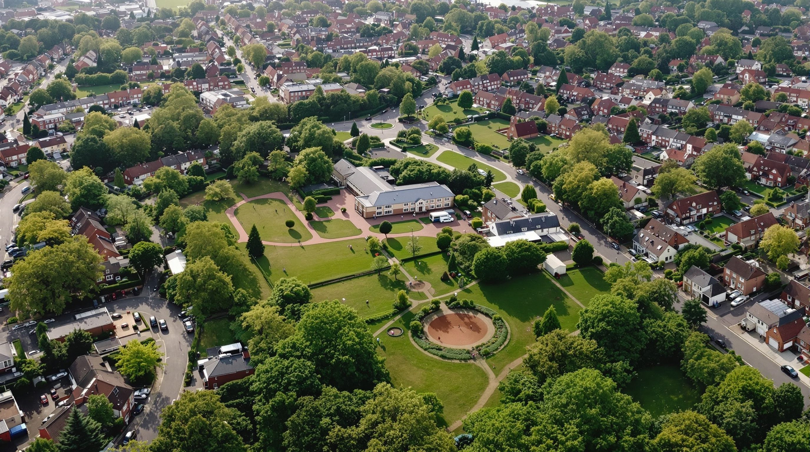
 Lesson 5.2
Lesson 5.2 · Housing & Neighbourhoods
The Neighbourhood Unit
From Clarence Perry's diagram to the 15-minute neighbourhood
A community you can walk across
In 1929 a sociologist drew a simple diagram: a residential area small enough that a child could walk to school without crossing a major road, with shops and a park at its heart. That diagram, the neighbourhood unit, has shaped how we plan communities for a century, and its core idea has just been reborn as the 15-minute city.
Time a five-minute walk from your door. Everything you reach is your neighbourhood, whether the plan says so or not.
Clarence Perry draws a community
The neighbourhood unit is the most influential planning diagram of the twentieth century, and it began with a social worry rather than a formal one. Clarence Perry, working with the Regional Plan of New York in 1929, was troubled by how the rising tide of motor traffic was cutting up communities and endangering children. His answer was to define a self-contained residential cell organised around a single, powerful sizing rule: the whole neighbourhood should be small enough that no child has to cross a busy arterial road to reach the primary school at its centre. From that one rule the rest of the diagram followed with almost mathematical inevitability. The primary school, sized for the community it serves, sits at the heart. A quarter-mile to half-mile walk, roughly a five to ten minute stroll, defines the radius, which yields a population of a few thousand, enough to support that one school. Shops cluster at the edges and corners where two neighbourhoods meet, so trade is shared. Through-traffic is kept to the bounding arterials, never funnelled through the interior, while internal streets are quiet and looping to discourage rat-running. A generous share of the land, around a tenth, is given to parks and playgrounds woven through the fabric. Perry's genius was to derive an entire spatial order from a single human measure, the walking child, and that derivation is why the diagram still teaches so well. The figure reconstructs his classic arrangement so you can trace how each element follows from the walk to school.
Six principles that still hold
Strip Perry's diagram to its logic and you find six principles that remain a solid checklist for community design. First, size by the catchment: fix the population and area around the walking radius of a key daily institution, historically the primary school. Second, put the civic and social heart at the centre, the school, community hall, place of worship and green, so daily life has a shared focus within walking distance. Third, put shops at the edges and intersections, where several neighbourhoods can support them together, rather than starving each cell of trade. Fourth, keep the boundaries legible and safe, with arterials forming the edges and carrying through-traffic, so the interior belongs to residents and children. Fifth, thread open space throughout, not as one leftover park but as a connected system of greens and playgrounds reachable on foot. Sixth, give internal streets a hierarchy that serves local access, not through-movement. Notice how modern this sounds: it is essentially a specification for a walkable, mixed, self-sufficient community. Radburn, New Jersey, built from 1929 by Clarence Stein and Henry Wright, translated the ideas into a real 'town for the motor age' with superblocks, cul-de-sacs and a pedestrian greenway network. The British New Towns after 1946, from Stevenage to Milton Keynes, were built as constellations of neighbourhood units. And Le Corbusier's and the team's Chandigarh organised the whole city as self-contained 'sectors', each roughly 800 by 1200 metres with an internal market street and green belt, arguably the purest large-scale neighbourhood-unit plan ever executed.
The pedestrian shed
The operational heart of the neighbourhood unit is a measure worth mastering in its own right: the pedestrian shed, or 'ped shed', the area within a comfortable walk of a centre. Convention sets it at a quarter-mile, about 400 metres or a five-minute walk, for the most everyday needs, and a half-mile, about 800 metres or a ten-minute walk, for a transit stop or a larger centre. New Urbanists adopted the quarter-mile as the radius of the neighbourhood and the half-mile as the radius of the transit-served district, a distinction that reappears directly in the next lesson on transit-oriented development. But there is a crucial subtlety that separates naive from expert use of the ped shed. The radius draws a perfect circle, the 'crow-fly' catchment, but people walk along streets, not through walls. The real, walkable catchment, sometimes called the 'pedestrian shed' proper or the 'walkshed', is the area you can actually reach along the street network in a given time, and in a poorly connected, cul-de-sac layout it can be less than half the area of the ideal circle. This is why block size and connectivity, covered in the streets module, are inseparable from neighbourhood planning: a fine-grained, permeable street grid makes the ped shed swell toward its ideal circle, while a coarse, disconnected layout collapses it. The figure contrasts the ideal circular catchment with the shrunken real walkshed of a badly connected layout, the single most important diagram in this lesson.
Where the idea went wrong
For all its influence, the neighbourhood unit drew sharp, deserved criticism, and a serious designer must hold both the idea and its flaws. Jane Jacobs, the most powerful critic, argued that the whole notion of the inward-looking, self-contained cell misunderstood how great cities actually work. Real urban vitality, she showed, comes from overlap, mixing and the crossing of paths between communities, not from sealing each community into a tidy introverted unit turned away from its neighbours. The arterial 'boundaries' that Perry drew to protect children can become dead barriers that isolate communities and concentrate disadvantage, a danger visible whenever a poor neighbourhood is walled off by highways. There is also a real risk of social homogeneity and, at worst, segregation: a unit sized and priced for one kind of household can become a monoculture, a concern we take up directly in the affordable-housing lesson. Isaac Reed and others noted that the diagram assumes a fixed, knowable population and a single dominant institution, assumptions that fit a mid-century suburb far better than a dense, mixed, evolving Indian city. And the school-as-centre logic weakens where children are bussed, schooled privately, or where the daily anchor is a market or transit stop rather than a school. The mature position is not to discard the neighbourhood unit but to keep its walkable, human-scaled ambition while rejecting its introversion, connecting neighbourhoods richly to one another rather than sealing them off.
The local high street as the real heart
If there is one element that has proven more durable than the school-at-the-centre, it is the local high street, the everyday commercial spine where the neighbourhood shops, eats, meets and does its ordinary business. Where Perry pushed shops to the edges, later thinking, and everyday Indian reality, put a lively mixed-use street at the heart of neighbourhood life. Think of the main bazaar street of any Indian mohalla or the market road of a Delhi colony or a Mumbai suburb: a fine-grained run of small shops at ground level with homes above, chai stalls, a vegetable market, a clinic, a temple or mosque, all within a few minutes' walk. This is the working heart of a neighbourhood, and it succeeds on principles you can design for: continuous active frontage so the walk is interesting and watched, small plot widths so many businesses can afford a doorway, a mix of daily needs so trips chain together, and enough resident density within the ped shed to keep the shops viable. The high street also solves Jacobs' objection to introversion, because a good high street is a seam, not a boundary: it draws people from several neighbourhoods and stitches them together. A key design lever is the ground floor: mandate or encourage active, shallow, subdividable ground-floor space along the spine and forbid blank walls and parking podiums that kill it. Width matters too: a high street that is comfortable to cross on foot, with slow traffic and frequent crossings, keeps both sides of the street commercially alive, whereas an over-widened road splits the trade in two and slowly hollows out the frontage. The neighbourhood's soul lives on this street, and protecting its fine grain against the blank frontage of malls and gated podiums is one of the most valuable things an urban designer can do.
The 15-minute neighbourhood, reborn
The oldest good idea in planning is suddenly the newest. The '15-minute city', popularised by Carlos Moreno at the Sorbonne and adopted as policy by Paris under Mayor Anne Hidalgo, holds that residents should be able to meet most daily needs, living, working, shopping, healthcare, education and leisure, within a 15-minute walk or cycle of home. Related terms abound: the '20-minute neighbourhood' in Melbourne and Scotland, the 'complete neighbourhood' in Portland, 'chrono-urbanism' for the underlying focus on time rather than distance. This is unmistakably Perry's neighbourhood unit renewed, but with the flaws corrected: it drops the introversion, embraces mixed use and social diversity, adds cycling to extend the shed, and frames the goal as access to daily needs by time rather than a sealed cell around a single school. Its power is partly rhetorical, it gives citizens and mayors a vivid, testable promise, and partly analytical, because you can map a city's 'completeness' by measuring what share of residents can reach each daily need within the time budget. The idea travels well to Indian cities, where dense mixed-use fabric already delivers 15-minute access in older cores like a Jaipur mohalla or Ahmedabad's old city, and where the real task is to protect that access as cities redevelop and sprawl. Whether you call it the neighbourhood unit, the ped shed, the complete neighbourhood or the 15-minute city, the enduring test is the same: can an ordinary person, and especially a child or an elder, meet the ordinary needs of a day on foot? Design so the answer is yes.
URDPFI Guidelines
Hierarchy of residential units, social infrastructure and per-capita open space
Sets indicative catchment populations and walking distances for schools, parks and local shopping that echo the neighbourhood-unit logic; adapt to local density.
CNU Charter of the New Urbanism
Neighbourhood, district and corridor principles including the pedestrian shed
Codifies the quarter-mile neighbourhood and half-mile transit shed; a useful, non-statutory design reference.
Chandigarh sector plan (worked precedent)
City organised as self-contained neighbourhood sectors
A large-scale executed neighbourhood-unit plan; study both its walkable interiors and its critiqued introversion and vast arterials.
City Master / Development Plan social-infrastructure norms
Location and sizing of schools, health posts, parks per population
The statutory route by which neighbourhood-scale facilities are secured; confirm the applicable norms with the local development authority.
Map your real walkshed
Test the gap between the ideal catchment and the real, network-constrained walkshed for a place you know.
OpenStreetMap or a street map, tracing paper, coloured pens; optional QGIS
Pick a centre: your home, a school, a market or a transit stop. Get a street map or open OpenStreetMap for the area.
- 1Draw the ideal quarter-mile (400m) and half-mile (800m) circles around the centre.
- 2Now trace the actual area reachable along the streets in 5 and 10 minutes of walking, respecting walls, dead-ends and missing crossings.
- 3Shade the difference between circle and real walkshed, and mark every daily need (school, shop, park, clinic, transit) inside each.
- 4Propose two or three new connections, footpaths, cut-throughs or crossings, that would most enlarge the real walkshed toward the ideal circle.
You’ll walk away with
An annotated map showing ideal circles versus real walksheds, the daily needs reachable, and proposed connections to close the gap.
Three altitudes on the same idea
Read the band that fits you — or all three.
Your project sits inside someone's ped shed, so design its ground floor and entrances to add to the walkable daily life around it, not to subtract from it. Put active, subdividable frontage on the local high street, avoid blank walls and parking podiums at grade, and place entrances where they feed the pedestrian network. A single building can strengthen or puncture a neighbourhood's completeness.
As the urban designer you set the catchment: you size neighbourhoods around a walkable shed, locate the school, park and high street, and, crucially, lay the connected street grid that makes the real walkshed approach its ideal circle. Reject Perry's introversion, connect neighbourhoods to one another with seams like shared high streets, and audit completeness by mapping what share of residents reach each daily need within a 15-minute walk.
Learn the ped shed by walking it. Time a five- and ten-minute walk from your home and mark on a map everything you can reach, school, shop, park, clinic, transit. That is your real walkshed, and comparing it to the ideal circle teaches you instantly how connectivity shrinks or grows a neighbourhood. The neighbourhood unit is simply this drawing, designed on purpose.
“The 15-minute city is a brand-new idea that will make neighbourhoods self-contained and isolated.”
Do it yourself
Quick checks before you move on.
- 1State the single sizing rule Perry used to derive the whole neighbourhood unit.
- 2Explain why the real walkshed is usually smaller than the ideal ped-shed circle.
- 3Give Jane Jacobs' main objection to the neighbourhood unit and how the 15-minute city answers it.
Pulling it together
Peer-reviewed journals & authoritative standards
- 01Town and Country Planning Organisation, URDPFI Guidelines — TCPO, Ministry of Housing and Urban Affairs, 2015.
- 02Congress for the New Urbanism, Charter of the New Urbanism — Congress for the New Urbanism, 2000.
- 03Emily Talen, on neighbourhoods and the pedestrian shed — Routledge, 2019.
- 04UN-Habitat, guidance on planned neighbourhoods and 15-minute access — UN-Habitat, 2020.
A walkable neighbourhood is only just if everyone can afford to live in it, so the next lesson turns to affordable and inclusive housing.
The author
Amogh N P
Architect, interior designer, and creative polymath. Studio Matrx began in his notebooks — his vision of design made honest, useful, and open to everyone. Its Academy is written and taught in his memory, and free, forever.
More about Amogh →