
 Lesson 6.1
Lesson 6.1 · Sustainable & Resilient Urbanism
Climate-Responsive Urban Design
Shaping streets, blocks and surfaces to work with climate, not against it
The city writes its own weather
A city is not a neutral stage on which climate happens; it manufactures its own, running several degrees hotter than the countryside it replaced. Every street width, block orientation and paving choice is a thermostat setting. Design them well and you cool a million people for free; design them badly and you bake them.
In hot India, shade beats sky. A narrow shaded lane is not backward; it is climate genius.
The urban heat island
The single most important climatic fact about cities is that they are hotter than their surroundings, a phenomenon called the urban heat island. Replace vegetation and soil with asphalt, concrete and glass, and you swap surfaces that cool themselves by evaporating water for surfaces that absorb solar radiation by day and release it slowly all night. Add the waste heat of vehicles, air conditioners and industry, subtract the wind that buildings block, and a large city can run three to seven degrees Celsius warmer than nearby fields, with the gap widest on still, clear nights when rural land has cooled but the city's mass is still radiating the day's stored heat. This is not an abstraction in India. Delhi, Ahmedabad, Nagpur and Chennai routinely record night temperatures far above their peri-urban belts, and the 2010 Ahmedabad heatwave, which killed an estimated thousands, prompted the first Heat Action Plan in South Asia, a model now replicated across dozens of Indian cities. The heat island matters because heat is lethal, because it drives a vicious spiral of air-conditioning that dumps yet more heat outdoors and more carbon into the sky, and because it falls hardest on the poor, who live in the densest, least-green, most heat-trapping quarters and can least afford to cool themselves. Crucially for a designer, the heat island is not weather that simply befalls a city; it is a designed outcome. The intensity depends on things we control: how much of the ground is sealed and dark, how much is planted and pale, how the buildings are shaped and spaced, and whether the wind can still move through. Climate-responsive urban design is the deliberate management of these variables.
Height-to-width: the shape of shade
If the heat island is the problem, the geometry of the street is the first lever. Picture a street as a canyon between two walls of buildings, and describe it by a single ratio: the height of the flanking buildings divided by the width of the space between them, the H:W or aspect ratio. This one number, together with the street's orientation, governs how much sky each point on the ground can see, a quantity planners call the sky view factor. A wide, low street, a shallow canyon with H:W near 0.3, sees a lot of sky: it gets blasted by the midday sun and heats up, but at night it also radiates its heat freely to the cold sky and cools down. A deep canyon, H:W of 1.5 or 2, sees little sky: its walls shade the ground for much of the day, keeping surfaces cooler when the sun is fierce, but at night those same walls trap outgoing radiation and the street stays warm. There is no single right answer; the ideal aspect ratio depends on latitude and, above all, on which season and time of day you most need to defend against. In a hot-dry climate like Jaisalmer or Jodhpur, the traditional city is a masterclass: streets so narrow and deep that they are in shadow almost all day, a geometry that trades away nighttime cooling for the far more valuable prize of daytime shade in a place where midday heat is the killer. The lesson generalises: in most of hot India, shade is worth more than sky, and a compact, deep-canyon street form is climatically intelligent, which is exactly the opposite of the wide, sun-exposed arterial that modern planning tends to draw. The figure contrasts a shallow and a deep street canyon.
Pointing the grid at the sun and wind
Once you accept that geometry governs comfort, orientation becomes a design decision rather than an accident of the survey line. The direction a street runs decides which facades take the harsh low sun of morning and evening and how deep the shadows fall through the day. A street running east to west has a north side and a south side with very different sun exposure and, in the tropics, a long sun-baked run; a street running north to south shares the sun more evenly between its two sides and its buildings shade each other across the day. Orientation also decides whether a street becomes a channel for the prevailing breeze or a wall against it. The craft is to align the grid so that it invites the cooling wind, in coastal Chennai or Mumbai the sea breeze, in the plains the summer afternoon wind, while shading the streets and openings from the worst solar angles. This is old knowledge: the treatises of vaastu and the classical Shilpa Shastras prescribed orientation for exactly these reasons, and the walled cities of Jaipur and Ahmedabad were laid out with a keen sense of sun and wind long before the word microclimate existed. Modern practice sometimes forgets it, aligning grids to property lines or highways rather than to the sky, and then spends fortunes on mechanical cooling to fix a problem the plan created. A climate-responsive plan begins with a sun-path diagram and a wind rose for the specific site, not a generic template.
Ventilation corridors: letting the city breathe
Wind is the city's free air-conditioning, and preserving its paths through the urban fabric is one of the highest-leverage moves in climate-responsive design. A ventilation corridor is a deliberately kept-open channel, a wide street, a river or canal, a linear park, a rail alignment, that lets cooler, cleaner air flow from the urban edge into the overheated core, flushing out trapped heat and pollution. The idea is codified most rigorously in cities with acute heat and pollution problems: Stuttgart, sitting in a bowl, mapped the cold-air drainage flowing down its wooded hillsides at night and wrote binding rules to keep those channels clear of tall buildings, and Hong Kong developed Air Ventilation Assessment guidelines after the SARS epidemic underlined the danger of stagnant, wall-to-wall high-rise. For Indian cities the corridors are often already there and merely need protecting: the Sabarmati in Ahmedabad, the Mula-Mutha in Pune, the sea-facing openings of Mumbai and Chennai, the ridge and its forest in Delhi. The threat is the wall of towers built across the breeze, or the riverfront hardened and lined so densely that the cooling air can no longer reach inland. A climate-responsive master plan identifies its breezeways and defends them in the development control rules, capping heights and requiring gaps between towers along key corridors so the wind is not bricked out. It is far cheaper to keep a corridor open than to cool a city that has sealed itself in.
Cool and green: the skin of the city
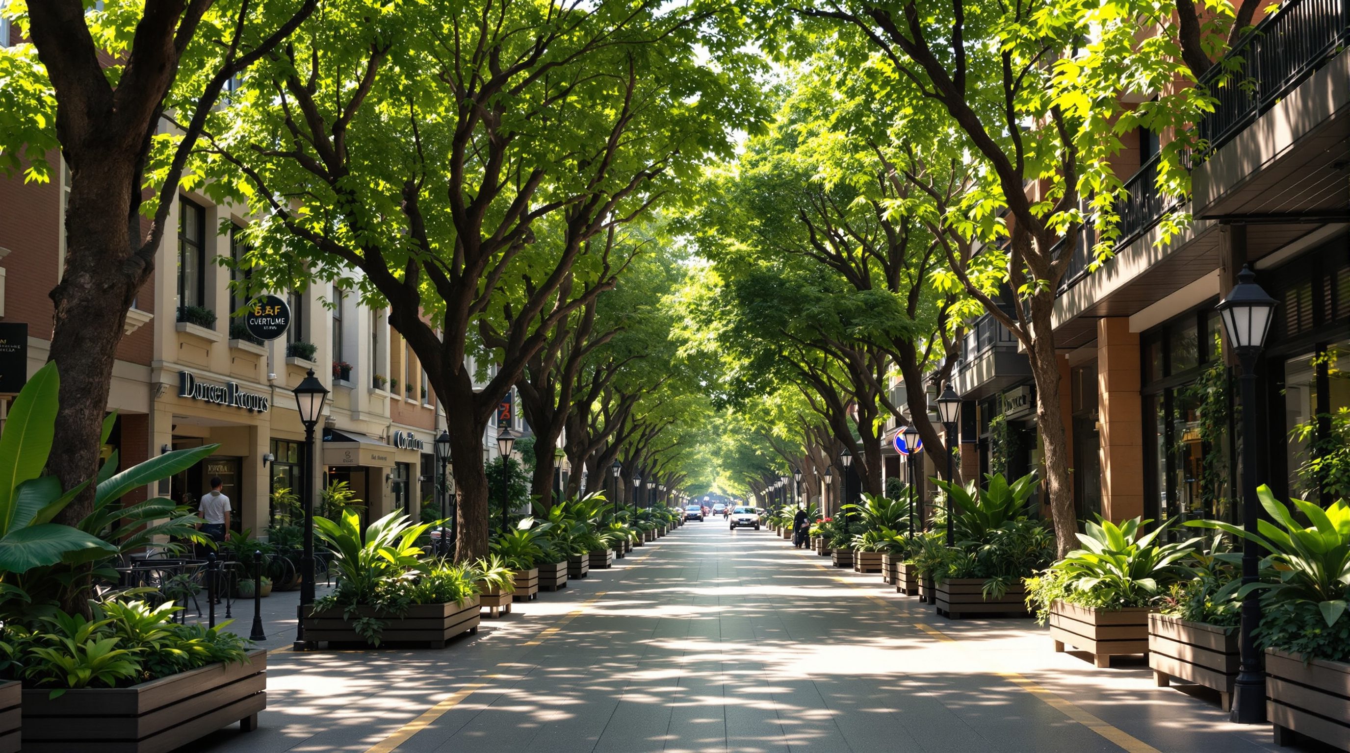
After geometry, orientation and airflow, the fourth lever is the physical skin of the city, its roofs, walls and ground, because their colour and material decide how much sun becomes heat. A dark asphalt road or a black bitumen roof can reach seventy degrees Celsius in the Indian summer sun, absorbing most of the radiation that hits it; a pale, reflective surface stays far cooler by bouncing that radiation back to the sky. This reflectivity is called albedo, and raising it across a city's roofs and pavements measurably lowers temperatures. India's own research and policy have embraced this: the Ahmedabad Heat Action Plan pioneered a cool-roofs programme, painting low-income rooftops white or with reflective lime, a cheap intervention that drops indoor temperatures by several degrees, and cool-roof provisions now feature in the national and state energy codes. Alongside reflective surfaces sits the more powerful green surface, the tree, the planted verge, the park, which cools not only by shading but by evapotranspiration, quietly pumping water into the air the way a wet cloth cools skin. A mature street tree is worth several tonnes of air-conditioning. The design principle is to attack the sealed, dark ground on every front: shade streets and car parks with canopy trees, replace impervious dark paving with lighter, permeable materials where structure allows, plant roofs and walls, and keep as much living, breathing, transpiring surface in the plan as density allows. Cool surfaces and green surfaces together are the fastest, most equitable way to bring a city's temperature down.
One country, five climates, five strategies
There is no universal climate-responsive template because India is not one climate but at least five, and the right strategy inverts from one to the next. The National Building Code and the design tradition recognise hot-dry, warm-humid, composite, temperate and cold zones, and each rewards a different urban form. In the hot-dry zone, Rajasthan, much of Gujarat, the strategy is compactness and shade: deep, narrow, shaded streets, thick masses to buffer the swing between scorching days and cool nights, courtyards and water for evaporative cooling, exactly the logic of Jaisalmer. In the warm-humid zone, Kerala, coastal Tamil Nadu, Bengal, the enemy is not the sun's intensity so much as oppressive humidity and stagnant air, so the strategy inverts: open the fabric, widen spacing, raise buildings on stilts and align everything to catch the sea breeze, sacrificing some shade for the far more valuable movement of air. The composite zone, Delhi, much of the northern plains, endures a brutal hot-dry summer, a humid monsoon and a genuinely cold winter, so its design must compromise across seasons, favouring shade and wind in summer while admitting some winter sun. Temperate Bengaluru or Pune can be gentler; cold Himalayan towns invert everything again, seeking sun and shelter from wind. The professional discipline is to name your zone first, then let its dominant discomfort, day heat, night heat, humidity, or cold, set the priorities for geometry, orientation, airflow and surface. A design imported from the wrong zone is not merely suboptimal; it can be dangerous.
The climate-responsive checklist
Climate-responsive urban design is not a style but a discipline of sequence: read the climate, then shape the fabric to it. In practice a designer runs a short, repeatable checklist for any site or plan. First, establish the climate zone and the single discomfort that most needs defending against, day heat, night heat, humidity, cold, or a seasonal mix. Second, set the street geometry, the H:W ratio and orientation, to deliver the shade or the sky exposure that discomfort demands, remembering that in most of India daytime shade is the prize. Third, identify and protect the ventilation corridors, the rivers, ridges, wide streets and open axes that let cool air in, and write their protection into the height and spacing rules. Fourth, treat every surface as a thermostat: maximise green and pale, minimise dark and sealed, shade the ground and cool the roofs. Fifth, integrate with the heat-action and disaster-management plans that increasingly govern Indian cities, because urban form and emergency response must work together. None of this requires exotic technology; the tools are the oldest in the planner's kit, the width of a street, the direction of a grid, the colour of a roof, the placement of a tree. What is new is the urgency, as climate change loads the dice toward hotter, more dangerous cities, and the recognition that the microclimate of a neighbourhood is designed, not given. The urban designer who internalises this holds one of the most powerful and least expensive levers for human comfort and survival that the profession possesses.
Energy Conservation Building Code / cool-roof provisions
Energy performance of buildings, including reflective roofs and envelopes
Cool-roof and envelope rules directly lower heat gain; state amendments and the eco-niwas code extend this to residential stock. Confirm the version adopted by your state.
Heat Action Plans (NDMA / city level)
Early warning and heat-mitigation measures for Indian cities
Ahmedabad's 2013 plan pioneered cool roofs and shade; urban form must align with the local Heat Action Plan's targets.
URDPFI Guidelines & National Building Code climate zones
Plan formulation and the five-zone climate classification
Provide the climate-zone framework and green-space norms; use them to set zone-appropriate geometry and open-space standards.
IGBC / GRIHA green-city and neighbourhood ratings
Voluntary sustainability ratings for buildings and layouts
Reward heat-island mitigation, tree canopy and cool surfaces; useful as a design checklist even where not mandatory.
Read your street's microclimate
Diagnose the climatic behaviour of one real street and prescribe three interventions, using nothing but observation and simple geometry.
Compass or phone, measuring tape or pacing, sketch paper, a sun-path chart for your latitude
Pick a street you walk often and note the time of day it feels hottest and coolest, and where the shade falls.
- 1Estimate the street's H:W ratio (building height divided by street width) and its orientation with a compass or phone, then sketch where the sun and shadow sit at midday.
- 2Map the surfaces: what fraction of the ground is dark and sealed, what is planted, and where are the trees. Note any breeze you can feel and where it comes from.
- 3Diagnose the dominant discomfort for your climate zone, day heat, night heat, humidity, or cold, and judge whether the street's form helps or hurts.
- 4Prescribe three interventions, for example canopy trees to shade the ground, a lighter road surface, or protecting a breeze path, and estimate roughly what each would do.
You’ll walk away with
A one-page microclimate diagnosis with an annotated section and three prioritised interventions.
Three altitudes on the same idea
Read the band that fits you — or all three.
Your building is one wall of a street canyon and one patch of the city's skin, so design it as a climatic citizen. Set your facade and roof albedo, your shading and your openings to the sun path and prevailing wind of the actual site, not a generic template. Where you can, give the street shade at the ground plane and keep your massing from blocking a breezeway your neighbours depend on.
As the urban designer you hold the master thermostat: the width and orientation of streets, the H:W ratios that decide shade, the corridors that let wind through, and the rules that govern surfaces. Encode climate into the development control regulations, not just the design guide, capping heights along breezeways, mandating street trees and cool roofs, and tuning the block form to the city's climate zone. You cool a city block by block, plan by plan.
Think of the city as a machine that makes its own weather, and of every street as a canyon whose depth decides its shade. Learn to read a sun-path diagram and a wind rose, then walk your own neighbourhood asking where it is hot and why. The intuition, shade beats sky in hot India, wind is free cooling, dark sealed ground is the enemy, will serve you in every project you ever touch.
“Wider, more open streets and towers with lots of space around them make a city cooler and airier.”
Do it yourself
Quick checks before you move on.
- 1Explain why a narrow, deep street in Jaisalmer is climatically intelligent for a hot-dry climate.
- 2Define the sky view factor and relate it to a street's H:W ratio.
- 3Name a ventilation corridor in an Indian city and say what would harm it.
Pulling it together
Peer-reviewed journals & authoritative standards
- 01UN-Habitat, guidance on climate change and urban form — UN-Habitat, 2022.
- 02C40 Cities, cool cities and urban heat resources — C40 Cities Climate Leadership Group, 2021.
- 03Town and Country Planning Organisation, URDPFI Guidelines — TCPO, Ministry of Housing and Urban Affairs, 2015.
- 04Indian Green Building Council, green cities and neighbourhood rating resources — Indian Green Building Council (IGBC), 2020.
Cooling by shade and airflow leads naturally to the living systems that provide them: the next lesson takes up green and blue infrastructure, the trees, parks and waters that do the work.
The author
Amogh N P
Architect, interior designer, and creative polymath. Studio Matrx began in his notebooks — his vision of design made honest, useful, and open to everyone. Its Academy is written and taught in his memory, and free, forever.
More about Amogh →