
 Lesson 6.2
Lesson 6.2 · Sustainable & Resilient Urbanism
Green & Blue Infrastructure
Treating parks, trees and waters as a working city system, not decoration
The city's living machinery
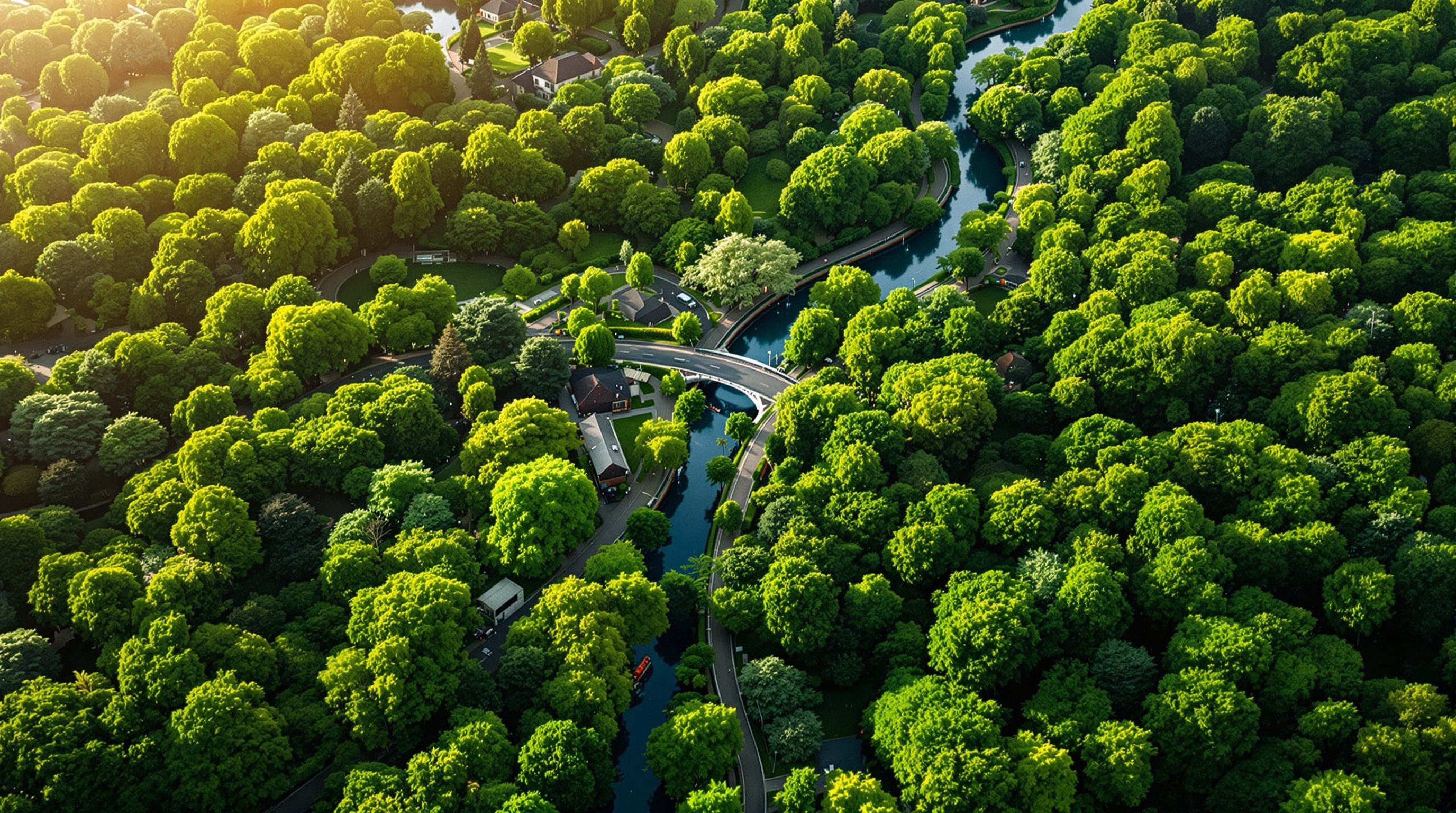
We are taught to see parks and rivers as amenities, nice if there is money left over after the real infrastructure is built. That is exactly backwards. A tree canopy is a cooling plant, a wetland is a stormwater works, a river is a ventilation duct. Green and blue systems are infrastructure that happens to be alive.
Draw the green and blue first. Let the buildings arrange themselves around the living systems, not the other way round.
Ecosystem services: what nature does for the city
The intellectual move that makes this lesson possible is to stop asking what a park looks like and start asking what it does. Ecologists call the benefits that living systems provide ecosystem services, and once you list them the case for treating nature as infrastructure becomes overwhelming. A mature tree canopy cools the air by shade and evapotranspiration, intercepts rainfall so less floods the drains, filters particulates from the air, sequesters carbon, dampens noise and lifts property values and mental health. A wetland or a lake stores floodwater, recharges groundwater, filters pollutants and moderates local temperature. A river corridor carries cool air into the city, supports fisheries and drains the land. These are not sentimental benefits; they are quantifiable services that a city would otherwise have to buy as grey infrastructure, pumps, chillers, filtration plants, flood culverts, at vastly greater cost and with none of the co-benefits. The discipline of green and blue infrastructure, GBI, is to plan, protect and design these living systems deliberately, as a network, with performance in mind, rather than leaving them as leftover space. The World Bank, UN-Habitat and a growing body of Indian practice frame nature-based solutions in exactly these terms: cheaper, more resilient and more equitable than the concrete alternatives they replace or complement. Reframing the humble neighbourhood park as a piece of the city's cooling and drainage system changes how you value it, where you place it, and how fiercely you defend it from being paved over.
From scattered parks to a green network
The word infrastructure carries a crucial implication: it must be a connected network, not a scatter of isolated pieces. A single roundabout garden does little; a continuous system of parks, greenways, tree-lined streets, river corridors and preserved natural land does a great deal, because connectivity multiplies the benefits. Wildlife can move along it, people can walk and cycle its length without crossing hostile traffic, cool air and stormwater can flow through it, and the pieces reinforce one another. This is the logic of the greenway and the green corridor, the linear park along a canal, a disused rail line or a river, stitching neighbourhoods together. Frederick Law Olmsted grasped this in the nineteenth century when he designed Boston's Emerald Necklace as a chain of connected parks rather than separate squares; modern practice extends it to the metropolitan scale. For an Indian planner the raw material is often already present and merely disconnected and degraded, the nalas and storm drains that were once streams, the temple tanks and lakes, the ridge forests, the riverbanks. The design task is to knit them back into a legible, protected network in the master plan, drawing the green and blue systems as a positive figure, land to be kept and linked, rather than the negative space between developable plots. A green network also structures the city legibly, giving it edges, seams and landmarks in exactly the sense Kevin Lynch described, so it serves the image of the city as well as its metabolism. The figure shows scattered parks re-linked into a working green-blue network.
Street trees and the urban forest
If green infrastructure has a workhorse, it is the street tree, and the metric that matters is canopy cover, the fraction of a city seen from above that sits under leaves. Ambitious cities set explicit canopy targets, thirty or forty percent, because the returns are so high: shaded streets are cooler and more walkable, tree-lined roads are calmer and safer, and the canopy quietly delivers cooling, cleaner air and stormwater interception across the whole city, not just in the parks. Yet street trees are chronically undervalued and easily sacrificed to road-widening, utility trenching and parking. Good practice designs the tree in from the start: adequate soil volume beneath the pavement, so roots have room and the tree survives past adolescence, species chosen for the climate and the space, and coordination with the utilities that otherwise mutilate the crown. Beyond the street, the urban forest, larger stands of dense native planting, does heavier ecological work. The Miyawaki method of planting dense, fast-growing native mini-forests on small urban plots has spread rapidly across Indian cities, from Chennai to Bengaluru, as a way to create biodiverse green quickly on marginal land. India also carries a deep tradition of the sacred grove and the great shade tree, the peepal, the banyan, the neem, at the heart of the settlement, a cultural inheritance that a thoughtful designer builds on rather than erases. The professional point is to treat trees as a capital asset with a maintenance budget, an inventory and a canopy target, not as decoration to be planted at inauguration and forgotten.
The blue network: lakes, tanks and rivers
The blue in green and blue infrastructure is the water, and in India it carries extraordinary weight because so much of it is both ecological and cultural heritage. The lakes of Bengaluru, the temple tanks of Tamil Nadu, the stepwells and baolis of the north, the tanks and kunds that once formed a cascading water system across the Deccan, were engineered infrastructure, storing monsoon rain, recharging wells, moderating floods and cooling their surroundings, long before piped supply. As cities grew, this blue network was catastrophically neglected: lakes were built over or turned into sewage sinks, tanks were encroached, streams were straitjacketed into concrete drains. The consequences are the recurring floods and water shortages that now plague Indian cities, a theme the next lesson takes up in detail. Reviving the blue network is therefore among the highest-value moves in Indian urban design, and it is a design and governance challenge as much as an engineering one: cleaning the water, restoring the natural edge instead of a hard concrete wall, preventing encroachment, and reconnecting the chain of tanks so water can once again move and store across the landscape. A restored lake or a daylighted stream returns a cascade of services at once, flood storage, groundwater recharge, cooling, biodiversity and a beloved public space, which is why blue infrastructure so often anchors a green network. Bengaluru's lake-revival citizen movements and the restoration of some of Chennai's and Hyderabad's tanks show both the difficulty and the payoff.
Waterfronts: promise and pitfall
Where a city meets a large water body, a river, a lake, a coast, sits some of its most valuable and most contested land, and the waterfront is where green and blue infrastructure becomes most visible and most political. Done well, a waterfront returns the water to the public as a great linear park, a cool, connected spine of recreation, movement and ecology, Ahmedabad's Sabarmati Riverfront being India's most prominent recent example, which reclaimed the riverbanks as continuous public promenade and park. Done badly, waterfront development hardens the natural edge into a concrete wall, privatises the frontage behind luxury towers, severs the river from its floodplain and the city from its water, and destroys the very ecology and flood function that made the water valuable. The Sabarmati project is instructive precisely because it is debated: it created cherished public space and flood-carrying capacity, but critics note the loss of the sandy riverbed ecology and the informal livelihoods it displaced. The design lesson is to hold two goals together, public access and ecological function, and to resist the temptation to treat the water merely as a scenic backdrop for real estate. A good waterfront keeps a soft, living edge where it can, preserves the floodplain as room for the river to rise, threads a continuous public path along its length, and connects the water back into the city's green network rather than walling it off. The riverfront is a test of whether a city sees its water as infrastructure and commons or as a view to be sold.
Designing for more than people
A city is a habitat, and the richness of the life it supports, its biodiversity, is both a measure of ecological health and a service in its own right, from pollination to pest control to the simple human need for contact with the living world. For decades urban design ignored non-human life or actively designed it out, favouring sterile lawns, exotic ornamentals and hard edges. Ecological design inverts this: it favours native species that support local insects and birds, layered planting that offers many niches, connected habitat so species can move, and a tolerance for the messy, the wild and the seasonal that manicured landscaping suppresses. India is one of the most biodiverse countries on earth, and its cities sit within that richness, hosting everything from the leopards of Mumbai's Sanjay Gandhi National Park to the migratory birds of urban wetlands. Designing for biodiversity means protecting the remnant natural land inside and around the city, wetlands, ridges, groves, coasts, restoring native ecosystems rather than importing generic landscaping, and building connectivity so isolated fragments do not slowly lose their species. It also means accepting a different aesthetic, one where a rain garden buzzing with insects or a native meadow left to seed is read as success, not neglect. The Landscape Institute and a growing Indian practice frame this as designing with nature rather than merely near it. For the urban designer the payoff is a city that is not only cooler and better drained but alive, and far more resilient for it, because diverse systems absorb shocks that monocultures cannot.
Standards, norms and the plan
Green and blue infrastructure only survives contact with real estate pressure if it is written into the binding instruments of planning, not left to goodwill. Indian practice has a starting kit. The URDPFI Guidelines set open-space and recreational norms, commonly expressed as a target of open space per thousand population and a hierarchy from tot-lot to neighbourhood park to city park and regional green. Master and development plans designate green belts, no-development zones along water bodies, and recreational land use that is meant to be inviolable. The challenge is enforcement: green and blue land is under constant pressure to be reclassified and built, and lakes and drains are encroached precisely because the plan's protections are weak or ignored. The professional's job is therefore twofold: to plan the network generously and connectedly in the first place, and to arm it with strong, legible, defensible rules, buffer zones along water bodies, tree-protection and canopy requirements, and open-space standards that cannot be quietly traded away. Emerging tools help: green-city and neighbourhood rating systems from IGBC and GRIHA reward measurable green and blue performance, and city biodiversity indices and tree censuses turn vague intentions into countable assets. The deepest shift, though, is conceptual, and it is the one this whole lesson argues for: to draw the city's living systems first, as the primary infrastructure they are, and let the buildable land arrange itself around them, rather than the reverse. A city that plans its green and blue network as seriously as its roads and drains will be cooler, safer, richer and more loved.
URDPFI Guidelines open-space and recreational norms
Per-capita open space and the park hierarchy in Indian plans
Set targets for green space per population and land-use categories for parks and green belts; the baseline for a green network.
Water-body buffer and no-development zone rules
Protection margins around lakes, tanks, rivers and drains
State and NGT-driven rules set buffers; confirm the applicable width with the local authority, as they vary and are frequently litigated.
IGBC / GRIHA green cities and neighbourhood ratings
Voluntary ratings rewarding canopy, biodiversity and blue-green features
Useful as a design checklist and to make green-blue performance countable even where not mandatory.
AMRUT green-space and water-body components
National mission funding parks and water-body rejuvenation
A funding route for reviving lakes and creating green space in Indian cities; align network plans to its criteria.
Map and mend a green-blue network
Take a piece of your city and redraw its green and blue systems as a connected network, finding the missing links.
OpenStreetMap or a base map, coloured pens or QGIS, tracing paper
On a base map (OpenStreetMap works), mark every park, tree-lined street, lake, tank, drain and river in your study area.
- 1Colour the green (parks, trees, groves) and the blue (lakes, tanks, streams, rivers) as a single system and look at where it is connected and where it is isolated.
- 2Identify three missing links, a street that could be a greenway, a drain that could be a daylighted stream, a gap between two parks, that would connect the fragments.
- 3For one lake or drain, sketch a restored soft edge and buffer, and note what services it would return, flood storage, recharge, cooling, biodiversity, public space.
- 4Draw the mended network as a positive figure and write two development-control rules that would protect it.
You’ll walk away with
A green-blue network map with three proposed links and two protective rules.
Three altitudes on the same idea
Read the band that fits you — or all three.
Your site is a node in the city's green and blue network, so design its edges to join, not break, it. Keep mature trees, give new planting real soil volume, hold a soft landscaped edge toward any water or open space, and let your ground plane extend the public green rather than walling it off. Treat stormwater and planting as part of the brief, not landscaping added at the end.
As the urban designer you draw the network: the greenways, canopy corridors, restored lakes and river spines that must be planned first and protected in the development control rules. Set canopy targets, buffer every water body, connect the fragments, and treat parks and waters as performing infrastructure with maintenance budgets and inventories. Your deliverable is a green-blue structure plan that the buildable land arranges itself around.
Stop seeing parks and rivers as decoration and start seeing them as machinery: a tree is a cooling plant, a wetland is a stormwater works, a river is an air duct. Learn the idea of ecosystem services, then walk your city and map its green and blue, noting where the network breaks. The habit of reading nature as infrastructure will reshape how you design forever.
“Green space is an amenity to add once the essential grey infrastructure, roads, drains and utilities, is built and paid for.”
Do it yourself
Quick checks before you move on.
- 1List four ecosystem services a mature street tree provides.
- 2Explain why a connected green network outperforms the same area of scattered parks.
- 3Name one Indian lake or tank revival and say what services its restoration returned.
Pulling it together
Peer-reviewed journals & authoritative standards
- 01World Bank, nature-based solutions and urban resilience resources — World Bank, Urban Development, 2021.
- 02UN-Habitat, urban green space and public space guidance — UN-Habitat, 2021.
- 03Landscape Institute, green infrastructure and biodiversity guidance — Landscape Institute (UK), 2020.
- 04Town and Country Planning Organisation, URDPFI Guidelines (open-space norms) — TCPO, Ministry of Housing and Urban Affairs, 2015.
Water is the most demanding of the blue systems, so the next lesson goes deep on managing the urban water cycle through water-sensitive urban design.
The author
Amogh N P
Architect, interior designer, and creative polymath. Studio Matrx began in his notebooks — his vision of design made honest, useful, and open to everyone. Its Academy is written and taught in his memory, and free, forever.
More about Amogh →