
 Lesson 4.1
Lesson 4.1 · Density, Land Use & Form
Density, FAR & Ground Coverage
How much city fits on a hectare, and why height is not the answer
Density is a dial, not a dirty word
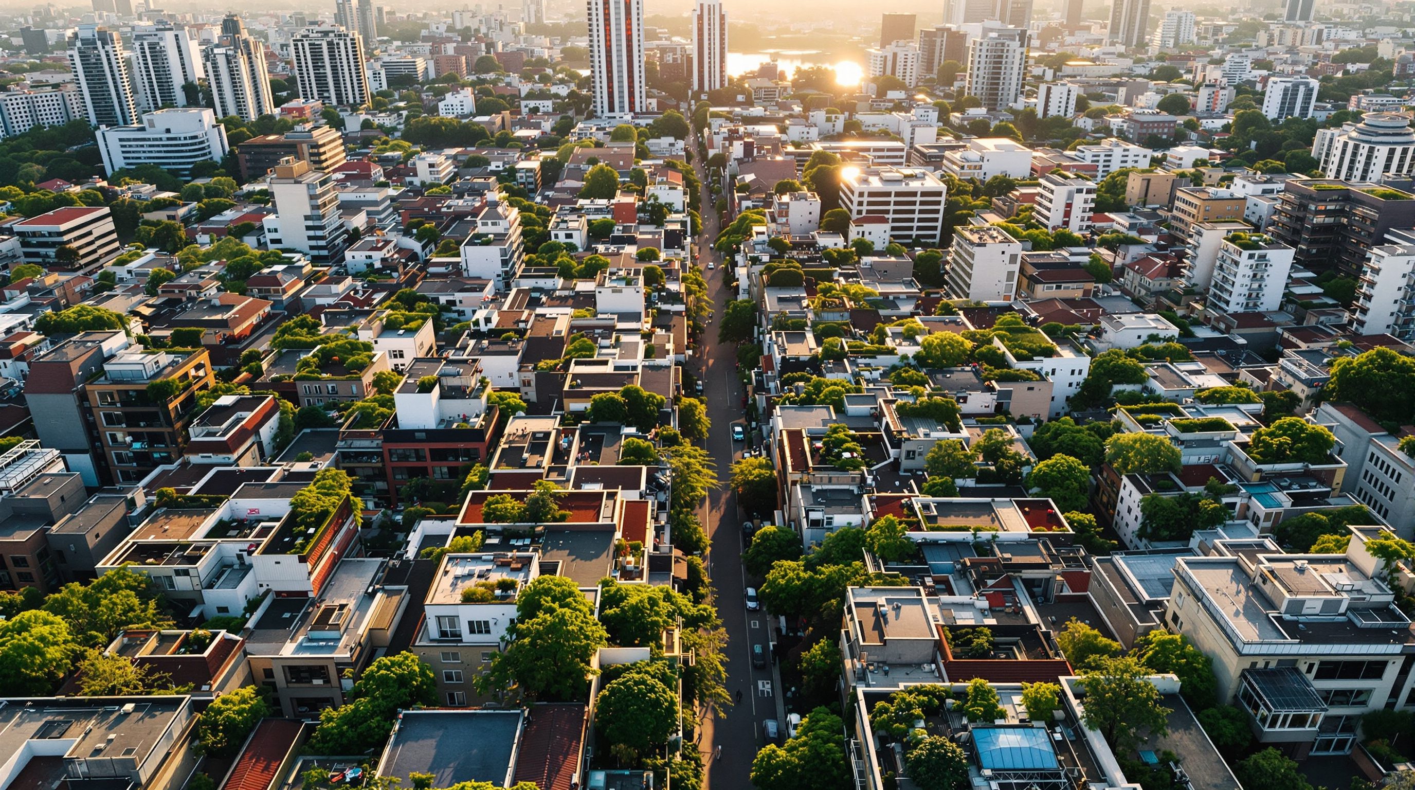
Ask a room to picture 'high density' and most people see grim towers and gridlock. Yet some of the most beloved places on earth, Paris, Barcelona's Eixample, the old core of Jaipur, are far denser than the towers people fear. Density is simply a number; what people actually love or hate is form. Learn to separate the two and you hold the single most powerful, most misused dial in city-making.
Same 300 dwellings/ha: Paris shrugs, a tower estate groans. Blame the form, not the number.
Density is a measurement, not a shape
Density counts how much of something sits on a given area of land: people per hectare, dwellings per hectare, or floor area per plot. That is all. It says nothing, by itself, about whether the result is a tower, a terrace or a bungalow colony. This is the confusion that poisons half of all planning arguments in India: residents hear 'higher density' and picture the isolated glass tower next door, when the same headcount could arrive as a gentle four-storey street of shops-with-homes-above. The distinction that unlocks everything is between density (a quantity) and form (a shape), and the fact that a single density can be built in radically different forms. Barcelona's Eixample carries roughly 300 to 400 dwellings per hectare in a calm, walkable, mostly six-to-eight-storey perimeter-block fabric with a courtyard in every block. Many an Indian tower 'township' delivers less density while feeling far more oppressive, because the form, isolated slabs in leftover parking, is worse. So the first professional habit is to refuse the lazy equation density-equals-towers. When a masterplan proposes to raise intensity, the real question is never only 'how much?' but always 'in what form?'. Hold those two questions apart and most density fights dissolve into design problems, which is exactly what they are.
Net density, gross density, and the trap between them
Before you can argue about a density figure you must know what land it is measured against, because the same neighbourhood yields wildly different numbers depending on the denominator. Net residential density counts dwellings (or people) only against the residential plot area itself, the land under and immediately around the housing. Gross density spreads the same dwellings across a larger area that also includes the streets, parks, schools, local shops and other supporting land the neighbourhood needs. Because the gross denominator is bigger, gross density is always the smaller number, often only half to two-thirds of the net figure. The trap is comparing one against the other, or quoting whichever flatters your case. A developer selling intensity may quote a high net density; an opponent may quote a low gross figure for the same scheme, and both can be technically correct. URDPFI guidance and most Indian development plans express residential density in gross terms for planning at the settlement scale, while a plot-level FSI calculation is inherently net. The professional discipline is simple but non-negotiable: always state your basis. Whenever you write or read a density number, ask 'net or gross, and of what land?', because a figure without that basis is not information, it is noise. The figure contrasts the two on one identical neighbourhood so you can see the same reality produce two honest but very different numbers.
FAR / FSI: floor area against plot area
The single most consequential number in Indian development control is the Floor Area Ratio, called Floor Space Index (FSI) across most Indian statutes. It is a pure ratio: the total built-up floor area you may construct divided by the plot area. An FSI of 1.0 on a 1,000 square metre plot permits 1,000 square metres of floor, which you might build as a single storey covering the whole plot, or two storeys covering half, or four storeys covering a quarter. FSI therefore controls bulk, the sheer quantum of floor, while leaving the arrangement of that floor to other controls. This is why FSI is the number developers, planners and politicians fight over hardest: it directly sets how much sellable or usable space a plot can yield, and thus land value. Indian FSI figures have historically been low by world standards. Mumbai famously capped much of its island city at an FSI of around 1.33 for decades, a restriction many economists, notably in work associated with Alain Bertaud, argued pushed the city out horizontally into punishing commutes and inflated floor prices, rather than letting it grow up near jobs and transit. Reforms through the Development Control and Promotion Regulations (DCPR 2034) have since raised permissible FSI along transit corridors. The essential insight is that FSI is a policy choice, not a law of nature: set it too low near a metro station and you have legislated sprawl; set it thoughtfully with form controls and infrastructure and you can house people where the trains already run.
Ground coverage, setbacks and the space between
If FSI governs total bulk, two companion controls govern how that bulk touches the ground: ground coverage and setbacks. Ground coverage (or 'ground coverage ratio', sometimes 'building coverage') is the fraction of the plot the building footprint may occupy at ground level, the shadow the building casts on its own plot. A ground coverage of 40 per cent means 60 per cent of the plot stays open. Setbacks are the mandated gaps between the building and its plot boundaries, front, rear and sides, which together produce that open remainder while also governing light, ventilation, fire access and privacy between neighbours. Here lies a beautiful and under-appreciated relationship: for a fixed FSI, lower ground coverage forces greater height. If you must build 4.0 FSI but may only cover 25 per cent of the ground, your building has to rise roughly sixteen storeys; permit 50 per cent coverage and the same floor area sits in eight. Indian regulations often chase 'open space' by demanding low coverage and deep setbacks, but the unintended consequence is taller, more isolated towers surrounded by residual gaps that are too narrow to be real parks and too wide to make a street. The great perimeter-block cities do the opposite: high coverage at the edges, a generous shared courtyard in the middle, and streets defined by continuous frontage. The figure shows how the same FSI resolves into three very different buildings as coverage falls.
Why height does not equal density
The most stubborn myth in the whole subject is that tall means dense and dense means tall. It is false, and seeing why is a rite of passage for any urban designer. A tower surrounded by the setbacks and parking it requires can deliver less density than a continuous six-storey street wall, because the tower spends its extra height buying back the ground it left empty. Le Corbusier's Ville Radieuse promised that towers in a park would liberate the ground for greenery; in practice, across countless 'towers in the parking lot' from Chandigarh's later sectors to Indian township developments, the freed ground became roads, car parking and unloved residual grass that no one uses and no one owns. Meanwhile Paris houses more people per hectare across most of its centre than many towered districts, at a uniform six or seven storeys, because it fills its blocks. The lesson is not that towers are always wrong; in a genuinely high-FSI, high-land-value transit node a well-designed tall building can be right. The lesson is that height is a form decision, and you should reach for it deliberately, when the density truly demands it and the ground-level result is still a good street, not reflexively because 'dense cities are tall'. A city can be very dense and almost entirely mid-rise; it can be full of towers and not especially dense. Density and height are different dials, and the mark of a mature designer is turning them independently.
Perimeter blocks versus towers
The clearest way to internalise all of this is to compare the two archetypal ways to house a given density: the perimeter block and the tower-in-open-space. The perimeter block, the DNA of Barcelona, Paris, Berlin and the older parts of many Indian cantonment and colonial districts, wraps buildings around the edge of the block to form continuous street frontage, leaving a protected shared courtyard within. It makes clear streets (public) and clear courtyards (private or semi-private), a sharp distinction that Jane Jacobs and later new urbanists prized because ambiguity about who owns space is what kills it. It puts eyes and doors on the street, supports ground-floor shops, and reaches high density at a humane six-to-nine storeys. The tower-in-open-space inverts this: freestanding slabs or points sit in shared, undifferentiated open ground. It can be appropriate at genuinely extreme densities or on constrained transit sites, and it maximises views and light to every unit, but it tends to produce weak streets, hard-to-supervise leftover space, and a car-dependent podium-and-parking base. Neither is universally right. The urban designer's job is to match form to context: perimeter blocks for most of the walkable, mixed city; carefully composed towers only where density, land value and transit truly justify them, and even then set on a strong street-defining base. Ahmedabad's older pols and Jaipur's walled city, incidentally, achieve remarkable density through a third, indigenous route, deep courtyard houses on a fine-grained street network, a reminder that the perimeter block is not the only humane high-density form.
Density with infrastructure, not density alone
A final, sobering discipline: density is only ever as good as the infrastructure and public realm that carry it. Adding FSI without adding water supply, sewerage, schools, open space and, above all, public transport does not create a good dense city; it creates an overloaded one, and it is this failure, not density itself, that residents rightly fear. This is the logic behind Transit-Oriented Development: concentrate the highest densities within walking distance of high-capacity transit, so that the extra people can move without extra cars, and use the uplift in land value to help pay for the very infrastructure the density requires. Delhi, Ahmedabad and other cities have adopted TOD policies granting higher FSI in transit-influence zones for exactly this reason. The corollary is that a responsible density argument is always a package: how much intensity, in what form, served by what infrastructure, paid for how. When you propose to raise density, you are implicitly promising the pipes, the trains and the parks to match. Make that promise explicit, tie the FSI to the infrastructure that carries it, and density becomes what it should be, the most sustainable, affordable and lively way to build a city, rather than the bogeyman it is so often mistaken for.
URDPFI Guidelines (TCPO, MoHUA)
National reference for population and residential density norms in Indian development plans
Expresses density largely in gross terms at settlement scale; use as a starting reference and confirm the applicable local plan figures.
Development Control & Promotion Regulations (DCR / DCPR)
Plot-level FSI, ground coverage, setbacks and permissible height in Indian cities
Mumbai's DCPR 2034 and Pune's DCPR set FSI by zone and grant higher FSI along transit corridors; always work from the current sanctioned regulation.
Transit-Oriented Development (TOD) policy
Enhanced FSI within the influence zone of mass transit
Delhi, Ahmedabad and other cities permit higher intensity near stations, linking density to transit capacity and value capture.
National Building Code / local building bye-laws
Light, ventilation, fire access and open-space requirements that shape setbacks and coverage
These often drive low coverage and deep setbacks; understanding them lets you argue intelligently for humane mid-rise form.
Same FSI, three forms
Prove to yourself that one density can take many shapes by resolving a single FSI into three different buildings on one plot.
Tracing paper, scale rule, pencil; optional simple massing in SketchUp
Take a 1,000 sq m plot and a target FSI of 3.0, so 3,000 sq m of floor must be accommodated.
- 1Scheme A: build it as a perimeter block. Choose a ground coverage (say 50 per cent) and work out the resulting number of storeys, then sketch the block with its courtyard and street frontage.
- 2Scheme B: build it as a single tower. Drop ground coverage to around 20 per cent, recompute the height, and sketch the tower with the residual open ground and the parking it needs.
- 3Scheme C: build it as a fine-grained courtyard-house fabric like a pol or the walled city, at low height and high coverage, and sketch the resulting lanes.
- 4For each, note the quality of the street, the open space and the light, and decide which form you would actually want to live in and why.
You’ll walk away with
Three quick massing sketches of the same FSI on the same plot, with a one-paragraph comparison of street, open space and habitability.
Three altitudes on the same idea
Read the band that fits you — or all three.
On any given plot the FSI, ground coverage and setbacks are the box within which your design must live, so read them first and treat them as the brief's true constraints, not the client's wish-list. Remember that low coverage plus high FSI forces you upward; if you want a humane mid-rise, argue for the coverage and setback relief that lets you fill the block instead of towering out of it. Design the ground floor and street edge as if the whole block's civility depends on it, because it does.
As the urban designer you set the density and, crucially, the form controls that decide how it lands. Never legislate FSI in isolation: pair it with coverage, setback and frontage rules that steer intensity into perimeter blocks and continuous streets rather than isolated towers, and tie the highest densities to transit and trunk infrastructure. Your deliverable is not a single number but a calibrated package, quantum plus form plus the pipes and trains that carry it.
Fix two ideas in your mind and you will out-think most arguments about density: first, density is a number and form is a shape, and one density can take many forms; second, height does not equal density. Practise by estimating the dwellings-per-hectare of a street you know, then ask whether the same figure could be built more kindly. Always state whether a density is net or gross.
“Higher density means high-rise towers and overcrowding.”
Do it yourself
Quick checks before you move on.
- 1Define FSI in one sentence and compute the permissible floor area for a 600 sq m plot at FSI 2.5.
- 2Explain, for a fixed FSI, what happens to building height as ground coverage falls.
- 3Give one reason the same neighbourhood can honestly be described by two very different density figures.
Pulling it together
Peer-reviewed journals & authoritative standards
- 01Town and Country Planning Organisation, URDPFI Guidelines (Vol. I) — TCPO, Ministry of Housing and Urban Affairs, 2015.
- 02Ministry of Housing and Urban Affairs, Transit-Oriented Development and urban policy resources — Government of India, 2017.
- 03Urban Land Institute, research on density, land value and compact development — Urban Land Institute, 2020.
- 04Spiro Kostof, The City Shaped and The City Assembled (on urban form and density) — MIT Press / Bulfinch, 1991.
Knowing how much to build, we turn next to what goes where, and why mixing uses rather than segregating them makes the fine-grained, living city.
The author
Amogh N P
Architect, interior designer, and creative polymath. Studio Matrx began in his notebooks — his vision of design made honest, useful, and open to everyone. Its Academy is written and taught in his memory, and free, forever.
More about Amogh →