
 Lesson 4.3
Lesson 4.3 · Density, Land Use & Form
Zoning & Development Control
The legal machinery that decides what can be built, and its discontents
The code that draws the city
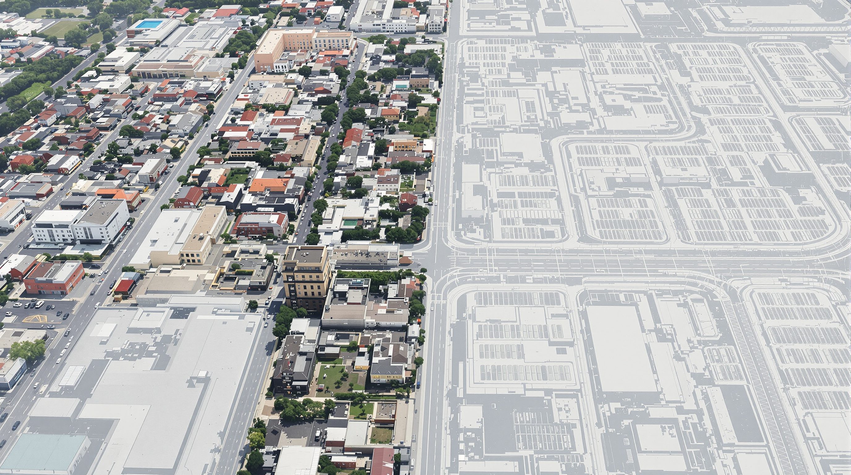
No architect draws a building in a vacuum. Long before the first line, an invisible rulebook has already decided what may stand on that plot: what it can be used for, how big it can grow, how far it must stand from its neighbours. That rulebook is zoning and development control, the most powerful design tool in the city, wielded mostly by people who never call themselves designers.
One reworded DCR clause reshapes ten thousand buildings. That is the real drawing board.
What zoning actually does
Zoning is the legal act of dividing a city into areas, zones, and specifying what may be built in each. It is the operational tool that turns the abstract vision of a Master Plan into enforceable rules on each individual plot. Every zoning system regulates some combination of three things. First, use: what activities are permitted, residential, commercial, industrial, institutional, and in what mix. Second, bulk: how much can be built, expressed through FSI/FAR, ground coverage, setbacks and height limits, the controls from our first lesson. Third, form and performance: increasingly, how the building meets the street, its frontage, parking, signage and the like. The genius and the danger of zoning are the same: it is proactive and legally binding, so it can prevent a chemical plant next to a school before it is built, but it can equally freeze a bad idea into law for decades, criminalising exactly the mixing and fine grain that make cities live. A crucial distinction runs through all zoning: development that complies with the rules is permitted 'as of right', granted more or less automatically, while anything else needs discretionary permission or a variance. The balance a city strikes between clear as-of-right rules and case-by-case discretion shapes everything from how predictable development is to how much room there is for both good judgement and, unfortunately, corruption. Understanding zoning as this three-part, proactive, legally binding instrument is the foundation for critiquing and improving it.
Euclidean zoning and its logic
The world's most widespread zoning model is 'Euclidean' zoning, named not for the geometer but for the town of Euclid, Ohio, whose zoning ordinance the United States Supreme Court upheld in the landmark 1926 case Village of Euclid v. Ambler Realty. Its logic is separation and hierarchy. It sorts land into a ladder of use districts, typically running from the most 'protected', single-family residential, down through multi-family, commercial and finally industrial, and in its purest form each district excludes the uses below it, so you may build a home in a commercial zone but never a shop in a residential one. To use and bulk it adds dimensional standards: minimum plot sizes, setbacks, height caps, and, especially in car-oriented versions, minimum parking requirements. The appeal is real: it is simple to administer, predictable for property owners, and effective at its original job of keeping genuinely noxious industry away from homes. This model, transplanted through colonial and post-colonial planning, underlies much of Indian development control too, which is why our Master Plans still speak the language of exclusive residential and commercial zones. But its very simplicity is its flaw: by separating uses that are perfectly compatible and mandating low densities and abundant parking, Euclidean zoning became the legal engine of sprawl, car dependence and the single-use monotony that the previous lesson diagnosed. Knowing its name and its 1926 origin lets you place the whole global argument about zoning reform in its proper historical frame.
Why planners turned against it
The revolt against Euclidean zoning gathered from several directions and is now something close to a professional consensus that the model, unmodified, does more harm than good in the walkable city. The functional critique, descending from Jane Jacobs, is that rigid use-separation destroys the diversity, footfall and mutual surveillance that make districts safe and vital, and forces a car trip for every errand. The economic critique, associated with writers like Edward Glaeser and, in the Indian context, Alain Bertaud, is that restrictive bulk limits, especially artificially low FSI, choke the supply of floor space where demand is highest, driving up prices, pushing growth to the distant fringe and locking people into long commutes; Mumbai's decades of low island-city FSI is the textbook case. The design critique is that Euclidean zoning regulates everything except the one thing that most determines whether a place is good, its physical form and its relationship to the street, so it can produce a technically compliant building that is a disaster at ground level. There is also an equity critique: exclusionary zoning, through large minimum plot sizes and bans on smaller or multi-family housing, has been used, notoriously in the United States and echoed in some Indian gated developments, to price out lower-income households and entrench segregation. The cumulative force of these critiques is why the last generation of planning has pushed toward mixed-use zoning, form-based codes, and the relaxation of FSI and parking minimums, the reforms that later lessons and this one describe.
Master Plans, DCR and DCPR
In India the zoning function is carried by a layered instrument. At the top sits the Master Plan or Development Plan, a statutory document, usually with a twenty-year horizon, that carries the land-use map and sets the broad framework; the Master Plan for Delhi, prepared by the Delhi Development Authority, is the most famous, with successive editions (MPD-2001, 2021 and the draft MPD-2041) steering the capital's growth. Beneath and alongside it sit the Development Control Regulations (DCR), in Maharashtra now recast and unified as the Development Control and Promotion Regulations (DCPR), which translate the plan's intentions into the plot-level rules a builder must follow: permitted uses per zone, FSI, ground coverage, marginal setbacks, height, parking, and the procedure for sanction. Mumbai's DCPR 2034 and Pune's DCPR are the working rulebooks that architects there consult daily, and their FSI provisions, particularly the enhanced FSI granted along Metro corridors, are among the most consequential and contested policy levers in urban India. Building bye-laws, often aligned to the National Building Code, add the health-and-safety layer of light, ventilation, fire and structural requirements. Overlaying all of this is the constitutional context: the 74th Amendment of 1992 devolved urban planning to elected local bodies (ULBs), though in practice powerful parastatal development authorities still dominate. The practical takeaway for any professional is unambiguous: never advise on what can be built from memory or from another city's rules; obtain and read the current sanctioned Development Plan and DCR/DCPR for that specific city, and confirm with the authority.
Transferable Development Rights
One of the most ingenious and characteristically Indian instruments within this machinery is Transferable Development Rights (TDR). The problem it solves is common: a city needs land for a road, a park, a slum rehabilitation or a heritage building's protection, but has little money to pay for it or wants to avoid demolishing a protected structure. TDR separates the right to build from the land itself. When an owner surrenders land for a public purpose, or cannot use their full development potential because their plot carries a heritage building, the authority issues a certificate representing the unused floor area, the development right, which the owner can then sell to someone else, who uses it to build extra floor area, over and above the base FSI, on a different 'receiving' plot elsewhere in the city. Mumbai pioneered large-scale TDR, using it to acquire land for infrastructure and to finance slum rehabilitation, and the concept now appears in many Indian development control regulations and in heritage conservation as a way to compensate owners of listed buildings for the floor area they forgo. TDR is powerful because it lets a cash-strapped city marshal development potential as a currency, but it is also delicate: if too much TDR is dumped onto receiving areas without matching infrastructure, it can overload neighbourhoods that never planned for the extra bulk, exactly the density-without-infrastructure trap of the first lesson. Used with discipline, TDR is a fine example of how development control can be creative, not merely restrictive. The figure shows the sending-and-receiving logic.
Predictability, discretion and the space for judgement
A quietly decisive design choice in any development-control system is how much it relies on clear, as-of-right rules versus case-by-case discretion. At one extreme, the United States tends toward detailed as-of-right zoning: if your project meets every dimensional rule, permission is near-automatic, which gives certainty but can lock in mediocrity, because a compliant building need not be a good one. At the other, the United Kingdom runs a famously discretionary system in which almost every proposal is judged on its merits against a plan, which allows contextual quality but at the cost of predictability and delay. India sits awkwardly in between: the DCR/DCPR set nominally clear rules, yet a thicket of special permissions, discretionary FSI, ad-hoc relaxations and 'compounding' of violations injects large amounts of discretion, and with it both flexibility and the well-known temptations of rent-seeking. There is no perfect answer, but the design principle is worth stating: rules should be as clear and objective as possible about the outcomes that matter, especially form and the public realm, and discretion should be reserved for genuine matters of judgement, not used to negotiate the basics plot by plot. This is precisely the promise of form-based codes, which we take up in the next lesson: to make the good street outcome the predictable, as-of-right result, rather than something that must be fought for through discretion every single time.
Reading, and reforming, the code
Where does all this leave the practitioner? First, with a duty of literacy: to read development control not as bureaucratic obstruction but as the deepest layer of urban design, the rules that shape thousands of buildings the designer will never touch. A single line changed in a DCR, permitting shops on residential streets, raising FSI near a Metro, requiring active frontage, mandating fewer parking spaces, does more to shape a city than a career of individual buildings. Second, with a reformer's eye: knowing the critique of Euclidean zoning, the professional can spot where a city's code is quietly manufacturing sprawl, dead frontage or unaffordability, and argue for the specific amendment that would help. Third, with humility and rigour about the specifics: zoning is intensely local and statutory, so a good professional speaks in principles but always defers to the current sanctioned plan and the local authority on the letter of the law, and never encourages a client to bank on a discretionary relaxation that may not come. The mature stance is to treat the code as both the medium and the message: the medium through which your design must pass, and itself a design, one that can be as thoughtfully, or as thoughtlessly, made as any building. Master it, and you can shape the city not one plot at a time but a rule at a time.
Master Plan / Development Plan (statutory)
Long-horizon land-use framework and zoning for a city, e.g. Master Plan for Delhi (MPD-2021, draft MPD-2041)
The top-level statutory instrument; always work from the current sanctioned edition and confirm with the authority (e.g. DDA).
Development Control (& Promotion) Regulations, DCR / DCPR
Plot-level rules for use, FSI, coverage, setbacks, height and parking
Mumbai DCPR 2034 and Pune DCPR are the daily working rulebooks; FSI along transit corridors is a key contested lever.
74th Constitutional Amendment Act, 1992
Devolution of urban planning powers to elected local bodies (ULBs)
Frames who is meant to plan; in practice parastatal development authorities often retain dominant control.
Transferable Development Rights (TDR) provisions
Instrument to sever and trade unused development potential between plots
Used for infrastructure land acquisition, slum rehabilitation and heritage compensation; must be matched to receiving-area infrastructure.
Decode a plot
Turn abstract zoning into a concrete envelope by reading the actual rules that govern one real plot.
The city's sanctioned Development Plan and DCR/DCPR, a base map, scale rule, calculator
Choose a real plot in a city whose Development Plan and DCR/DCPR you can access, and note its address and area.
- 1Find the plot on the sanctioned land-use map and record its zone and the permitted, permissible and prohibited uses for that zone.
- 2From the DCR/DCPR, extract the base FSI, any additional or premium FSI (including TOD or TDR-loaded FSI), ground coverage, marginal setbacks, height limit and parking requirement.
- 3Compute the maximum buildable envelope: permissible floor area, footprint and approximate storeys, and sketch it on the plot with its setbacks.
- 4Write two sentences on one rule that helps the resulting street and one that harms it, and propose a single amendment you would make to the code.
You’ll walk away with
A one-page 'plot decode' sheet: zone, uses, key bulk figures, a massing sketch of the maximum envelope, and one proposed code amendment.
Three altitudes on the same idea
Read the band that fits you — or all three.
The DCR/DCPR and the sanctioned land use are the true first brief on any project, so read them before you sketch and design within them rather than against them. Learn where your city's code is rigid and where it grants discretionary relief, and never promise a client floor area or a use that depends on a variance you cannot guarantee. Where the rules force a bad street outcome, document it, because you are the profession best placed to argue the code should change.
As the urban designer or planner, the code is your primary medium; you shape more of the city through a well-drafted DCR clause than through any single scheme. Push your city's zoning away from rigid Euclidean separation toward mixed use, sensible FSI tied to transit and infrastructure, active-frontage requirements and fewer parking minimums. Reserve discretion for genuine judgement and make good public-realm outcomes the predictable, as-of-right result, not a favour to be negotiated.
Grasp the three things all zoning controls, use, bulk and form, and the one big idea that the dominant Euclidean model separates uses that need not be separated. Then learn to read a real Master Plan and DCR: find a plot, look up its zone, and list what you could and could not build there. That exercise teaches more about how cities are really made than most design studios.
“Zoning is just neutral, technical rule-making that keeps order in the city.”
Do it yourself
Quick checks before you move on.
- 1Name the three things zoning regulates and give an example control for each.
- 2Explain in one sentence why Euclidean zoning is blamed for sprawl.
- 3Describe the sending and receiving logic of Transferable Development Rights.
Pulling it together
Peer-reviewed journals & authoritative standards
- 01Delhi Development Authority, Master Plan for Delhi (MPD-2021 and draft MPD-2041) — Delhi Development Authority, 2021.
- 02Town and Country Planning Organisation, URDPFI Guidelines (development control framework) — TCPO, Ministry of Housing and Urban Affairs, 2015.
- 03India Code, Constitution (Seventy-fourth Amendment) Act and State Town Planning Acts — India Code, Government of India, 1992.
- 04Institute of Town Planners, India, professional resources on development control — Institute of Town Planners, India, 2020.
If conventional zoning regulates use but neglects form, what would a code that did the opposite look like? Next: form-based codes and the shaping of urban form.
The author
Amogh N P
Architect, interior designer, and creative polymath. Studio Matrx began in his notebooks — his vision of design made honest, useful, and open to everyone. Its Academy is written and taught in his memory, and free, forever.
More about Amogh →