
 Lesson 0.1
Lesson 0.1 · Foundations: What Urban Design Is
What Urban Design Is
The craft of the space between buildings, where a city becomes a place
The city lives in the gaps
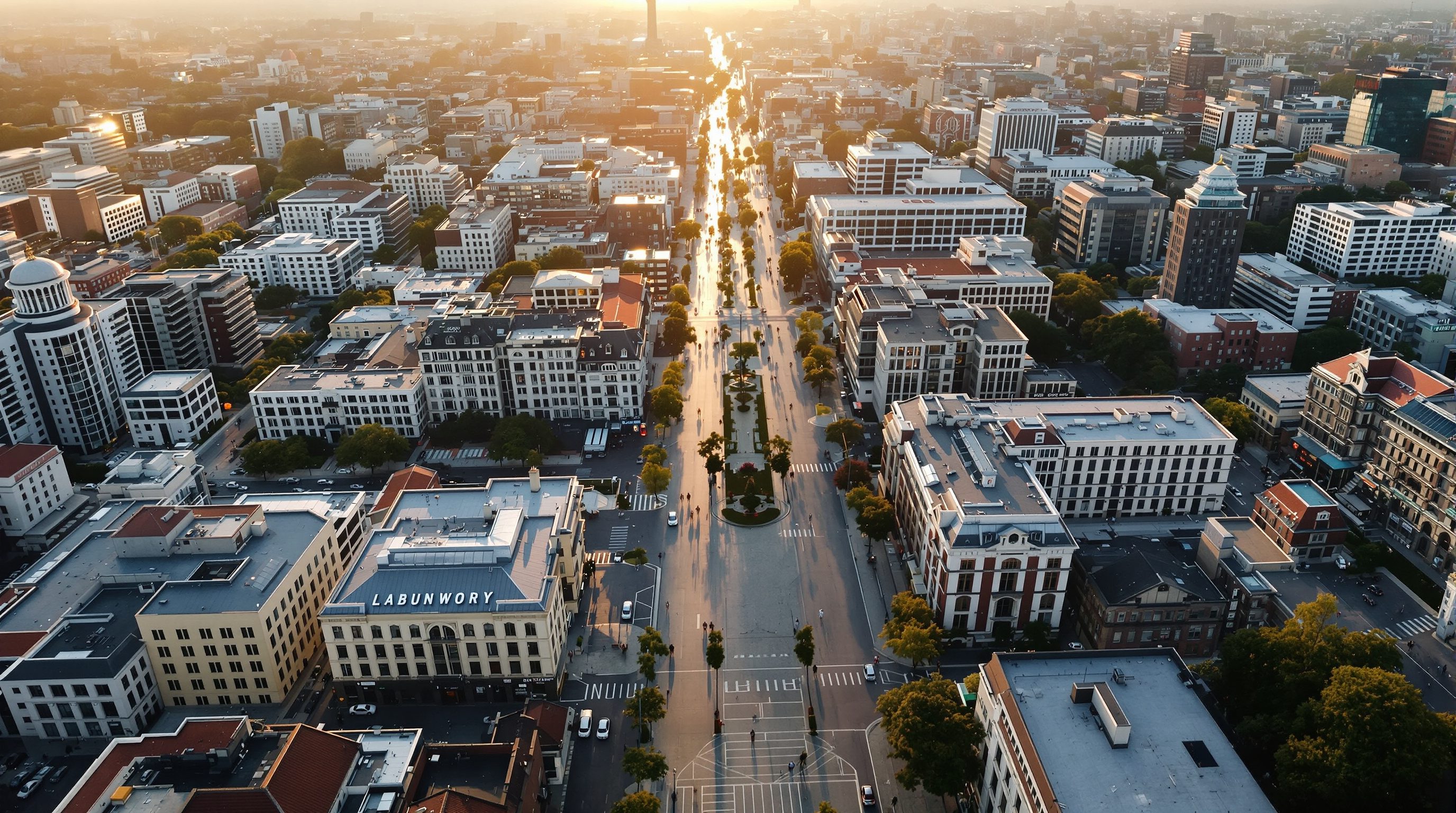
A city is not a collection of buildings; it is the space between them. That space, where you walk, meet, wait, linger, and cross, is the true material of urban design. Learn to see it and you will never look at a street the same way again.
First rule of the studio: draw the white, not just the black.
A working definition
Urban design is the art and discipline of shaping the physical setting for life in towns and cities. It works at the scale between architecture and planning, choreographing how buildings, streets, squares, parks, and infrastructure come together to make places that people find useful, safe, beautiful, and worth caring about. Where the architect asks how one building should stand, and the planner asks how a region should grow, the urban designer asks the question in the middle: what happens in the space between the buildings, and how do many separate decisions add up to a coherent whole? A useful shorthand, often traced to the practice of figures like the Urban Design Group in the UK, is that urban design is the design of the public realm and the framework that gives private buildings a shared civic order. It is inherently collaborative. No single person designs a city; the urban designer sets the rules of assembly, the block sizes, street widths, frontage lines, and heights, within which hundreds of architects, builders, and residents make their own moves over decades. That collaborative, rule-setting character is what distinguishes urban design from every neighbouring craft. An architect can, in principle, control every joint of a single building; the urban designer never controls the whole result, only the relationships between the parts and the quality of the space they enclose. This is why the discipline is sometimes called the design of relationships: the relationship of a building to its street, of a street to its neighbours, of a neighbourhood to the river or ridge that gives a city its structure. It is also inherently political and economic, because the space between buildings is shared, contested, and paid for collectively, and every line an urban designer draws distributes advantage, shade, footfall, safety, and value, among the people who will live with it.
The space between is the material
Think of a favourite street. You do not remember the buildings one by one; you remember the room they made together, the width of the pavement, the shade of the trees, the rhythm of doorways and shopfronts, the way a square opened at the end. That collective outdoor room is the urban designer's canvas. Camillo Sitte, writing in Vienna in 1889, argued that the great squares of European cities worked as enclosed, irregular rooms, not as leftover voids around monuments, and he taught planners to design the void as carefully as the solid. This is the perceptual shift at the heart of the discipline: stop treating streets and squares as gaps left over after the buildings are placed, and start treating them as the primary spaces to be designed. Buildings then become the walls of those outdoor rooms, and their facades become the wallpaper, their doors the plug points of activity, their setbacks the depth of the room. In Jaipur's walled city, laid out in 1727 under Vidyadhar Bhattacharya on a grid of chowkris, the continuous arcaded frontages and the great chaupars (market squares) show exactly this logic; the buildings are disciplined so the public space can be generous and legible. The same instinct explains why Barcelona's Eixample, planned by Ildefons Cerda in 1859, chamfered the corner of every block: the cut corners turn each intersection into a small octagonal room, widening the pavement exactly where people cross and gather. Once you learn to see the outdoor room, you begin to judge places by it, whether the walls hold, whether the floor is generous, whether the room has a use and a door, and whether, standing in it, you feel enclosed and welcome rather than exposed and lost.
Reading a city in black and white
One of the urban designer's core tools is the figure-ground plan, a map that blackens all the built mass and leaves the open space white (or the reverse). Giambattista Nolli's 1748 map of Rome is the founding example; it treated the interiors of churches as public void, coloured like the streets, revealing the continuous network of accessible space that stitched the city together. When you draw a figure-ground of a traditional Indian bazaar street, a medieval European core, or a superblock district of Barcelona's Eixample, you see a fine-grained, well-defined public network carved out of dense mass. Draw the same map of a car-oriented suburb or a tower-in-the-park housing estate and the black shrinks to scattered islands in a white sea of undefined space; the outdoor rooms have dissolved. This single diagram, taught in every urban design studio, trains the eye to judge whether a place has coherent, shaped public space or merely residual leftover space between objects. The power of the figure-ground is that it removes style entirely, so you cannot be seduced by a shiny render or a heritage facade; you see only structure, grain, and connectivity. A dense figure with a continuous white network usually predicts a walkable, sociable place, because destinations are close and the routes between them are defined; a sparse figure with amorphous white usually predicts car-dependence, because nothing is close and nothing is enclosed. Practitioners often draw a figure-ground of the existing site and a proposed one side by side; if the proposal turns solid grain into scattered islands, the scheme is quietly destroying public space no matter how good the individual buildings look. Learning to read and draw this map is, for many students, the moment urban design stops being abstract and becomes a craft you can practise with a pen.
What urban design is not
Urban design is not landscape decoration, not city-scale architecture, and not the same as statutory planning. It is not merely making things pretty; a beautifully rendered plaza that nobody can reach on foot has failed as urban design. Nor is it the drawing of a single mega-building and calling the leftover ground floor a public space. It is also not the purely legal, land-use exercise of zoning, though it works hand in glove with it. Le Corbusier's unbuilt Plan Voisin for Paris (1925) and the tower-in-the-park estates it inspired are a cautionary tale: superb individual buildings set in vast open ground can still make miserable, disorienting public space because the outdoor rooms were never designed, only the objects. Good urban design is judged not by the objects but by the quality, connectedness, and life of the space between them, and by whether ordinary people, a child, an older person, a street vendor, can use it comfortably. It is worth naming the confusions directly. It is not the same as engineering the road, though roads are its most common raw material; a road engineered only for vehicle throughput will actively destroy the street as a place. It is not the same as project architecture, because its client is ultimately the public, and its timeframe runs longer than any single building's life. And it is not the same as beautification, the retro-fitting of paving, planters, and street furniture onto a fundamentally broken layout, which is often what gets called urban design when budgets are small and ambitions smaller. Real urban design is upstream of all of these: it decides where the blocks are, how wide the streets run, where the ground floor meets the pavement, and how the whole thing connects, and only then does it care about the paving pattern.
Why it matters, especially in India
India is urbanising at extraordinary speed; the Census of India recorded a steadily rising urban share, and the built form now going up around every Indian city will shape daily life for generations. Whether those streets are walkable, shaded, and safe, or hostile, hot, and car-choked, is largely an urban design question, decided by block size, frontage, footpath width, and the treatment of the ground floor, long before any single building is designed. National programmes such as the Smart Cities Mission and AMRUT have pushed public-space and street-design projects up the agenda, while the URDPFI Guidelines issued through the Town and Country Planning Organisation give states a common vocabulary for plan-making. Urban design is where these policies meet the pavement. Ahmedabad's Sabarmati Riverfront and the pedestrianisation experiments in several Indian cities show that reclaiming the space between buildings, for people rather than only for vehicles, is now a live civic project, not an academic one. The stakes are unusually high in the Indian context because so much of urban life already happens outdoors, in the public realm: the street vendor, the informal market, the temple forecourt, the evening walk, the wedding procession, the children's cricket match in a leftover lot. A design culture imported wholesale from car-first, indoor-first cities can quietly erase this life, replacing porous, active edges with blank compound walls and service lanes. Conversely, urban design that understands the Indian street, its mixed use, its shade needs in a hot climate, its tolerance for many activities at once, can protect and amplify a public life that many wealthier cities are now trying, expensively, to rebuild. This is why urban design in India is not a luxury import but a survival skill for liveable cities, and why learning it well is an act of stewardship for the millions who will use these streets.
Designing frameworks, not just forms
Because a city is built by many hands over long time, the urban designer's most powerful outputs are often not finished pictures but frameworks: a street network, a block-and-plot structure, design codes, frontage rules, and a hierarchy of public spaces that others will fill in. Leon Krier and the New Urbanists made this explicit with the idea of the urban code, and the Form-Based Codes Institute has since built a whole discipline around regulating built form and the street rather than only land use; Christopher Alexander, in A Pattern Language, offered a whole vocabulary of small, repeatable spatial patterns from which coherent places could grow. The skill is to specify just enough, block dimensions, build-to lines, active-frontage requirements, tree spacing, to guarantee a good public realm, while leaving room for variety, change, and the unplanned life that makes cities vital. An urban designer who over-specifies produces a lifeless stage set; one who under-specifies produces chaos. The craft lives in that balance. This framework mindset also changes how you measure success. You will rarely stand back and admire a finished object you fully controlled; instead you will return years later and read the place the frameworks produced, whether the ground floors filled with shops, whether the trees grew into a canopy, whether the square found a use nobody wrote into the brief. The best urban designers design for this handover deliberately, leaving generous, robust, forgiving structures that improve as they age and as people adopt them, rather than brittle compositions that only work if everyone obeys the render. Designing the rules, and trusting the city to write the poem, is the mature stance of the discipline.
Design the rules, and the city writes the poem.
URDPFI Guidelines (TCPO, MoHUA)
National guidance for formulating and implementing urban and regional development plans in India.
Gives states a shared vocabulary, from master plans to layout norms, within which urban design decisions sit.
Smart Cities Mission
Government of India programme funding area-based development and public-space projects.
Many street-redesign and placemaking projects that are, in substance, urban design were delivered under this mission.
Urban Design Group guidance (UK)
Professional articulation of what urban design is and how it is practised.
A useful international reference for the discipline's scope: design of the public realm and the framework for private development.
See the space between
Train your eye to read the public realm as the primary material of urban design.
Pen, tracing paper, a printed plan or OpenStreetMap, optional QGIS
Choose one street or square you use often, in your own city.
- 1Photograph or sketch the place at eye level, then find or trace a plan of it.
- 2Draw a figure-ground: fill all built mass solid, leave all open space white.
- 3Mark where the outdoor space is a well-defined room and where it dissolves into leftover space.
- 4List three physical moves (a frontage, a tree line, a narrowed carriageway) that would make the space more room-like.
You’ll walk away with
A one-page figure-ground with annotations identifying rooms, leftovers, and three improvement moves.
Three altitudes on the same idea
Read the band that fits you — or all three.
As an architect, urban design is the context your building must join, not fight. Your facade is somebody else's street wall; your ground floor is part of a stranger's walk to work. Reading the block, the frontage line, and the public space first lets your building strengthen the outdoor room rather than damage it.
As an urban designer, you are the author of the space between buildings. Your primary deliverables are the street network, the block-and-plot structure, and the codes that align many private buildings into a coherent public realm. You design frameworks and the public floor, then defend the quality of that space through every downstream decision.
Start by seeing the void, not the buildings. Take any street you know and draw a figure-ground: black for built mass, white for open space. Ask whether the white forms clear outdoor rooms or scattered leftovers. That single exercise trains the core instinct of the whole discipline.
“Urban design is just architecture done at a bigger scale, or landscaping to make a development look nice.”
Do it yourself
Quick checks to lock in the core idea.
- 1In one sentence, define urban design without using the word building.
- 2Name a street you love and describe the outdoor room its buildings make.
- 3Sketch a figure-ground of a place near you and judge: rooms or leftovers?
The core frame
Peer-reviewed journals & authoritative standards
- 01Urban Design Group, What is Urban Design — Urban Design Group (UK), 2024.
- 02URDPFI Guidelines, Urban and Regional Development Plans Formulation and Implementation — Town and Country Planning Organisation, MoHUA, 2015.
- 03Smart Cities Mission, Government of India — Ministry of Housing and Urban Affairs, 2024.
- 04Camillo Sitte, City Planning According to Artistic Principles (reissue) — Routledge, 1889.
If the public realm is the material, at what sizes do we shape it? Next we zoom through the scales of urban design, from the whole city down to a single doorstep.
The author
Amogh N P
Architect, interior designer, and creative polymath. Studio Matrx began in his notebooks — his vision of design made honest, useful, and open to everyone. Its Academy is written and taught in his memory, and free, forever.
More about Amogh →