
 Lesson 0.2
Lesson 0.2 · Foundations: What Urban Design Is
The Scales of Urban Design
From the region to the doorstep, and why every scale needs the others
Zoom, and the rules change
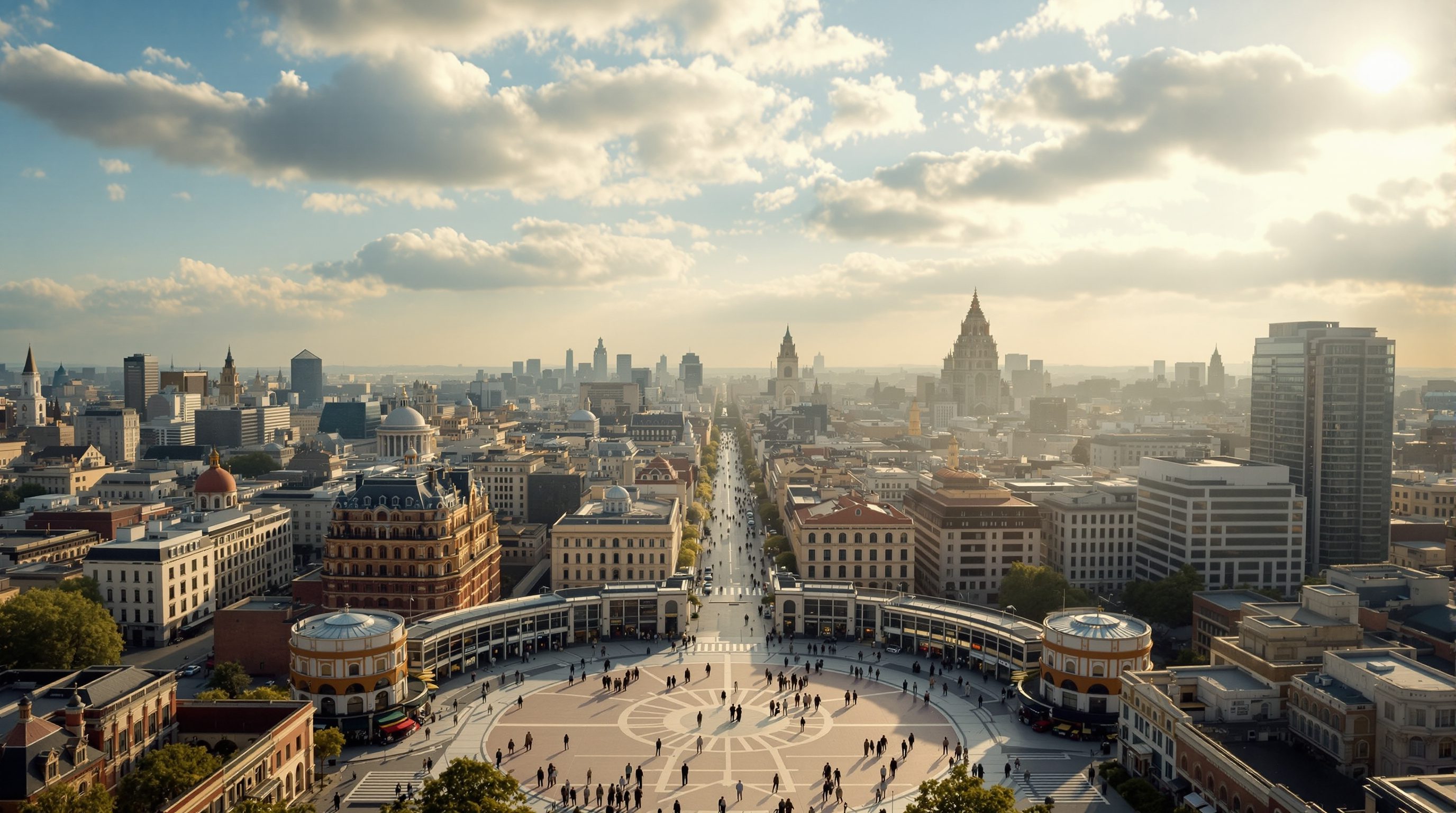
The same city looks like a policy diagram from 10,000 metres, a network of blocks from 1,000, and a bench in the shade from two. Great urban design moves fluently between these scales, and fails whenever they contradict each other.
Keep a pin at human height on every plan you draw.
Why scale is the organising idea
Everything in a city exists inside something larger and contains something smaller. A bench sits on a footpath, which lines a street, which bounds a block, which forms part of a neighbourhood, which sits in a district, which makes up a city, which anchors a region. Urban design is the discipline that keeps these nested scales in agreement. A decision at one scale, say, a regional choice to run a metro line, cascades down: it fixes station locations, which reshape districts, which call for denser blocks, which demand wider footpaths and shaded waiting places at the smallest scale. When scales agree, a place feels effortless and legible; when they fight, you get the familiar Indian pain of a gleaming metro station marooned behind a six-lane road with no safe way to walk the last two hundred metres. That last-mile failure is not a detail; it is a scale mismatch, the regional and the human scale never reconciled. Learning urban design is largely learning to hold several scales in your head at once and to check, constantly, that a move that looks right at one scale does not wreck another.
Region and city: structure and growth
At the largest scales, the region and the metropolitan city, urban design blurs into planning. Here the concerns are structural: where growth goes, where it must not go (floodplains, aquifer recharge zones, prime farmland, ecologically sensitive hills), and the armature of major infrastructure, arterial roads, rail and metro corridors, trunk water and drainage, regional green and blue networks. This is the domain of the master plan or development plan, prepared in India under state Town and Country Planning Acts and guided by the URDPFI Guidelines. The urban designer's contribution at this scale is to insist that structure serves form and life downstream: that corridors are planned for transit-oriented development rather than only for cars, that the blue-green network (rivers, drains, lakes, ridges) is protected as public structure and not treated as residual land, and that the plan's density and land-use decisions can actually produce walkable districts later. Chandigarh's regional and city plan by Le Corbusier and his team, organised into sectors served by a hierarchy of roads (the 7Vs), is a famous, if debated, example of city-scale structure imposing a strong order that every smaller scale then had to live within. The debate about Chandigarh is itself instructive: the city-scale armature is clear and much admired, yet many critics argue the enormous sectors and the road hierarchy produced a place better suited to the car than to the pedestrian, precisely the risk of letting the largest scale dictate without testing it at the smallest. A more recent Indian example of city-scale ambition is the wave of metro-rail systems, from Delhi to Kochi to Nagpur, each of which is a regional-scale decision that only pays off if districts around stations are allowed to densify and if the walk to the platform is designed with care. The lesson at this scale is humility about consequences: a single line on a regional plan can determine, for decades, whether millions of daily journeys are pleasant or punishing.
Big scales set the skeleton; you cannot fix bad bones with good paving.
District and neighbourhood: the walkable unit
Zoom in and you reach the scale most associated with urban design proper: the district and the neighbourhood, the piece of city you can cross on foot in five to ten minutes. Clarence Perry's neighbourhood unit (1929) proposed organising residential areas around a walkable catchment, a primary school and local shops at the centre, arterial roads at the edges rather than through the middle. The idea recurs everywhere, from the mohalla of the traditional Indian city to the modern superblock and the fashionable 15-minute city, and it is echoed in the Indian planning notion of the ward or the local area plan. At this scale the urban designer sets the street network and its connectivity, the mix and grain of land uses, the location of parks, schools, and markets within walking distance, and the density that makes local shops and transit viable. The crucial variable is connectivity: a fine, permeable grid of small blocks offers many routes and short walks, while a coarse layout of superblocks and cul-de-sacs forces long detours and pushes everyone into vehicles. Ahmedabad's traditional pols, dense clusters of houses around shared courts and narrow lanes, show how a neighbourhood can pack in privacy, community, and walkability at once.
Block and plot: the DNA of urban form
The block is arguably the single most consequential unit of urban design, because it is where the public network and private development meet. Block size sets walkability (small blocks mean more corners, more routes, more frontage for shops); block shape and the plot subdivision within it set the grain, whether a street is lined with many narrow buildings and many doors, or one long blank wall. Barcelona's Eixample uses roughly 113-metre blocks with chamfered corners; Manhattan's grid uses long, narrow blocks that create continuous avenues; the traditional Indian bazaar packs narrow plots tightly along a spine. The perimeter block, buildings pushed to the street edge around a shared private courtyard, is a workhorse of good urban form because it cleanly separates a lively public street from a quiet, safe interior. It is also where regulation bites: floor space index (FSI or FAR), ground coverage, setbacks, and height controls in the local Development Control Regulations (DCR or DCPR) directly shape what the block can become. An urban designer who understands blocks can predict the life of a street from its plan; one who ignores them will be surprised by blank walls and dead frontages no landscaping can rescue. Grain deserves special attention in the Indian context, where the traditional city is exceptionally fine-grained: narrow plots, many owners, many small shops, and an active edge that changes every few metres. When large-format development replaces this with a single podium and a compound wall, the number of doors on the street can collapse from dozens to one, and with them go the eyes, the transactions, and the incidental life. This is why urban designers increasingly write plot-width rules and active-frontage requirements into codes, sometimes capping the maximum length of a blank wall or requiring a minimum number of entrances per hundred metres, to protect grain from the economics of consolidation. The block, in short, is where an abstract density figure becomes either a lively street or a dead one.
Street and place: the human scale
At the smallest scales, the street section and the individual place, square, ghat, forecourt, corner, urban design becomes intensely physical and human. Here the measures are in metres and seconds: footpath width, carriageway width, the ratio of building height to street width (enclosure), tree spacing and canopy, the frequency of doors and windows at eye level, seating, shade, crossing distances, and the treatment of the ground floor. This is the scale Jan Gehl calls the scale of life between buildings, where design either invites people to walk, sit, and linger or repels them. The street section, a simple cross-sectional drawing showing how the right-of-way is divided between footpath, cycle track, planting, parking, and carriageway, is the everyday deliverable that decides whether a road is also a place. Guidance such as the NACTO and Global Street Design Guide standards, and in India the work of ITDP and WRI on complete streets and tactical urbanism, operates almost entirely at this scale. It is also the scale where success or failure is most visible: you can literally count the people using a good street and the empty benches of a bad one. Enclosure is worth dwelling on, because it is the invisible variable that makes streets feel comfortable or bleak away into nothing. A height-to-width ratio around one-to-two to one-to-three (buildings roughly a third to a half the width of the street) tends to feel like a room; open it to one-to-six and the street stops enclosing and becomes a void, which is exactly what happens when a two-storey market is fronted by a fifty-metre road. In a hot climate, this scale also carries the burden of comfort: tree canopy, arcades, and narrow, shaded lanes are not decoration but thermal infrastructure, the difference between a street usable at three in the afternoon and one abandoned until dusk. The human scale is where all the larger decisions are finally paid out, in shade or glare, in a crossing made or a barrier hit, in a place you want to be or one you hurry through.
The real skill: moving between scales
The mark of a mature urban designer is not mastery of any one scale but fluency in moving between them, and in catching the moments where they disagree. A generous street section (human scale) is worthless if the block is too big to reach it on foot (neighbourhood scale); a beautiful transit corridor (city scale) fails if the station forecourt dumps you onto a hostile road (place scale). The discipline offers explicit tools for this traverse: the transect, popularised by New Urbanism, arranges settlement from rural to urban core as a continuous gradient, letting you tune density, street type, and building form consistently at every point; the nested hierarchy of master plan, local area plan, and street design does the same in the Indian planning system. The practical habit is to design top-down and check bottom-up: sketch the regional structure, then keep zooming in to a person standing on the actual footpath and ask whether the big moves still serve them. If the answer is no at the human scale, the big move is wrong, no matter how elegant the diagram.
Always end the review standing on the footpath, not hovering over the plan.
URDPFI Guidelines (TCPO, MoHUA)
Hierarchy of plans in India: perspective, development/master, and local area plans.
Defines the nested plan scales an urban designer must work down through, from region to layout.
Development Control Regulations (DCR / DCPR)
State and city rules on FSI/FAR, setbacks, ground coverage, and heights.
Operate mainly at the block and plot scale; they decide what built form the street will actually get.
Global Street Design Guide (GDCI/NACTO)
International guidance for designing streets as places at the human scale.
The reference for the street-section and place scale; complemented in India by ITDP and WRI street guidance.
The four-scale portrait
Describe one real place at four scales and find the scale that was forgotten.
Tracing paper, pen, OpenStreetMap or QGIS for the plan base
Pick a metro or bus station precinct in a city you know.
- 1Sketch it at the city scale: how does the corridor and land use around it work?
- 2Sketch it at the neighbourhood scale: what can you reach on foot in five minutes?
- 3Sketch one block beside it: block size, grain, ground-floor uses.
- 4Draw one street section at human scale: footpath, trees, crossings, enclosure.
- 5Name the scale that is failing and one move to fix it.
You’ll walk away with
A four-panel drawing (city, neighbourhood, block, street) with the failing scale flagged and one corrective move.
Three altitudes on the same idea
Read the band that fits you — or all three.
Your building answers to at least three scales at once: it is an object, a wall of a street, and a piece of a block. Before you fix a plan, read the block structure and the street section your site sits in; a facade that ignores enclosure and frontage rhythm will read as wrong however refined the object is.
As an urban designer you are the custodian of scale-agreement. Your job is to translate the city-scale plan into block, street, and place, and to push back up when a regional decision cannot produce a decent human scale. Design top-down, then verify by standing, in drawing or in person, on the footpath the plan will create.
Practise the zoom. Pick a place and describe it four times: as a region, a neighbourhood, a block, and a street section. You will feel which scale it was really designed for, and which scale was forgotten. That forgotten scale is usually where the place hurts to use.
“Urban design happens at one scale, the neighbourhood or the street, and the bigger picture is just planning's job.”
Do it yourself
Quick checks on the scales.
- 1List the scales from region to doorstep in order, from memory.
- 2For your daily commute, name one scale mismatch you experience.
- 3Estimate the block size of your neighbourhood in metres, and judge if it is walkable.
The nested view
Peer-reviewed journals & authoritative standards
- 01URDPFI Guidelines, hierarchy of development plans — Town and Country Planning Organisation, MoHUA, 2015.
- 02Global Street Design Guide — Global Designing Cities Initiative, 2016.
- 03ITDP India, Complete Streets and street design resources — Institute for Transportation and Development Policy, India, 2024.
- 04Congress for the New Urbanism, the Transect and neighbourhood design — Congress for the New Urbanism, 2024.
We have zoomed down to the footpath, where the city's life actually happens. Next we study that life directly, the public realm and the people in it, through Jacobs, Gehl, and Whyte.
The author
Amogh N P
Architect, interior designer, and creative polymath. Studio Matrx began in his notebooks — his vision of design made honest, useful, and open to everyone. Its Academy is written and taught in his memory, and free, forever.
More about Amogh →