
 Lesson 3.2
Lesson 3.2 · Streets, Movement & Networks
Walkability & the Pedestrian
The five Ds, shade and crossings that make walking the natural choice
Every trip begins on foot
No matter how you travel, your journey starts and ends as a pedestrian. Walking is the one mode everyone shares, the cheapest the city offers, and the first casualty of car-centric design. A city that fails the walker fails everyone, because it has broken the connective tissue that every other trip depends on.
Walk your route once as if you had a wheelchair. Whatever stops you is your first design brief.
The mode that carries every other
Walking is not one mode among many; it is the substrate beneath all of them. You walk to the bus stop, from the parked car, along the metro platform, to the shop door. This makes the pedestrian environment the true measure of a city's transport system, because a broken footpath breaks a metro trip just as surely as a cancelled train does. Jan Gehl built a career on this insight, teaching that we must design 'cities for people' at eye level and at walking pace, studying what he called the life between buildings before we study the buildings themselves. Gehl's surveys in Copenhagen over decades showed that when you provide good conditions for walking and lingering, people walk and linger more, and the reverse holds too: neglect the pedestrian and public life quietly evacuates the street. Walking is also the great equaliser. It costs nothing, requires no licence, and is the only option for children, many elders, the poor, and anyone without a vehicle, who together are the majority in most Indian cities. A city that walks well is a city that includes everyone; a city that walks badly has, whether it admits it or not, chosen to exclude.
The five Ds of walkability
Why do people walk in some places and drive in others? Transport researchers Reid Ewing and Robert Cervero distilled the built-environment factors into a memorable set often called the five Ds. Density puts enough people and destinations close together to make walking worthwhile. Diversity, meaning a mix of uses, ensures there is somewhere worth walking to nearby, a shop, a school, a workplace, a park, rather than a monoculture of only houses or only offices. Design covers the fine grain: continuous footpaths, short blocks, safe crossings, active frontages and human-scaled buildings. Destination accessibility asks how easy it is to reach the things people want across the wider area. Distance to transit measures proximity to a bus or metro that extends the walk into a longer trip. The Ds are multiplicative rather than additive: brilliant footpath design is wasted if density is too low to give it purpose, and high density is miserable if the design underfoot is hostile. Walkability, in other words, is a system property of the neighbourhood, not a feature you can bolt onto a single street. The figure summarises the five and how they reinforce one another.
Designing a footpath that works
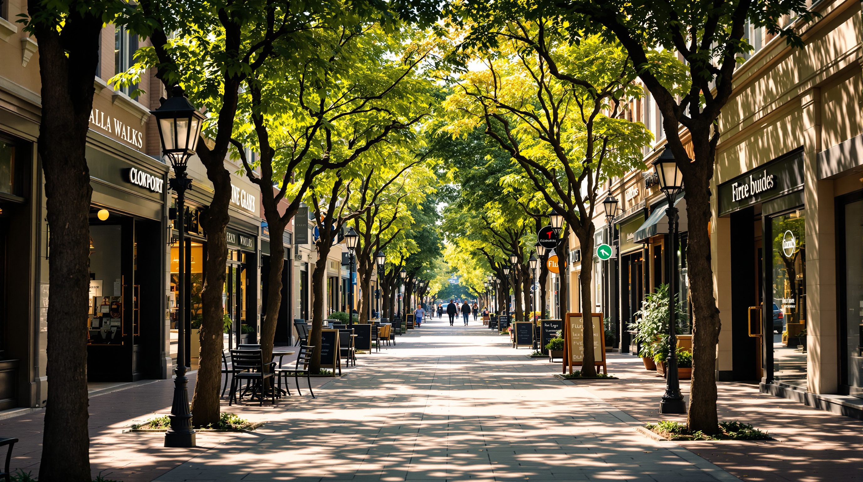
The footpath is the pedestrian's carriageway and deserves the same rigour we give the vehicle's. Start with the through-zone, a continuous, level, unobstructed walking path of at least 1.8 metres so two people can pass and a wheelchair can turn, widening to 2.5 metres or more on busy streets. Keep it flat and continuous across side streets and driveways by carrying the footpath through at its own level, forcing turning vehicles to ramp up rather than making the pedestrian ramp down, a detail that quietly asserts who has priority. Separate the walking path from moving traffic with a buffer, ideally a planted furniture zone that also holds poles, bins and signage. Give it a firm, non-slip, well-drained surface, because a footpath that turns to a sheet of water or slick tile in the monsoon is unusable when it is needed most. Add shade, seating at intervals, and lighting scaled to the walker, not the highway. Shade deserves special emphasis in the Indian context, because in a climate where midday pavements can be punishing for much of the year, an unshaded footpath is one nobody will use by choice. A continuous canopy of street trees is the cheapest and most effective walkability intervention available, cooling the surface, softening the light, and, as Gehl found, encouraging people to linger rather than hurry through. Chennai and Ahmedabad have both treated tree canopy as transport infrastructure rather than mere landscaping. None of this is exotic; it is the ordinary craft that car-centric budgeting starved for decades, and reviving it is largely a matter of deciding the pedestrian matters and then holding the footpath budget line against the perennial pressure to widen the carriageway instead.
Universal access is the baseline, not the extra
A footpath that only serves the able-bodied adult is a footpath that fails. Universal design starts from the hardest cases, a wheelchair user, a blind person, a parent with a pram, an elder with a walker, and finds that solving for them improves the street for everyone. The essentials are unglamorous and non-negotiable: flush or gently ramped kerbs at every crossing, tactile paving to guide and warn people with visual impairments, level continuous surfaces free of sudden steps, and crossings timed for a slow walker rather than a jogger. India's Harmonised Guidelines and Space Standards for Barrier-Free Built Environment set out these requirements, and the Rights of Persons with Disabilities Act makes accessibility a legal obligation, not a courtesy. Yet the gap between code and kerb is vast: ramps that end in a step, tactile tiles that lead into a pole, crossings with no dropped kerb at all. The discipline for the designer is to walk the route as the least-abled user would, in a wheelchair or blindfolded with a guide, and fix what that reveals. Accessibility is not a compliance checkbox added at the end; it is the test of whether the design was ever real.
Crossings: where walking gets dangerous
Walking along a street is one problem; crossing it is where pedestrians die. A crossing must do three things: be frequent, be short, and be safe. Frequent means spaced so that no one is tempted to dash across mid-block because the nearest legal crossing is a five-minute detour away, a design failure that gets blamed on 'jaywalking'. Short means the exposed distance is minimised through kerb extensions that narrow the carriageway at the corner, and refuge islands that let people cross one direction at a time. Safe means the crossing is raised or clearly marked, well lit, and placed where drivers expect it and sight-lines are clear. The tabletop crossing, raised to footpath level so the vehicle must slow and the pedestrian never steps down, is among the most effective tools, common now in redesigned Indian streets. Signal timing matters as much as geometry: pedestrian phases must give a realistic walking speed, around 1.2 metres per second, and generous crossing time for the slow. Grade-separated foot-over-bridges and subways are often proposed as the answer, but they frequently fail because people will not climb stairs and detour when the road is right there; the safer, cheaper answer is usually to calm the traffic and cross at grade.
The realities of the Indian footpath
Any honest account of walkability in India must reckon with the footpath as it actually is: occupied. It is occupied by parked two-wheelers and cars, by vendors and their carts, by transformer boxes and electrical cabinets, by construction debris and shop overflow, and where it survives all of that, it is often too narrow, too high-kerbed, or simply absent. The naive response is to clear it all; the wise response is to design for it. Vending is not a nuisance to be eliminated but an economy and a source of the very 'eyes on the street' that make walking safe, so good design gives vendors a defined zone with the footpath continuing behind them. Parking is a pricing and enforcement problem as much as a design one; give it a marked place and charge for it, and the footpath can be defended. The Street Vendors Act of 2014 gives vendors legal recognition and calls for designated vending zones, which is a design opportunity, not a threat. The goal is a street where the vendor, the parked scooter, the tree and the walker each have a place, rather than a fantasy street swept clean of Indian life. That is the difference between a plan that works and a rendering that never will. It is worth stressing that most trips in Indian cities are already made on foot or by cycle; the pedestrian is not a minority to be accommodated but the majority whose needs have been systematically ignored in favour of a car-owning minority. Designing for the occupied, lived-in footpath is therefore not a compromise of good practice but the substance of it, and the cities that accept this, rather than fighting their own streets, are the ones whose redesigns actually endure past the ribbon-cutting.
From gut feel to walk score
Walkability can be measured, which matters because what gets measured gets funded. Simple proxies like Walk Score estimate how many everyday destinations lie within a short walk of an address. Pedestrian Level of Service methods grade footpaths on width, continuity, surface, buffer, shade and crossing quality, turning a subjective 'this feels unsafe' into a letter grade a budget can respond to. The '15-minute city', popularised in Paris by Carlos Moreno and Mayor Anne Hidalgo, reframes the whole question as an accessibility target: can residents reach most daily needs, work, shops, school, healthcare, green space, within a fifteen-minute walk or cycle? It is less a rigid rule than a lens that exposes where a neighbourhood forces car dependence. For the student and practitioner, the takeaway is to audit before you design: walk the route, time it, count the obstacles, note the shade and the crossings, and let the evidence, not the assumption, drive the redesign.
Harmonised Guidelines for Barrier-Free Built Environment
Accessibility standards for footpaths, kerbs, ramps and crossings
The reference for universal access in India; align every crossing and footpath detail with it.
Rights of Persons with Disabilities Act, 2016
Legal duty to make public spaces and transport accessible
Makes accessibility a statutory obligation, not an optional add-on; confirm current rules with the authority.
Street Vendors Act, 2014
Recognition of vendors and designation of vending zones
Turns vending from an obstacle into a plannable footpath zone; coordinate with the town vending committee.
IRC / URDPFI footpath norms
Footpath widths and pedestrian facility standards
Provide reference minimums; treat them as floors, not targets, on busy streets.
Walk audit and footpath fix
Audit a real walking route, then redesign its worst 100 metres for a genuinely walkable, accessible experience.
Phone camera, measuring tape or pacing, notebook, tracing paper or a plan printout
Pick a route you walk often, ideally one that also serves a bus stop, school or market.
- 1Walk the route and log every obstacle, gap, missing crossing, unshaded stretch and inaccessible kerb, with rough measurements.
- 2Score the route against the five Ds and note which are failing.
- 3Choose the worst 100-metre segment and redraw it in plan: continuous 1.8m-plus through-zone, defined vending and parking, buffer planting for shade, and at least one safe at-grade crossing with dropped kerbs and tactile paving.
- 4Repeat the walk in your mind as a wheelchair user and adjust anything that still fails.
You’ll walk away with
An annotated audit map plus a redesigned 100-metre footpath plan with an accessibility note.
Three altitudes on the same idea
Read the band that fits you — or all three.
Your building's ground floor and setback are the pedestrian's world. Keep active uses, doors and glazing at the footpath edge; never blank a long frontage with a compound wall or a parking podium, which kills the walk. Carry the footpath level across your entry so cars ramp up to you, and give any mandated setback back to the public as usable, shaded, walkable space.
As the urban designer you set the pedestrian's terms across the district: block length, crossing frequency, footpath continuity, shade and vending zones. Design from the least-abled user inward and treat universal access as the baseline test of the scheme. Remember the five Ds are multiplicative, so coordinate land use and density with your street design, not in isolation from it.
Make walkability tangible by auditing your own daily walk. Time it, measure the footpath width, count the obstacles and crossings, note where there is shade and where there is none. Try the route once imagining you use a wheelchair. This audit, repeated, trains the eye that every good pedestrian designer relies on.
“Pedestrians in India ignore the rules, so foot-over-bridges and railings are the fix.”
Do it yourself
Test yourself.
- 1List the five Ds of walkability and give one Indian example of each failing.
- 2Explain why frequent at-grade crossings usually beat a foot-over-bridge for safety.
- 3State the minimum clear through-zone width you would fix before allocating any other footpath space, and why.
Pulling it together
Peer-reviewed journals & authoritative standards
- 01Gehl, Cities for People — Gehl / Island Press, 2010.
- 02ITDP India, Footpath Design and Pedestrian-First Street resources — Institute for Transportation and Development Policy, India, 2021.
- 03Global Designing Cities Initiative, Global Street Design Guide (pedestrian realm) — Global Designing Cities Initiative, 2016.
- 04Project for Public Spaces, What Makes a Great Walkable Place — Project for Public Spaces, 2020.
Good footpaths need somewhere to go; the next lesson steps back to the street network itself and how its connectivity makes walking either short and direct or long and defeating.
The author
Amogh N P
Architect, interior designer, and creative polymath. Studio Matrx began in his notebooks — his vision of design made honest, useful, and open to everyone. Its Academy is written and taught in his memory, and free, forever.
More about Amogh →