
 Lesson 2.3
Lesson 2.3 · The Public Realm
Public Life & Human Scale
Designing the city at five kilometres an hour, for the walking human body
The city at five kilometres an hour
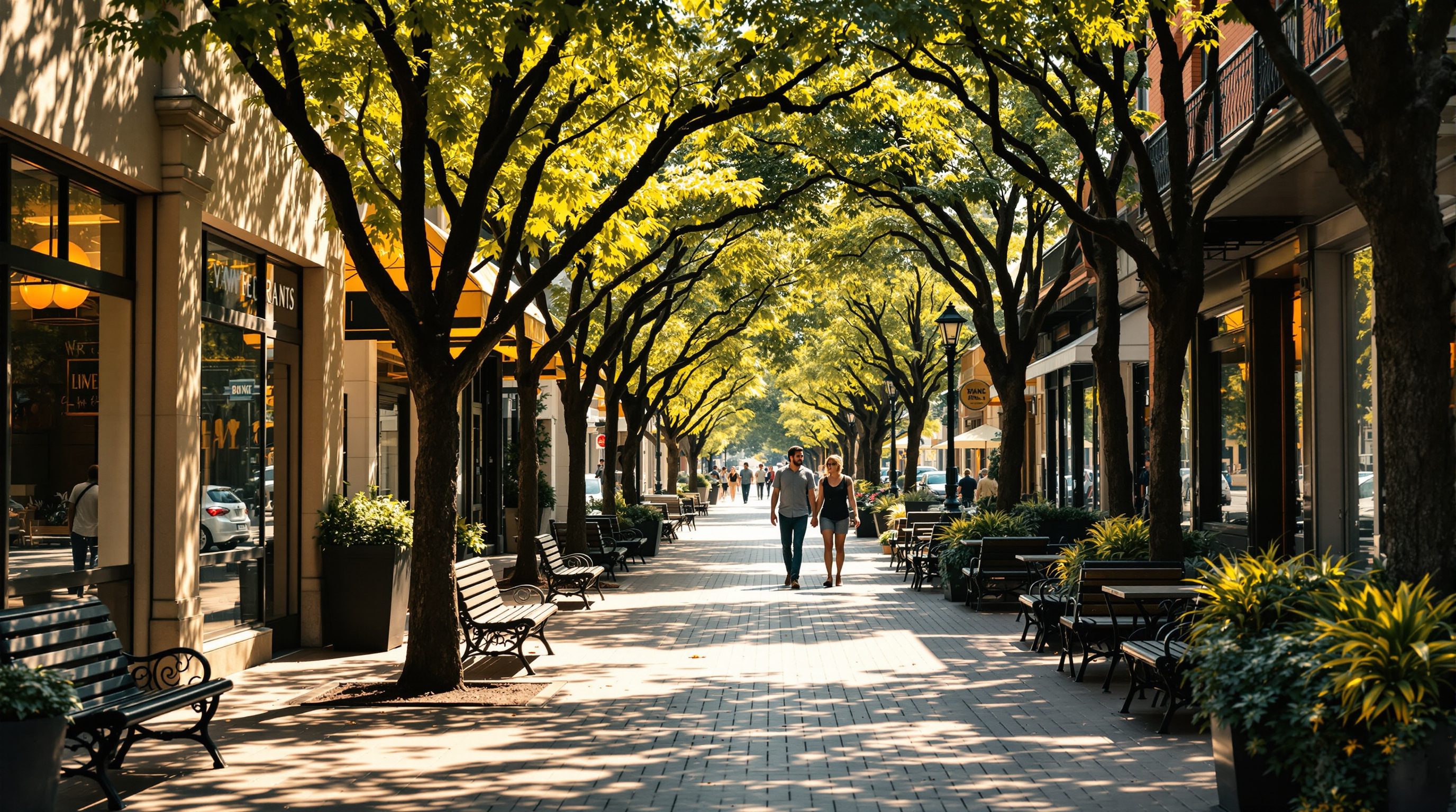
The human body walks at about five kilometres an hour, sees best straight ahead and slightly down, and reads a face at a hundred metres. For ten thousand years cities were built to those specifications. Then, for sixty years, we built them for the car at fifty. Human-scale design is the work of putting the walking body back at the centre of the plan.
Craning your neck is a design failure; the city should meet you at eye level.
Life between buildings
Jan Gehl, the Danish architect who spent a career studying how people actually use cities, framed the discipline with a simple hierarchy. Buildings are one thing; the life between them is another, and it is the life that makes a city worth living in. In Life Between Buildings (1971) and later Cities for People (2010), Gehl argued that modern planning had obsessed over the objects — the towers, the roads, the plots — and neglected the space in between, where human life actually happens. His famous rebuke to a generation of planners: 'First life, then space, then buildings — the other way around never works.' The order matters. Most projects start with the buildings, arrange the space around them, and hope life follows; it rarely does. Gehl inverts it: understand the life you want, shape the space to support it, and let the buildings serve that space. This is not sentimentality. Gehl backed it with counts — pedestrians tallied, activities mapped, before-and-after studies across decades — that turned soft claims about liveability into hard evidence planners could not ignore. When Copenhagen began pedestrianising its Stroget in 1962, critics said Danes were not Italians and would never linger outdoors; Gehl's counts showed public life expanding year on year as the space was made for it. The lesson is durable and portable: design for the life first.
Necessary, optional and social
Gehl's most useful analytical tool sorts outdoor activity into three kinds. Necessary activities are the things people must do regardless of conditions — going to work, to school, to the market, waiting for a bus. These happen even on a hostile street, because there is no choice. Optional activities are the things people do only if the place invites them — strolling for pleasure, sitting in the sun, standing to watch, pausing at a shopfront. These are exquisitely sensitive to quality: in a poor environment, only the necessary happens; in a good one, optional activity blooms. Social activities — conversations, children's play, greetings, simply being among others — depend on the first two: they arise wherever people are present, and are therefore an indirect result of how well the space supports the necessary and the optional. This gives the designer a precise diagnostic. If a street shows only necessary activity — people hurrying through, no one lingering — the environment is failing, and improving it will unlock optional and then social life. It also explains why quality compounds: better paving, seating, shade and edges do not merely add comfort; they convert a street from a place people endure into a place people choose, and choice is where public life begins.
The twelve quality criteria
Gehl distilled human-scale quality into twelve criteria, grouped in three sets of four. Protection: from traffic and accidents (feeling safe walking), from crime and violence (a lively, watched public realm), and from unpleasant sensory experience (wind, rain, heat, glare, pollution, noise). Comfort: opportunities to walk (room, good surfaces, no obstructions), to stand and stay (edges and supports to pause at), to sit (primary and secondary seating), to see (sightlines, lighting, unimpeded views), to talk and listen (low noise, seating arranged for conversation), and to play and exercise (invitation to activity by day and night). Delight: scale (buildings and spaces sized to the human body and senses), the chance to enjoy positive climate aspects (sun, shade, breeze as the local climate demands), and positive sensory experience (good design, fine materials, trees, water, greenery). Notice how the list ascends a hierarchy of need — first keep me safe, then make me comfortable, then delight me — and how the same criteria read differently across climates: 'enjoy the climate' means sun in Copenhagen and shade in Chennai. Used as a scorecard, the twelve criteria turn a vague sense that a place 'feels nice' or 'feels awful' into a specific, improvable diagnosis.
Why the eye level rules everything
Human-scale design rests on the physiology of the walking body. Our senses evolved for a forward-facing biped moving at about five kilometres an hour: we perceive detail sharply straight ahead and a little downward, we read broad emotions in a face at roughly 100 metres and fine expression at 25, and we take in the world in a horizontal band because our eyes sit level and our necks tire when craning up. Gehl draws the consequence bluntly: architecture that rewards the fast-moving eye — the sculptural silhouette seen from a car or across a river — often starves the slow-moving eye at street level, where blank plinths, parking podiums and sheer glass offer nothing to a pedestrian. The remedy is to design the lower floors, roughly the first 4 to 5 metres, with the intensity the walking eye demands: doors every few metres, transparency, texture, things to touch and read. Speed is the other axis. At 60 km/h a driver can process only large, simple signs and broad forms; at 5 km/h a walker savours detail. A street tuned for 60 is illegible and hostile at 5, and vice versa. Human-scale design chooses the walker's speed as the governing tempo and lets everything faster adapt to it.
Soft edges and active frontage
If one variable predicts street life above all others, it is the edge — the ground-floor interface between building and public space. Gehl's studies of Copenhagen found that 'soft' edges — active, transparent, articulated ground floors with many doors and things happening — generated many times the lingering and staying activity of 'hard' edges of blank walls and closed shutters. The reasoning is simple: people linger where there is something to lean on, look at, step into and out of; the edge is where inside and outside overlap, where the shopkeeper watches the street and the stroller pauses at a window. Urban designers now measure this directly with a frontage or active-edge index: over a hundred metres of street, how many separate front doors and active units are there, how transparent is the ground floor, how much of the length is blank? A rich edge might have 15 to 20 doors per 100 metres; a hostile one, none. India's traditional bazaars are the world's masters of the soft edge — the shopfront open to the street, the otla to sit on, the goods spilling out, the upper-floor jharokha overlooking the way. The most damaging thing a new development can do to public life is to line a street with parking podiums, compound walls and blank service edges. Fight for the active ground floor; it is where the city lives.
The 100-metre and 1-kilometre rules
Two rules of thumb anchor human-scale design in measurable distance. The 100-metre rule is a rule of the senses: it is roughly the distance at which we can still see a human figure move, recognise a face's broad expression and read a scene as social. Public spaces and their key features should be composed within this social field of vision — a square much larger than about 100 metres across begins to lose its human legibility, which is one reason vast plazas feel dead. The 1-kilometre, or roughly 15-minute, rule is a rule of the legs: about a kilometre, or a 10-to-15-minute walk, is the distance most people will comfortably cover on foot for a daily errand before they reach for a vehicle. This single number underlies the '15-minute city' and the neighbourhood-unit tradition, and it should govern how far apart we place the things of everyday life — a park, a school, a clinic, a market. In dense Indian neighbourhoods this walking radius is often already lived; the design task is to protect the footpath, the shade and the mixed uses that make it pleasant, not to engineer it from scratch. Between them, the 100-metre and 1-kilometre rulers connect the scale of a single square to the scale of a whole neighbourhood, both tuned to the walking body.
Human scale on the Indian footpath
India is, by daily practice, one of the most walking-and-cycling-dependent societies on earth, yet its footpaths are too often afterthoughts — narrow, broken, obstructed by poles and parked scooters, encroached or simply absent, forcing pedestrians into the carriageway. The human-scale agenda here is not exotic; it is basic dignity and safety. ITDP India and the Global Street Design Guide press for a continuous, unobstructed walking zone of adequate width, a clearly organised furniture-and-vending zone rather than a banished one, safe frequent crossings, shade trees, and streetlights scaled to the walker. Programmes under the Smart Cities Mission and AMRUT have funded 'complete streets' and Raahgiri-style car-free days that let citizens re-experience their roads at five kilometres an hour. The tension to manage honestly is between walking, vending and vehicles competing for the same scarce section — resolved not by removing the vendor (who is often the soft edge that makes the street safe and useful) but by designing the section so each has its place. Human scale in India means, first, giving the pedestrian a footpath worth the name, and then layering onto it the shade, seating, edges and mixed uses that turn a route into a place. It also means designing for the Indian climate rather than importing a temperate template: a Copenhagen street chases the sun, but a Chennai or Nagpur street must chase the shade, with continuous tree canopy, deep arcades and shaded waiting areas doing the work that open sunny plazas do in the north. The walking body is universal; the climate it walks through is not, and human-scale design must answer both.
Gehl — 12 Quality Criteria & Public Life tools
A framework and survey method for human-scale quality of public space
Use the twelve criteria as a design scorecard and the public-life count as evidence.
Global Street Design Guide / NACTO
Street design centred on walking, safety and place
Provides section standards for continuous walking zones, crossings and edges.
ITDP India — Complete Streets / Footpath Design
Guidance on walkable, safe Indian street sections
Applies human-scale principles to Indian footpaths, vending and mixed traffic; defer to city standards for local widths.
Smart Cities Mission / AMRUT
National missions funding complete streets and public space
Vehicles for delivering walkable, human-scaled streets at city scale.
A human-scale street audit
Take a 200-metre stretch of a street you use and audit it at eye level, on foot, against Gehl's framework.
Measuring tape or pacing, clock, printed base map, camera
Walk the stretch once slowly without recording, just noticing where your body wants to pause or hurry.
- 1Score the stretch against the twelve quality criteria (protection, comfort, delight), rating each 1-3 and noting evidence.
- 2Measure the active-edge index: count front doors and active units per 100 metres, and estimate the percentage of blank frontage.
- 3Do a five-minute activity tally at one spot: how many people show necessary versus optional versus social activity.
- 4Check the walking zone: measure the clear, unobstructed footpath width and mark every obstruction, gap and unsafe crossing.
You’ll walk away with
A one-page street report card: the twelve-criteria scores, the active-edge index, an activity tally, and three prioritised, human-scale improvements.
Three altitudes on the same idea
Read the band that fits you — or all three.
Design your lower five metres for the walking eye: many doors, transparency, texture, a reason to pause. The upper floors can address the skyline, but the ground floor belongs to the pedestrian, and a blank plinth or parking podium is a wound to the street. Make the edge soft.
As the urban designer you set the tempo of the whole environment to the walker's five kilometres an hour. Use the twelve quality criteria as a scorecard, protect a continuous walking zone, measure the active-edge index, and space daily needs within the 1-kilometre reach. Life first, then space, then buildings.
Walk a street slowly and ask three of Gehl's questions: is it safe, is it comfortable, is it delightful? Count the doors per hundred metres and note where people linger versus hurry. You are learning to read public life, and the reading always happens at eye level, on foot.
“A striking, iconic building automatically improves the public realm around it.”
Do it yourself
Quick self-checks:
- 1State Gehl's three kinds of activity and which one signals a failing street.
- 2Estimate the active-edge index (doors per 100m) of a street near you.
- 3At what distance can you read a face's broad expression, and why does it set a limit on square size?
Bringing it together
Peer-reviewed journals & authoritative standards
- 01Jan Gehl, Cities for People and Life Between Buildings — Island Press, 2010.
- 02Gehl — Cities for People tools and the 12 quality criteria — Gehl, 2018.
- 03Global Designing Cities Initiative, Global Street Design Guide — Global Designing Cities Initiative, 2016.
- 04ITDP India, footpath and complete-street design guidance — Institute for Transportation and Development Policy, India, 2019.
We have designed the walls, the life and the edges of the outdoor room; the next lesson drops to the floor itself — the ground plane underfoot.
The author
Amogh N P
Architect, interior designer, and creative polymath. Studio Matrx began in his notebooks — his vision of design made honest, useful, and open to everyone. Its Academy is written and taught in his memory, and free, forever.
More about Amogh →