
School Planning Inside Townships
Schools as township amenities — how many of what type by population, the walk-to-school catchment, safe siting away from arterials, the school-park pairing and safe routes
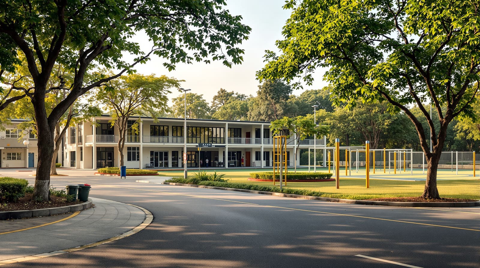
It is 7:40 on a Tuesday morning in a township on the edge of Pune. The arterial spine is already thick with cars, but the children are nowhere near it. They are spilling out of the residential clusters along tree-lined footpaths, satchels bouncing, crossing a single quiet internal lane at a raised table where a guard holds up a flag, and arriving at a primary school that sits beside a green playground at the heart of their neighbourhood. No parent has started a car. No child has crossed the arterial. The whole journey, from doorstep to gate, has taken under ten minutes on foot.
That scene is not an accident of goodwill. It is the product of a decision made years earlier, on a master-plan drawing, about where the schools would go, how many of them there would be, and how children would reach them. Get that decision right and a township acquires its single most powerful daily-life anchor and its strongest sales argument. Get it wrong — schools deferred to a late phase, sited next to a six-lane road, too few for the children who actually arrive — and you have built a dormitory that families drive out of every morning. In a township, schools are not buildings you add later; they are amenities you provision by population, site by catchment, and connect by safe walking routes — and they must open early enough that families believe in them before they move in.
Why schools-in-township is a planning question, not a real-estate afterthought
This guide is about school amenity planning at township scale — how many schools of what type, where they sit, who they serve and how children safely reach them. It is deliberately not about the architecture of a school building (classroom sizes, ventilation, the staffroom), and it is emphatically not a school-rankings guide. The unit of analysis here is the township and its projected child population, not the school as an object.
At this scale a school does three things at once. First, it is a daily-life anchor: alongside the corner shop and the park, the walk to school is one of the small number of journeys that almost every family makes every day, and it structures how a neighbourhood feels and functions. This is the neighbourhood-unit idea — the century-old planning notion that a residential cell should be sized around the catchment of a single primary school — applied directly, and it is the same walk-to-amenity logic that drives walkable neighborhood design. Second, a good school is a demand and value driver: in the Indian market, the single most common question a young family asks of a new township is "what about schooling?", and a credible answer measurably moves both sales velocity and price. Third, the school site is a piece of social infrastructure that, paired with open space, can do double duty — its grounds becoming community sports fields after hours.
A township typically contains many neighbourhoods, so it needs a hierarchy of educational provision rather than one school: anganwadis and pre-schools woven into each residential cluster, primary schools at the neighbourhood level, and larger secondary and senior-secondary schools serving several neighbourhoods or the township as a whole. Planning this hierarchy is the township planner's job, and it sits squarely within the broader provisioning exercise described in designing a residential township.
Provisioning by population: how many schools, of what type
The starting point is demography, not architecture. From the township's projected population and an assumed household size, you estimate the child cohort — the share of residents who will be of pre-school, primary, secondary and senior-secondary age. As a working rule of thumb for Indian urban populations, school-going children are often taken as roughly a quarter to a third of total population across all stages, but this is sensitive to the township's target market: an affordable-housing township with young families will skew far higher than a premium retirement-leaning one, so the demographic assumption must be made explicitly and defended.
Against that cohort you apply per-population standards. The most-cited Indian framework is the URDPFI Guidelines 2014 (Urban and Regional Development Plans Formulation and Implementation), which set out indicative population thresholds and site areas for educational facilities. These are norms, not laws — they are planning guidance, they vary in interpretation, and they should be treated as a sizing starting point that you then reconcile with your actual demographic projection, the local development control rules and the relevant state township policy. The table below gives an honest, qualified reading of the broad shape of those standards; treat every figure as indicative and verify against the current text and your local authority before committing land.
| School type | Indicative population served (norm) | Indicative site size | Planning role & siting note |
|---|---|---|---|
| Pre-school / anganwadi / creche | ~1 per 2,500–5,000 people | ~0.08–0.2 acre (small plot or ground-floor unit) | Woven into each residential cluster; walking distance very short, ideally < 300 m |
| Primary school (up to class 5) | ~1 per 5,000–10,000 people | ~0.5–1.0 acre | The neighbourhood-unit anchor; every home within a safe short walk |
| Secondary school (classes 6–10) | ~1 per 10,000–25,000 people | ~1.5–3.0 acres | Serves several neighbourhoods; cycling distance acceptable |
| Senior-secondary / integrated school (classes 11–12) | ~1 per 25,000–100,000 people | ~3.5–5.0 acres plus sports land | Township-level; near transit and main internal collector, not the arterial |
The discipline this table enforces is simple: you cannot decide where schools go until you know how many of each type the population requires, and you cannot size the land reservation until you have done that arithmetic. A 30,000-person township is not "a school" — it is several pre-schools, three or four primary schools, one or two secondary schools and at least one senior-secondary, each needing a reserved, correctly sized and correctly sited plot. This per-population provisioning logic mirrors the way community facilities planning and healthcare facilities in townships are derived from the same demographic base.

Catchment and walking distance: the neighbourhood-unit applied
Numbers tell you how much school you need; catchment tells you how it must be distributed. The governing principle is that a primary school should sit within a safe, short walk of every home it serves — commonly expressed as around 400 to 800 metres, or a five-to-ten-minute walk for a small child. This is not arbitrary. It is the operational heart of the neighbourhood-unit concept: a residential cell is sized so that a child can walk to its primary school without crossing a major road, and the school, with its playground, sits at or near the cell's centre.
Catchment radius is therefore a design constraint, not an outcome. If a township is large, you do not build one big primary school at its centre and ask everyone to come; you distribute several primary schools so that their catchments tile the residential area with no home left beyond the comfortable walking threshold. Secondary and senior-secondary schools, serving older children who can cycle or take a shuttle, can have larger catchments and be fewer in number — which is why the hierarchy matters. The same catchment-tiling logic governs the distribution of parks in open space planning; schools and parks are the two amenities most worth tiling tightly, because they are walked to daily by the residents least able to travel far.

Siting: central, safe, paired with green, away from the arterial
Where exactly the plot goes within its catchment is the next decision, and a handful of rules carry most of the weight. Site the school centrally within the neighbourhood it serves, so the catchment is balanced and the walk is short from every direction. Give it safe, calm access — its entrance should open onto a quiet internal street with a generous drop-off and waiting zone, never directly onto an arterial or a high-speed collector. Keep it away from noise and pollution sources: not abutting the main spine, the bus depot, an STP or an industrial edge. And pair it with open space.
That last point deserves emphasis. The school-park pairing is one of the most efficient moves in township planning. Locate the school adjacent to a neighbourhood park or playground and three things happen: the school gains generous sports and assembly land it would otherwise have to buy; the park gains a daytime guardian and an active edge; and the community gains a shared green-and-sports resource at a single, walkable, well-overlooked location. This is the same pairing logic celebrated in open space planning, and it is why the school land reservation and the open-space reservation should be drawn together, not in separate exercises. Reserve dedicated playground and sports land with the school from the outset — a senior-secondary in particular needs a playfield, and retrofitting one later is nearly impossible.

Safe routes to school: the network that lets children walk
A well-sited school is wasted if children cannot safely reach it on foot, so the safe-routes-to-school network is as much a part of the plan as the plot itself. The objective is a continuous, legible, protected pedestrian network from every residential cluster to its school, designed so that no child ever has to cross an arterial. In practice that means: shaded, unbroken footpaths of adequate width on the streets children use; raised, well-marked crossings with traffic calming at every point a footpath meets an internal road; the school entrance set back with a safe drop-off and a waiting area separated from moving traffic; and — the non-negotiable — catchments drawn so that the journey stays entirely on internal, low-speed streets.
Where a busier collector must be crossed, it should be at a single controlled, raised, signalised or supervised point, never as a free-for-all. This safe-routes logic is the school-specific application of the wider pedestrian-priority street design discussed in walkable neighborhood design: the difference is only that here the user is a six-year-old and the tolerance for error is zero. If children can walk to school safely, the morning car-trip evaporates, the arterial stays clearer, and the township earns the daily-life quality that buyers can feel on a site visit.

Making it real in India: phasing, delivery, land reservation, shared use
The hardest school problems in Indian townships are not geometric — they are about timing and delivery. A school must open early. Families with school-age children will not move into a township that promises a school in "Phase 3"; they will buy elsewhere and the township stays empty, which in turn means the school cannot fill, a chicken-and-egg trap that has stalled many a peripheral development. The successful Indian integrated townships understood this: Magarpatta City near Pune and Aranya at Indore among the better-known examples treated social infrastructure as an early enabler of demand, not a reward for it. The planning rule is blunt — bring at least the pre-school and a primary school forward into an early phase, even ahead of the population that would strictly justify them.
Delivery models vary and should be chosen deliberately. A developer may run the school directly, lease or sell a reserved plot to an established school operator, or enter a public-private partnership; the public route is a government or aided school on land the developer reserves and hands over. Each has trade-offs in control, brand, fees and long-term maintenance, and the choice interacts with the township's governance — the RWA or township-management body that will live with these institutions for decades. Whatever the model, the discipline that protects the township is land reservation: lock the school plots, correctly sized and sited, into the sanctioned master plan and the development control framework from day one, so they cannot be quietly converted to saleable housing when margins tighten. State township policies and the relevant development authority typically require such reservations, and the Right to Education Act's neighbourhood-school expectation reinforces the case for genuine, accessible provision rather than a token plot.
Two further Indian realities are worth naming. First, affordability and equity: a township that provisions only a premium private school has not really provisioned schooling for the households it markets to as "all-inclusive" — RTE intent and the township's own social mix argue for a range, including affordable or aided options. Second, shared use: school grounds and sports facilities, idle every evening and through the long holidays, are a community asset waiting to be unlocked. Designing the school-park edge for safe after-hours public access turns a single-purpose plot into a township-wide recreation resource — the kind of dual-use efficiency that good community facilities planning chases everywhere.
References
1. Town and Country Planning Organisation, Ministry of Urban Development, Government of India — Urban and Regional Development Plans Formulation and Implementation (URDPFI) Guidelines, 2014 — social infrastructure and education facility standards.
2. National Building Code of India, 2016 (Bureau of Indian Standards) — Part on educational buildings and life-safety provisions.
3. The Right of Children to Free and Compulsory Education (RTE) Act, 2009 — neighbourhood-school and access provisions.
4. Relevant State Integrated Township Policy (for example, the Maharashtra / Uttar Pradesh / Haryana township schemes) — land reservation and amenity-provision requirements.
5. Clarence Perry, The Neighbourhood Unit (Regional Plan of New York, 1929) — the catchment-around-a-primary-school concept.
6. Indian Roads Congress — pedestrian facility and traffic-calming guidance relevant to safe routes to school.
7. IGBC Green Townships Rating System (Indian Green Building Council) — social infrastructure and walkability credits.
Read this beside its sibling guides on community facilities planning and healthcare facilities in townships, and explore how DesignAI can help you test school siting and walking-distance catchments across a township master plan.
Export this guide
Related Guides — Deep-dive reading
Security for People Living Alone in India (2026): Calm, Practical Habits When There Is No Second Person to Notice
Living alone is an ordinary and growing part of Indian life - the student in a new city, the working single, the elder whose children are abroad, the person after a separation. It does not call for fear. It calls for a few deliberate habits, because there is no second person in the home to notice trouble, raise the alarm, or catch an accident. This is calm self-reliance, layer by layer.
SecurityDesigning a Residential Township
Planning a township as a self-contained system — many neighbourhoods plus shared schools, healthcare, parks and community facilities, served by trunk roads, water, power and stormwater
Township PlanningHow to Plan a Home for Multi-Generational Living
Designing for grandparents, parents and children under one roof — privacy, accessibility and harmony
Home PlanningRelated Tools — Try Free
Rainwater Tank Sizer
How big should your rainwater tank be? Computes annual harvest, recommended tank capacity in litres, water-bill savings, and payback — for 10 Indian cities.
RWH CalculatorDoor Access-Level Planner
Plan who can open which doors — an access matrix by role and zone, following least privilege.
Access MatrixChild & Elder Home-Safety Audit
Room-by-room safety audit for households with children or seniors — 10 categories, 70+ checkpoints tagged by audience.
Safety Audit