
Car-Free Neighborhood Design
Designing a neighbourhood where the car is a guest — the car-free-to-car-light spectrum, parking at the edge, the land that comes back, and an honest take on Indian feasibility
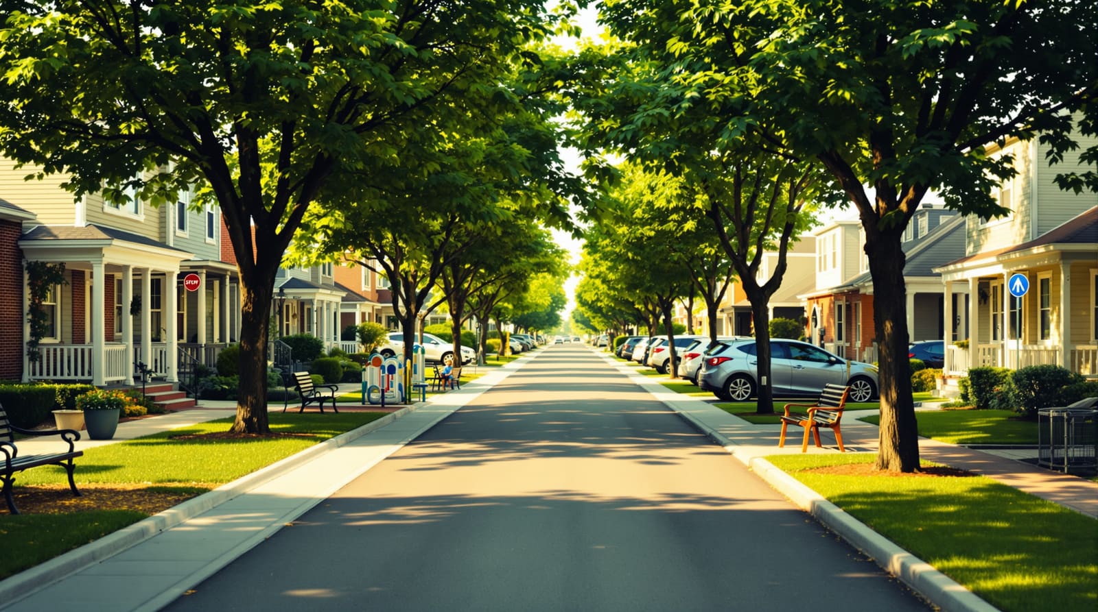
It is seven in the evening in a new residential enclave on the outskirts of Pune. The cars have already been left behind — parked in a multi-level structure at the gate, where each family walks the last two hundred metres home. The internal lanes belong to other things now. A clutch of eight-year-olds is playing a furious game of cricket against a compound wall, with no parent hovering at the edge anxious about a reversing SUV. An elderly couple walks a slow loop under a canopy of rain trees. A delivery rider on a small electric cart hums through at a walking pace, nods, and is gone. Nobody is breathing exhaust. Nobody is shouting over engine noise. The street is doing the oldest job a street has ever done — being a place, not just a conduit.
This is not Europe, and it is not a render. It is the kind of thing a handful of Indian schemes are now reaching for, half-succeeding at, and learning hard lessons from. The idea is deceptively simple and culturally radical: in a country that has spent thirty years organising its new neighbourhoods around the private vehicle, what happens if you decide the car is a guest, not the master? A car-free neighbourhood is not a place with no cars — it is a place where the car has been deliberately moved to the edge so that the centre can be given back to people.
The model: removing the car as an act of design
It helps to be precise about words, because almost nobody is doing the maximalist version. Truly "car-free" — no private cars owned or parked anywhere in the development — is vanishingly rare and, in the Indian context, close to fantasy. What is real and achievable sits on a spectrum.
A car-free core means no moving private cars inside the residential fabric at all; vehicles stop at the perimeter and the interior is purely pedestrian and cycle. A car-light neighbourhood keeps cars but strips them of dominance — parking is minimised and pushed to the edge, internal streets are designed for people first and cars only as slow, occasional guests. A car-lite scheme is the gentlest move: cars are still present and convenient, but the worst of their footprint — wide carriageways, surface parking sprawl, kerbside clutter — is reined in. Most good Indian projects should honestly aim for car-light, not car-free.

The intellectual lineage runs from Vauban in Freiburg, Germany — a district of around 5,000 people where most households live car-free or car-reduced, cars are parked in peripheral solar garages, and the internal streets are play streets where children have legal priority over the rare crawling vehicle. It runs through Barcelona's superblocks (superilles), which take a grid of nine city blocks, push through-traffic to the perimeter, and reclaim the interior streets as squares and gardens. And it has a quiet Indian ancestor too: the pedestrian cores of well-made cluster and courtyard housing, where homes open onto a shared internal walk rather than a road. This guide is about that deliberate removal and relocation of the car — which is distinct from, and builds on, walkable neighbourhood design: walkability is about the quality of the pedestrian experience, whereas a car-free model is the structural decision to take the car out of the centre in the first place.
The core moves
Strip away the rhetoric and the model comes down to a small number of physical decisions that reinforce one another.
Park at the edge, in shared structures. This is the keystone. Instead of a car following you to your door — and a driveway, a porch and a surface bay following the car — vehicles are collected in a multi-level or basement structure at the periphery of the neighbourhood. The walk from car to home is short but real: a hundred to three hundred metres. That single shift is what frees the interior. It also nudges behaviour honestly — when the car is fractionally less convenient than the cycle or the walk for a short trip, people make the short trip on foot.
Give the interior to people. With cars gone, the internal "streets" stop being carriageways and become lanes — narrow, shaded, paved for walking, wide enough only for the slow service or emergency vehicle that occasionally needs to pass. This connects directly to how you think about the street hierarchy: in a car-light scheme the hierarchy is inverted, with the pedestrian-priority lane at the top and the vehicle road demoted to the edge.
Build a fine pedestrian and cycle network. A car-free centre only works if walking and cycling are genuinely the easiest way to move. That means a dense, well-connected mesh of paths with short blocks, continuous shade, and no dead ends — the network must be finer-grained than a car network ever is.
Put everyday needs within a walk. This is the 15-minute city logic at neighbourhood scale: a kirana shop, a creche, a clinic, a chai stall, a small park, all reachable on foot in a few minutes. If residents must drive out for milk and vegetables, the car never really leaves.
Connect to transit and solve the last mile. The neighbourhood cannot be an island. It needs a credible link to the wider city — a Metro station, a bus corridor — and a clean last-mile answer (a shuttle, e-rickshaws, a cycle-share dock) so that being car-light does not mean being stranded.

What you gain: the land comes back
The case for all this is not abstract virtue. It is a tangible recovery of land, air and time. A conventional Indian gated layout can surrender a third or more of its developable ground to carriageways, turning circles, driveways and surface parking. When the car steps back, that land returns — and it returns to the things a community actually values.
| Where the car goes | What the land becomes |
|---|---|
| Surface parking bays scattered through the layout | Consolidated edge garage, freeing dispersed land for greens & play |
| Wide internal carriageways & turning circles | Shaded pedestrian & cycle lanes, squares & sit-outs |
| Private driveways & porches at each plot | Front gardens, doorstep stoops & neighbour-to-neighbour space |
| Kerbside parking & service roads | Rain gardens, swales & tree pits for stormwater & shade |
| Vehicle setbacks & manoeuvring aprons | Community gardens, creche yards & gathering courts |
| Reduced road land overall | Higher buildable area for homes & shared amenities |
The freed land is most valuable when it is planned as a connected system rather than leftover scraps, which is the work of deliberate open-space planning. Beyond the land, the gains compound: children can play on the street unsupervised, which is perhaps the single most powerful test of whether a neighbourhood is humane; the air is measurably cleaner where there are no idling engines; the quiet is restorative; and — well documented since Donald Appleyard's work and revived by Jan Gehl — streets with less traffic simply produce more neighbourly contact, more eyes on the street, more safety. The car-free move is, at heart, a community-building move.

The honest hard part in India
It would be dishonest to present this as easy here. India is not Freiburg, and the obstacles are real, cultural and physical.
Ownership is aspiration. The car and, even more universally, the two-wheeler are not merely transport in India — they are markers of arrival, of having made it. Telling a family that they must park a hundred metres from their door, or own fewer vehicles, runs straight into a deeply held aspiration. The two-wheeler in particular is so cheap, so flexible and so embedded in daily life that no Indian scheme can pretend it away. A workable model must accommodate the scooter, not banish it.
The heat discourages walking. A car-free model assumes people will choose to walk. For a good part of the year, across much of India, walking three hundred metres in unshaded sun at two in the afternoon is genuinely punishing. Continuous shade — from trees, colonnades, deep verandahs — is not a nicety here; it is the precondition without which the whole model collapses.
The last mile is weak. Indian public transit, where it exists, rarely reaches the gate. The gap between the Metro station and home is exactly where car-dependence is born. If the scheme cannot solve that gap convincingly, residents will buy cars and the experiment fails.
Service, delivery and emergency access are non-negotiable. An Indian home receives a constant stream of vehicles — the gas cylinder, the water tanker, the ambulance, the furniture truck, the swelling tide of e-commerce and food delivery. A car-free interior must still let these through, on a controlled basis, or it becomes unliveable.
And there is plain resistance — from buyers who equate convenience with a car at the door, and from developers who fear that car-free is unsellable. Lavasa and many integrated townships show how easily grand mobility ambitions get diluted once the market and the finances bite.
Making it real: the pragmatic Indian version

The answer is not purity but a calibrated car-light scheme that respects the constraints while capturing most of the gains.
Begin with peripheral parking that is generous enough to be credible — a shared structure at the edge sized for the cars and two-wheelers people will actually own, not an idealised fraction of them. The honesty of the model lives in keeping the walk short and the structure shaded and safe, so the edge feels like an extension of home, not a punishment.
Make the internal streets genuinely shaded and walkable — narrow, tree-lined, with continuous canopy and seating — so that the choice to walk is the easy choice for nine months of the year. Layer in a cycle and e-rickshaw last mile: small electric carts or cycle-rickshaws that move people, groceries and the elderly across the car-free zone and to the transit edge.
Keep a single managed vehicle spine or controlled access for service, deliveries and emergencies — bollard-controlled or time-windowed lanes that admit the ambulance and the gas truck at a crawl, then return to the pedestrian by default. Add visitor management at the edge garage so guests park outside and walk in like everyone else.
Done this way, the model stops being a European import and becomes something Indian: the pedestrian core of a cluster scheme, scaled up, with the two-wheeler accommodated and the heat designed around. It is one of the strongest moves available to anyone building the future Indian township — not because it bans the car, but because it finally stops letting the car decide everything.
References
- Carlos Moreno et al., "Introducing the 15-Minute City" — Smart Cities journal (2021).
- Congress for the New Urbanism, Charter of the New Urbanism (2nd ed.).
- City of Freiburg, Vauban district mobility and parking concept (Quartier Vauban documentation).
- Barcelona City Council, Superblocks (Superilles) Programme — urban mobility plan.
- Jan Gehl, Cities for People (Island Press, 2010).
- Ministry of Housing & Urban Affairs, URDPFI Guidelines (2014) — layout and mobility standards.
- IGBC Green Townships Rating System — Indian Green Building Council.
Pair this with walkable neighbourhood design for the pedestrian experience and cluster housing explained for the built form, and let DesignAI help you test where the cars go and what the freed land could become.
Export this guide
Related Guides — Deep-dive reading
Barcelona's Superblocks: The Building With No Building
Salvador Rueda and the Urban Ecology Agency of Barcelona did not design a structure — they redrew the rules of the street. The Superilles programme reclaims two-thirds of Barcelona's asphalt from the car, turns junctions into plazas, and proposes that the future of architecture may lie less in the object than in the ground between objects. A study of its geometry, its measured health payoff, and the contested politics of who the reclaimed city is really for.
The Future of ArchitectureSecurity for People Living Alone in India (2026): Calm, Practical Habits When There Is No Second Person to Notice
Living alone is an ordinary and growing part of Indian life - the student in a new city, the working single, the elder whose children are abroad, the person after a separation. It does not call for fear. It calls for a few deliberate habits, because there is no second person in the home to notice trouble, raise the alarm, or catch an accident. This is calm self-reliance, layer by layer.
SecurityCluster Housing Explained
Grouping homes around a shared court instead of road-facing plots — the cluster as a planning unit, low-rise high-density, more usable open space, and the Aranya Indore lesson
Urban Housing ModelsRelated Tools — Try Free
Interior Layout Planner — Printable Graph Grid
Printable graph grid to sketch room layouts to scale before committing to furniture placement.
Layout ToolVisitor Access Planner
Size visitor handling at a gate or reception — lanes needed at peak and the temporary-pass pool.
Visitor FlowChild & Elder Home-Safety Audit
Room-by-room safety audit for households with children or seniors — 10 categories, 70+ checkpoints tagged by audience.
Safety Audit