
The High Line: How a Derelict Freight Viaduct Rewrote the Rules of the Urban Park
James Corner Field Operations, Diller Scofidio + Renfro and Piet Oudolf turned a mile-and-a-half of abandoned elevated rail in Manhattan into a linear park that walks on top of the city — the definitive case study in adaptive reuse, 'agri-tecture', the peel-up paving plank, and the gentrification the greenery could not hold back.
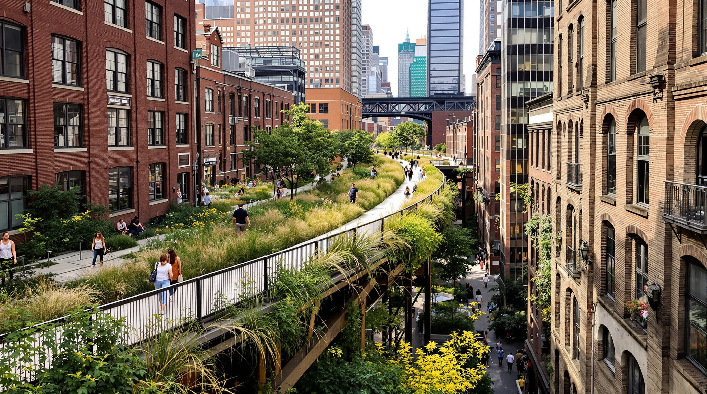
There is a moment, climbing the stair at Gansevoort Street, when the city drops half a storey below you and does not come back. You are walking on a railway that has not carried a train since 1980, thirty feet in the air, through a ribbon of wild grasses and self-seeded perennials that seems to have grown there by accident. It did not. Almost every blade of that apparent wilderness was designed, argued over, and manufactured. The High Line is one of the most influential public spaces of the twenty-first century precisely because it hides its own artifice so well — and because it asks a question the discipline is still trying to answer: when the infrastructure that built our cities falls silent, what do we do with the bones?
That question is why the building — and it is a building, an inhabited structure, even if we call it a park — belongs in any serious account of where architecture is going. It is the canonical demonstration of adaptive reuse at the scale of infrastructure, and it is also the most honest available lesson in what such reuse can unleash. The same design that saved a doomed viaduct also helped detonate one of the fastest waves of gentrification in recent New York history. Studio Matrx's editorial position is to hold both of those truths at once.
We wanted to keep the wildness of it. Not to turn it into another manicured park, but to let the strangeness of the place — a meadow floating over Manhattan — survive the act of saving it.
The question it poses
For most of the twentieth century the West Side Line was pure utility. Built by the New York Central Railroad and fully operational by 1934, the elevated viaduct lifted freight trains off Manhattan's deadly street-level tracks — Tenth Avenue had earned the nickname "Death Avenue" — and ran them directly through the warehouses and factories of the meatpacking and manufacturing districts. Trains delivered meat, dairy and produce straight into the second floors of buildings. Then trucking killed the traffic, the southernmost sections were demolished, and the last train reportedly ran in 1980, hauling a load of frozen turkeys. For two decades the structure sat abandoned, growing a spontaneous meadow of grasses and wildflowers in the ballast, threatened at every turn with demolition.
The conventional answer to a derelict elevated structure is a wrecking ball. In 1999, as the freight operator issued a call for reuse proposals, two neighbourhood residents — Joshua David and Robert Hammond — founded Friends of the High Line to argue for the opposite: that the ruin was the point. Inspired in part by Paris's earlier Promenade Plantée (1994), they proposed to keep the structure and inhabit it. A 2003 ideas competition and then a 2004 design competition — drawing hundreds of entries — produced the winning team: James Corner Field Operations as project and landscape lead, Diller Scofidio + Renfro as architects, and the Dutch plantsman Piet Oudolf as planting designer. The City of New York, which took ownership of the structure in 2005, ultimately invested around $115 million of public money into a project that had begun as a citizens' campaign.
The central architectural argument is a refusal. Faced with a mile and a half of extraordinary found space, the team resisted the temptation to do too much. Their concept — the one that reset the field — was to treat the design as a form of curated survival rather than construction.
Agri-tecture: the plank that becomes a meadow
The team named their strategy "agri-tecture" — part agriculture, part architecture. In practice it is a system, and it is worth understanding precisely because it is the reason the High Line does not read as a normal park.
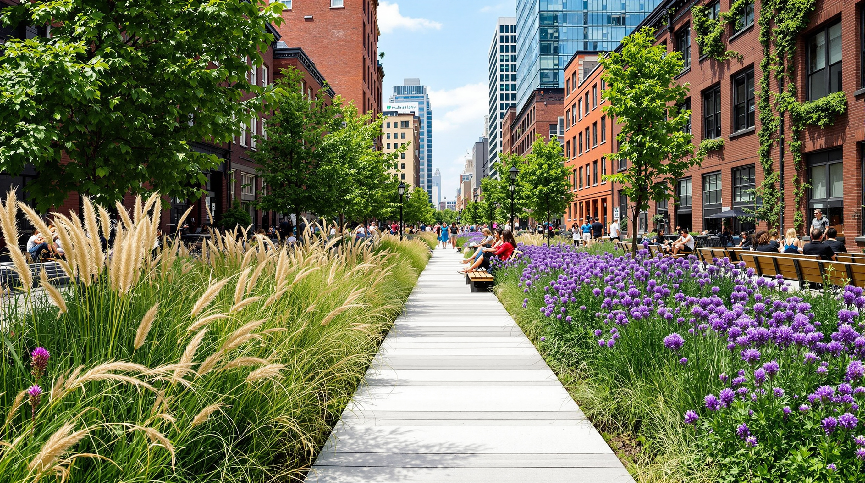
The entire walking surface is digitised into discrete units of paving and planting, then assembled along the length into a continuous gradient that shifts from 100% hard paving, where the path needs to carry crowds, to 100% soft, richly vegetated biotope, where the planting takes over. Between those extremes the two interpenetrate. The device that makes this possible is a bespoke precast concrete plank with two special properties: the joints between planks are left open, so rainwater drains and plants can colonise the seams; and the ends of the planks are tapered into points — "peel-up" combs — that comb into the planting beds rather than meeting them at a hard kerb. The path seems to fray into the meadow. There is no clear edge between where you walk and where the landscape lives.
Below the meadow, the design is quietly radical in its restraint. The riveted steel columns and girders of the 1930s viaduct were retained, cleaned and repainted; structural engineers Robert Silman Associates with Buro Happold assessed and repaired the frame rather than replacing it. The historic rail bed was stripped back, waterproofed, and rebuilt with a new drainage layer and a lightweight engineered soil profile — deep enough for perennials and small trees, shallow enough not to overload a structure designed for boxcars, not gardens. In several places the original rail tracks were lifted, catalogued, and reset back into the planting as a memory of what the surface used to be.
Piet Oudolf and the choreographed wild
If agri-tecture is the architecture, the feeling of the High Line belongs to Piet Oudolf. Oudolf is the leading figure of the "New Perennial" or naturalistic planting movement, and his brief was to honour the self-seeded landscape that had colonised the tracks during two decades of abandonment — without simply freezing it. His palette leans heavily on grasses and hardy perennials chosen as much for their structure, seed-heads and winter skeletons as for their summer bloom. The result is a landscape designed to look good dead: bleached, rustling, rust-coloured in January, not just lush in June.
This is a genuine break from the inherited idea of a city park as a green lawn with ornamental beds. Oudolf's planting reads as ecology rather than decoration — layered, seasonal, apparently self-governing — and it is one of the reasons the High Line felt, on opening, like a new kind of place rather than a new version of an old one.
Its place in the canon of the ground
The High Line sits in this canon under the theme of Landscape, Public Realm & Cultural Ground — the ground between buildings. Its influence there is almost impossible to overstate. In the years since Phase I opened in June 2009, an entire global genre of elevated and repurposed-infrastructure parks has followed in its wake, from Seoul's Seoullo 7017 to Chicago's 606 to countless "our-city's-High-Line" proposals. A 2025 systematic review of "High Line parks" as a design type — published in the peer-reviewed Journal of Asian Architecture and Building Engineering — treats the project as the origin point of a recognised model, and tries to codify what does and does not transfer to other cities.
| Fact | Detail |
|---|---|
| Design team | James Corner Field Operations (lead) · Diller Scofidio + Renfro · Piet Oudolf (planting) |
| Structural engineers | Robert Silman Associates · Buro Happold |
| Original structure | New York Central West Side Line, elevated freight viaduct, operational by 1934 |
| Length / area | ~1.5 miles (2.3 km) · ~310,000 sq ft |
| Phased openings | Phase I 2009 · Phase II 2011 · Phase III 2014 · Spur 2019 |
| Public investment | ~$115 million (City of New York) |
| Client / steward | Friends of the High Line, with NYC Parks |
The third position: the High Line effect
An honest account cannot end with the seed-heads. The High Line is also the origin of a phrase that has become a warning: "the High Line effect." By transforming a derelict structure into an internationally photographed amenity, the park sent a shock through the West Chelsea and Meatpacking property markets. Reported figures vary, but peer-reviewed work is unambiguous about the direction. A 2020 study in Landscape and Urban Planning by Black and Richards — an econometric, GIS-based analysis — found that the amenity's value flowed overwhelmingly to property owners and higher-income newcomers rather than to the existing, more diverse and lower-income residents nearby, a pattern the authors frame as eco-gentrification: green improvement as a driver of displacement.
The designers and Friends of the High Line have since acknowledged this openly. Robert Hammond, one of the co-founders, has said publicly that the project failed the local community it was meant to serve, and the organisation launched a High Line Network specifically to help other infrastructure-reuse projects avoid repeating the pattern. This is the uncomfortable, essential lesson: a landscape can be a masterpiece of design and an engine of inequality in the same gesture. Beauty is not neutral. Who a park is ultimately for is a question the drawings do not answer — the city does, afterwards, through rent.
Why it belongs in the canon
Strip away the theory and the controversy and one fact remains: before the High Line, very few people believed a rusting, condemned piece of freight infrastructure could become one of the most visited cultural spaces in a global city. It proved that the most sustainable landscape is often the one that already exists — that ruin and value are not opposites — and it did so by editing rather than building, keeping the strangeness of the found place intact. It also proved that a citizens' campaign could redirect the destiny of a piece of the city, and that landscape, not the building, could be the main event.
The High Line's answer to Kushner's question — where is architecture going? — is double-edged and all the more useful for it. Architecture is going up onto the leftovers: onto the viaducts, the rail cuts, the flyovers and the derelict edges that the last century built and abandoned. And it is going there with its eyes open to the fact that saving a ruin beautifully is the easy part. The hard part is making sure the people already living beneath it are still there to enjoy it.
References
- James Corner Field Operations & Diller Scofidio + Renfro — "The High Line," official project descriptions and data (design team, agri-tecture concept, precast plank system, ~1.5 miles, phased 2009–2019). dsrny.com (primary source)
- Friends of the High Line — "History" (West Side Line, last train 1980, CSX, Joshua David & Robert Hammond, 1999 founding, phased openings). thehighline.org/history (primary source)
- Black, K. J. & Richards, M. (2020). "Eco-gentrification and who benefits from urban green amenities: NYC's High Line." Landscape and Urban Planning, 204, 103900. DOI: 10.1016/j.landurbplan.2020.103900. (peer-reviewed; the "High Line effect" evidence)
- Systematic review (2025). "Theoretical studies and design models of High Line parks: a systematic review." Journal of Asian Architecture and Building Engineering (Taylor & Francis). DOI: 10.1080/13467581.2025.2533206. (peer-reviewed; the High Line as a design type)
- Oudolf, P. & Kingsbury, N. (2013). Planting: A New Perspective. Timber Press. (scholarly book; the naturalistic planting philosophy behind the High Line's landscape)
- "The New York High Line officially open." ArchDaily (2009); and "Revisit: High Line." The Architectural Review. archdaily.com (architectural press)
Part of The Future of Architecture in 300 Buildings — Studio Matrx's canon of the buildings asking where architecture goes next. Chapter 13: Landscape, Public Realm & Cultural Ground.
Export this guide
Related Guides — Deep-dive reading
The Lowline: Can You Pipe Sunlight Underground and Grow a Public Park?
Raad Studio's proposal to turn a derelict trolley terminal beneath Manhattan's Lower East Side into the world's first subterranean park is one of the most influential buildings never built — a test of remote-skylight technology, of found infrastructure as raw material, and of whether an idea can shape architecture even when the money runs out.
The Future of ArchitectureACROS Fukuoka: Emilio Ambasz and the Building That Gave Its Park Back
Two decades before the vertical forest, Emilio Ambasz hid a million square feet of concert hall and offices under a fifteen-storey climbing garden — turning the oldest argument in cities, land value versus open space, into a single terraced hill in the heart of Fukuoka.
The Future of ArchitectureOne Green Mile: How MVRDV and StudioPOD Reclaimed the Space a Flyover Throws Away
Beneath a roaring Mumbai flyover, MVRDV and StudioPOD turned 200 metres of derelict undercroft into a green public room — a project that pushes adaptive reuse past the building and onto the leftover space infrastructure leaves behind. A close read of its concept, its water-and-planting engineering, its Indian civic stakes, and the questions a corporate-funded park raises.
The Future of ArchitectureRelated Tools — Try Free
Rainwater Tank Sizer
How big should your rainwater tank be? Computes annual harvest, recommended tank capacity in litres, water-bill savings, and payback — for 10 Indian cities.
RWH CalculatorGarden Planning Toolkit
Get a tailored garden plan — planting layers, Indian species, features and a checklist — from your climate, space, sun and goals.
PlannerDesign Brief Generator
Answer 10 questions and generate a professional interior design brief PDF for your designer or architect.
Brief Generator