
Madrid Río: How a City Buried a Motorway and Got Its River Back
West 8 and the MRío consortium turned ten kilometres of buried M-30 ring road into a 120-hectare riverside park stitched over the tunnel roof. This deep study reads its central move — landscape as the lid on infrastructure — its Salón de Pinos, its bridges by Perrault, and the municipal debt the green cannot quite cover.
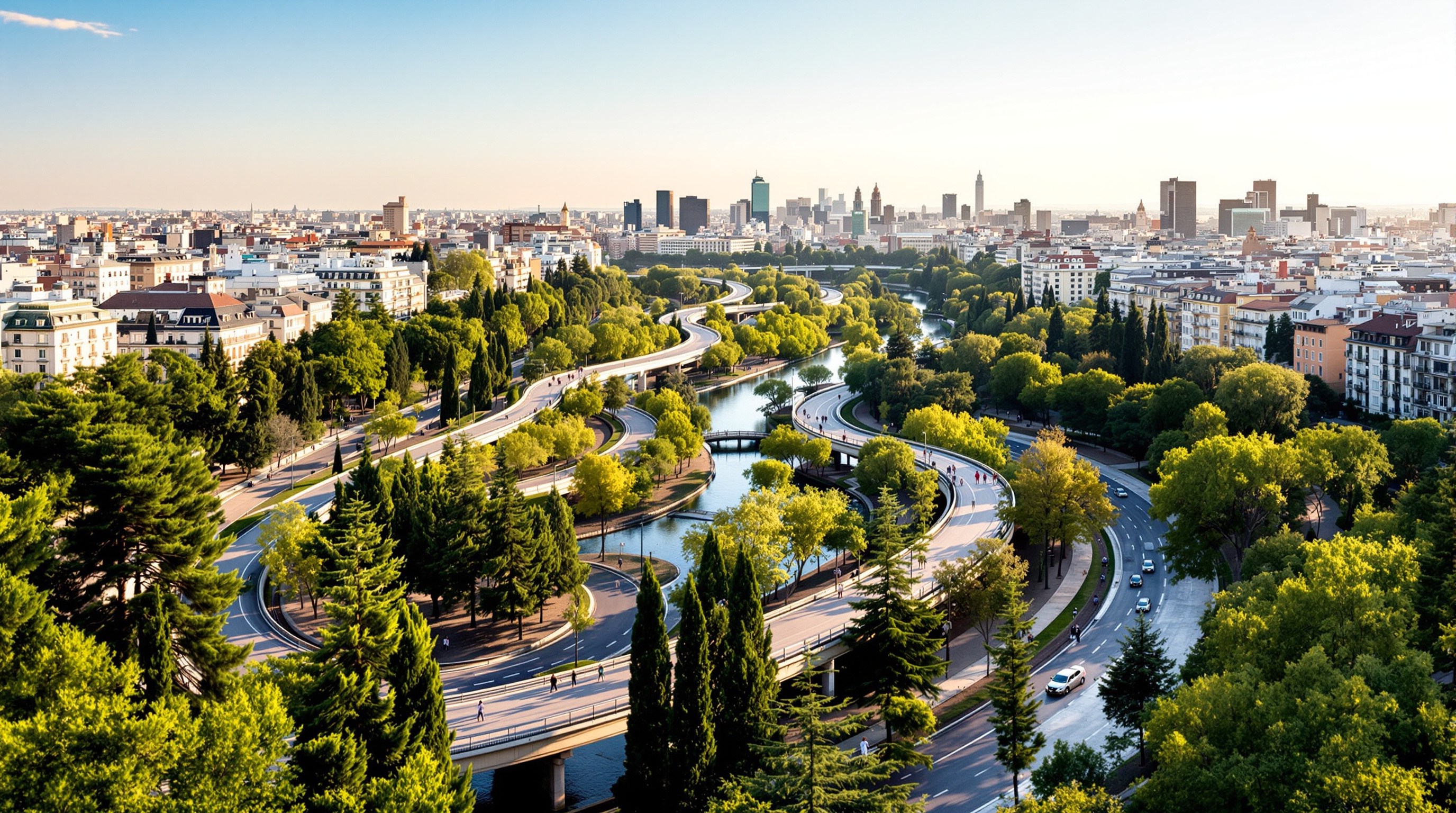
For forty years, the western edge of central Madrid was defined by a road. The M-30, the city's inner ring, ran along both banks of the Manzanares River as a roaring elevated barrier — six to ten lanes of traffic that severed the historic city from the working-class districts of Usera, Carabanchel and Arganzuela, and turned the river itself into a drainage ditch nobody wanted to look at. Then, in one of the largest urban civil-engineering operations Europe had seen, Madrid put the road underground and laid a park on top of it. The barrier became a seam. The ditch became a promenade. The question Madrid Río answers — and it is a future-facing question for every dense city choked by mid-century infrastructure — is disarmingly simple: what if the motorway is not the site's problem but its foundation?
That inversion is why the project belongs in any serious account of where architecture is going. Madrid Río is not really a building; it is roughly 120 hectares of new public ground conjured over a tunnel. Its central architectural act is a lid — and the discipline it demonstrates, landscape treated as the visible surface of buried infrastructure, is now one of the defining strategies of the twenty-first-century city.
The winning team proposed to resolve the urban situation exclusively by means of landscape architecture — not more architecture on the river, but a continuous green surface that could heal the wound the road had left.
The question it poses
By the early 2000s Madrid faced the classic post-war dilemma. The M-30 was essential to the region's traffic, but as an at-grade and elevated highway along the Manzanares it was an environmental and social catastrophe: noise, pollution, and a physical wall between the two halves of the city. Mayor Alberto Ruiz-Gallardón made its burial the signature project of his tenure. Between roughly 2004 and 2007, contractors drove some 43 kilometres of tunnels beneath the city and sank about ten kilometres of the M-30 underground along the river — the section usually cited when people describe the works. The engineering came first; only then did the question of the surface arise.
That surface was the subject of an international ideas competition in 2005, won by a consortium led by the architect Ginés Garrido: the three Madrid practices Burgos & Garrido, Porras La Casta, and Rubio & Álvarez-Sala (together trading as MRío arquitectos) with the Rotterdam landscape office West 8, led by Adriaan Geuze. Their proposal was notable for what it refused. It did not try to line the new banks with signature buildings or a grand axial monument. It proposed, almost polemically, to solve the whole problem with landscape alone — planting, paths, water and bridges — as if the most radical move available to architecture in 2005 was to build almost nothing above ground and let the ground itself do the work.
The central move: landscape as the lid
The intellectual key to Madrid Río is that the park is not next to the infrastructure; it is the infrastructure's roof. The tunnel and the park were conceived as a single section. Below runs the motorway; above sits a planted deck; between them a structural slab carries soil, trees, paths and people. This is the logic that lets the design connect two banks that a road had held apart for a generation.
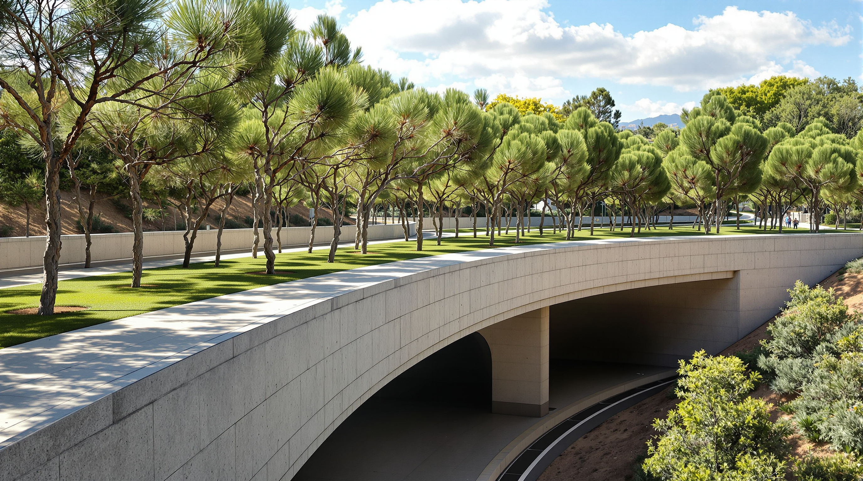
The park's signature is the Salón de Pinos — the "hall of pines," a long, informal grove of some 8,000 pine trees planted in loose choreographed clusters directly over the tunnel deck. West 8's instinct here was telling. Rather than a manicured formal garden, which would have advertised its own artifice, they used a rugged, drought-tolerant Mediterranean species that reads as almost native, softening the monumental infrastructure beneath into something that feels like it grew there. The pines also do quiet technical work: their root balls sit in engineered soil profiles calibrated to the slab's load capacity, and their canopy screens the residential blocks from the river's glare and noise.
The bridges: architecture returns, precisely
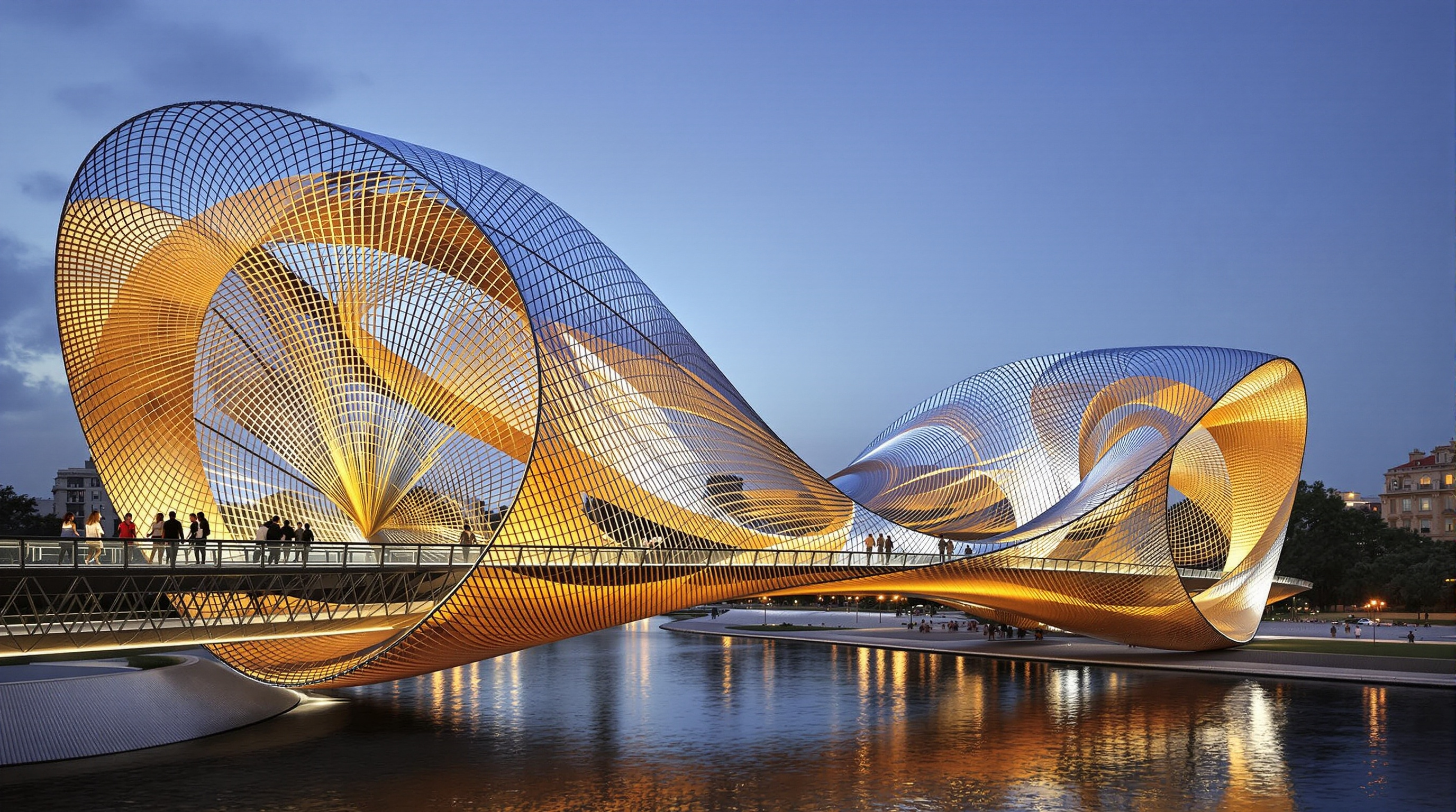
If the strategy was to build almost nothing above ground, the exceptions prove instructive. The scheme threads roughly a dozen new pedestrian bridges across the river — the points where the two reconnected banks actually touch — and here the designers allowed real architecture back in. The most celebrated is the Arganzuela Footbridge (2011) by Dominique Perrault: two great cones of spiralling steel mesh, one leaping over the park and one over the water, nearly meeting at a raised central lookout. It is about 278 metres long and reportedly cost around €13.6 million. Nearby, the twin Puentes Cáscara ("shell bridges") carry concrete domes lined on their undersides with mosaics by the artist Daniel Canogar, so that the act of crossing becomes, briefly, the act of standing inside a small vaulted room. The logic is consistent: the ground is landscape, but the crossings — the moments of connection the whole project exists to make — are worth an architect's full attention.
| Element | What it does | Note |
|---|---|---|
| Buried M-30 | Removes the elevated road barrier | ~10 km underground along the river |
| Slab / lid | Carries the park over the tunnel | Load-calibrated for soil + mature trees |
| Salón de Pinos | The signature grove | ~8,000 Mediterranean pines |
| Arganzuela Footbridge | Landmark river crossing | Dominique Perrault, ~278 m, 2011 |
| Restored Manzanares | River left open, banks re-naturalised | Fish ladders; birdlife returned |
Its place in the chapter: reclaimed ground
Madrid Río sits squarely in the lineage this chapter traces — the reclaimed-infrastructure park. Its obvious cousins are New York's High Line (a railway made a promenade) and Seoul's Cheonggyecheon (a stream freed from beneath a freeway). But Madrid Río is the most ambitious of the type in one specific sense: the High Line and Cheonggyecheon largely removed the infrastructure they replaced, while Madrid Río kept its motorway fully operational and simply hid it, carrying tens of thousands of vehicles a day directly beneath the picnicking families. It is the purest built argument that landscape can be a working roof — that a city need not choose between mobility and public space if it is willing to stack them. Beyond the tunnel deck the project also re-naturalised the Manzanares itself, reworking the old channel dams, adding fish passes, and inviting back the herons and kingfishers that had abandoned the concrete river. The reward came in 2015, when Harvard's Graduate School of Design awarded Madrid Río its Veronica Rudge Green Prize in Urban Design — the field's most serious recognition.
The house 'third position': the debt beneath the green
An honest reading cannot stop at the pines. The park is the beautiful surface of a project whose full cost was enormous and politically fraught. Burying the M-30 was financed largely through a municipal vehicle, Madrid Calle 30, and the wider works are commonly reported to have cost on the order of €3.9–4.1 billion — figures that should be treated with care, because they mix the road engineering with the landscape and are quoted inconsistently across sources. Much of that spending sat off the city's headline balance sheet and contributed to a municipal debt load that dominated Madrid politics for a decade after Gallardón left office. Critics argued the money bought a spectacular park for the river districts while the rest of the city inherited the bill; defenders answered that few investments have returned more public space, cleaner air and social repair per euro. There is a second, subtler critique the parametric-era enthusiasm can miss: a park over a live motorway is permanently dependent on that motorway's ventilation, fire safety and structural upkeep — the green is only ever as durable as the machine breathing beneath it.
Studio Matrx's position is to hold both truths. Madrid Río is a landmark demonstration that a city can reverse a mid-century mistake and reclaim its river at scale — and a reminder that "landscape as the lid on infrastructure" is a strategy that hides its costs as elegantly as it hides its traffic. The future it points to is real and worth pursuing; it is also expensive, and the bill does not disappear because you planted eight thousand pines over it.
Why it belongs in the canon
Strip away the accounting and one fact remains: Madrid took the single most hostile object in its urban fabric — an elevated ring motorway on its river — and, without stopping the traffic, turned its roof into one of Europe's great new public spaces. That move, landscape stitched over hidden infrastructure to reconnect a divided city, is now part of the standard vocabulary of urban design from Boston to Seoul. Madrid Río did not invent the idea. It proved it could be done at the scale of a river and a ring road, and that when it is done well the seam disappears entirely — until all a visitor sees is the water, the pines, and the far bank they can finally walk to.
References
- West 8, "Madrid Río" — official project description (consortium with MRío arquitectos; ~120 ha of new public space; Salón de Pinos of ~8,000 pines; ~12 pedestrian bridges). west8.com (primary source)
- Burgos & Garrido arquitectos, "Madrid Río" — lead-architect project page (Ginés Garrido; the "3 + 30" strategy; competition 2005). burgos-garrido.com (primary source)
- Harvard Graduate School of Design, Veronica Rudge Green Prize in Urban Design 2015 — award to Madrid Río. gsd.harvard.edu (primary source; institutional)
- Garrido, G. et al. (2022). "Parks and roads build the cities: the M-30 and Madrid-Río project, building landscape." Conference/journal paper, ResearchGate. researchgate.net (peer-reviewed / scholarly)
- Cuesta, R. et al. "Engineering, politics and territorial planning of Madrid's river spaces: the historical transformation of the Manzanares River through great urban development operations." ResearchGate. researchgate.net (peer-reviewed / scholarly)
- "Madrid Rio / Burgos & Garrido + Porras La Casta + Rubio & Álvarez-Sala + West 8." ArchDaily (2011). archdaily.com (architectural press; project data mirror)
- "Arganzuela Footbridge / Dominique Perrault Architecture." ArchDaily (2012); and Wikipedia, "Arganzuela Footbridge" (length ~278 m; cost ~€13.6M; opened March 2011). archdaily.com (press / reference)
Part of The Future of Architecture in 300 Buildings — Studio Matrx's canon of the buildings asking where architecture goes next. Chapter 13: Landscape, Public Realm & Cultural Ground.
Export this guide
Related Guides — Deep-dive reading
Cheonggyecheon Stream Restoration: How Seoul Tore Down a Highway to Uncover a River
In 2005 Seoul demolished an elevated expressway carrying 168,000 cars a day and put a 5.8-kilometre stream back in its place. This deep study reads the project's central move — subtraction as design — its pumped-water hydrology and flood engineering, its ambivalent ecology, and the politics of a restoration that never quite decided which past it was restoring.
The Future of ArchitectureSoFi Stadium: How HKS Turned a Roof into a Building and Buried the Rest
HKS's $5-billion venue in Inglewood is the most expensive stadium ever built — but its real argument is spatial, not financial. A translucent ETFE canopy the size of nineteen acres floats free of the walls it shelters, the seating bowl is sunk a hundred feet to duck under LAX's flight path, and a thousand-tonne double-sided screen hangs where the scoreboard used to be. This is the stadium reconceived as landscape, canopy and media surface.
The Future of ArchitectureHouse for Trees: How Vo Trong Nghia Turned a House into Five Flowerpots
In one of the densest districts of Ho Chi Minh City, VTN Architects built a family home as five concrete boxes whose real purpose is to carry big tropical trees on their roofs — a low-cost prototype that treats a private house as public green infrastructure, and asks whether architecture's future job is to grow the city back.
The Future of ArchitectureRelated Tools — Try Free
Cross-Ventilation Analyzer
Estimate airflow and air changes per hour (ACH) from room size, window areas, layout, and local wind — with NBC 2016 Part 8 compliance check.
Ventilation CalculatorDesign Brief Generator
Answer 10 questions and generate a professional interior design brief PDF for your designer or architect.
Brief GeneratorGarden Planning Toolkit
Get a tailored garden plan — planting layers, Indian species, features and a checklist — from your climate, space, sun and goals.
Planner