
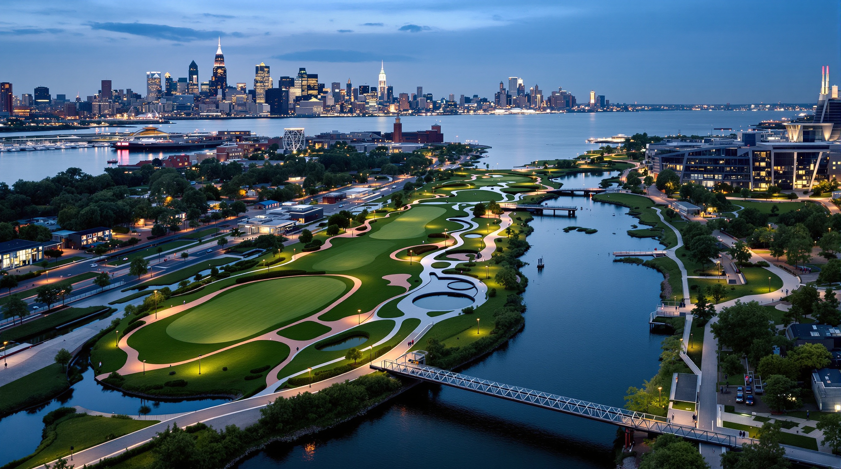
Hunter's Point South Park: The Waterfront That Was Designed to Flood
SWA/Balsley, Weiss/Manfredi and Arup turned an abandoned Queens shoreline into an 11-acre park that yields to the East River instead of walling it out — a working prototype for the 'soft', adaptive, resilient public realm that a warming, rising-water century now demands.
For a century the standard architectural answer to water was the wall. When a city met a river or a harbour it drove in a bulkhead, poured a concrete edge, and drew a hard line between the dry human world and the wet one. Hunter's Point South Park, on a former industrial peninsula in Long Island City, Queens, is built on the opposite premise. Its central move is to stop fighting the East River and start negotiating with it — to design a public landscape that expects to be flooded, absorbs the blow, drains itself, and comes back. It is a park engineered to get wet.
That inversion is why the project belongs in any serious account of where architecture is going. As sea levels rise and storm surges intensify, the twentieth-century instinct to build a higher, harder wall is running out of road: walls fail catastrophically, they cut cities off from their own water, and they simply move the flood somewhere else. Hunter's Point South proposes a different discipline — landscape as soft, adaptive infrastructure — and, crucially, it is not a competition board or a manifesto. It is eleven acres of built, tested, heavily used public ground.
In place of a concrete flood barrier, the park's constructed wetlands, sloped rock edges and a catchment lawn are designed to receive a storm surge, hold it, and release it back to the river as the tide recedes — protection by yielding rather than by resistance.
The question it poses
The site is a fragment of New York's industrial afterlife: a post-industrial spit at the mouth of Newtown Creek, long fenced off, contaminated and inaccessible, that the city's Economic Development Corporation and Queens West Development Corporation earmarked for a new mixed-use neighbourhood of roughly thirty acres. The park is the public spine of that plan — and the brief handed to the design team asked it to do two jobs at once. It had to be a genuinely desirable everyday park for thousands of new residents, and it had to be the neighbourhood's first line of defence against the very river it opened onto.
The team that answered was itself a statement about how this kind of work now gets done. SWA/Balsley, the landscape practice led by Thomas Balsley, and the architecture studio Weiss/Manfredi worked as genuine co-authors rather than as landscape-plus-decoration, with the global engineering firm Arup as prime consultant and infrastructure designer. There is no clean line here between the building and the ground, between architecture and landscape and civil engineering — and that blurring is part of the point. The discipline that produces a resilient waterfront is not any one of those professions; it is all of them, fused.
Kushner's animating question for this canon is simple: what does a building tell us about where architecture is going? Hunter's Point South answers by redefining what counts as protective infrastructure. The future it points to is one where the thing that keeps the city dry is not a grey wall you resent but a green park you love — where flood defence is indistinguishable from public amenity.
Protection by yielding: the resilience strategy
The design's intelligence is in a sequence of soft edges, each doing hydraulic work while looking like nothing more than a pleasant place to walk. Instead of a single hard bulkhead holding the line, the park layers several yielding systems between the river and the neighbourhood behind it.
Read the section from the water inward. First a sloped rock sill rimmed with gabions — wire cages of stone — takes the direct energy of waves and tidal push, dissipating it the way a natural shoreline does rather than reflecting it back like a vertical wall. Behind that sits roughly 1.5 acres of constructed tidal wetland, a band of salt-tolerant marsh planted with species such as coastal little bluestem and seaside goldenrod that can survive a soaking in brackish river water; the marsh cleans stormwater and swallows surge before it reaches anything precious. A meandering causeway, raised just slightly above the river, threads along the edge so people can walk the water's rim while the wetland does its quiet defensive work below.
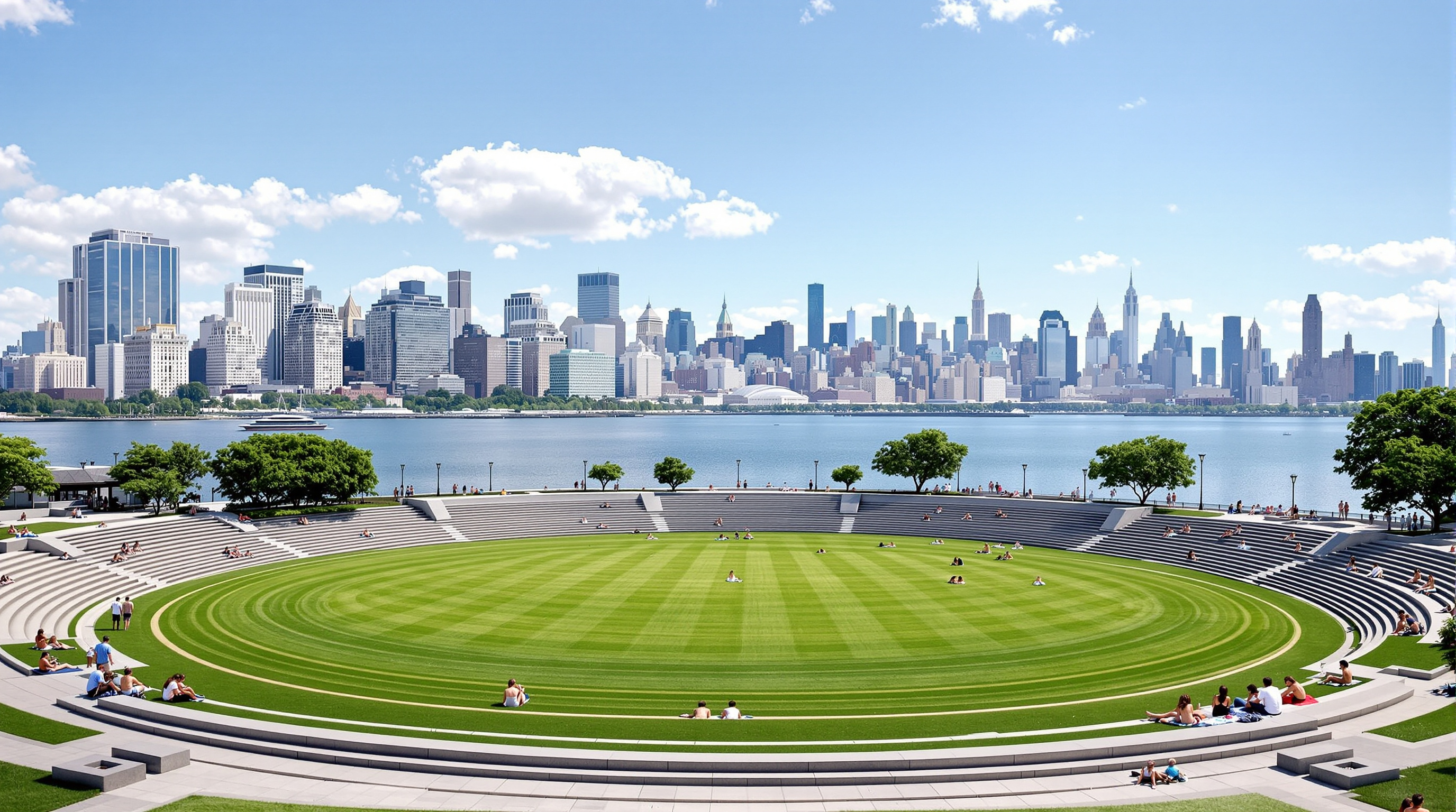
The cleverest single element is the great oval lawn. It reads, on a summer weekend, as an ordinary field of green ringed by low seating steps. Hydraulically it is a basin: the lawn is tilted back toward the river and encircled by a low precast concrete wall, so that if a surge overtops the bulkhead the lawn becomes a shallow reservoir that holds the water and then, because of its tilt, lets gravity drain it back to the East River as the tide falls. Everyday amenity and emergency catchment are the same object. Nobody has to build, maintain or look at a separate flood structure, because the flood structure is the place people already want to be.
The numbers behind the picture
Soft engineering earns its keep only if the performance is real, and Hunter's Point South is unusually well documented — the Landscape Architecture Foundation's Landscape Performance Series studied the completed Phase 1 and recorded measured, not modelled, results.
| Metric | Reported performance |
|---|---|
| Continuous waterfront park | ~11 acres (Phase 1 ~9.5 acres, 2013; Phase 2 ~5.5 acres, 2018) |
| Constructed tidal wetland | ~1.5 acres of salt-tolerant marsh |
| Annual rainfall intercepted / managed | ~73% of average annual rainfall |
| Flood-storage capacity | ~557,800 gallons |
| Storm-surge event accommodated | up to ~6 feet |
| Gabion / rock-filled edge | 760+ feet along the biofiltration swale |
| On-site solar generation | ~37,000 kWh/year from 64 photovoltaic panels |
The figures matter because they translate a poetic idea — a park that yields to water — into an engineering claim a city can underwrite. Intercepting nearly three-quarters of annual rainfall on site relieves New York's combined sewers, which otherwise dump untreated overflow into the harbour during storms. Half a million gallons of flood storage is not decorative; it is capacity that would otherwise have to be bought as pipe, tank and wall.
Architecture at the edge: the cantilevered overlook
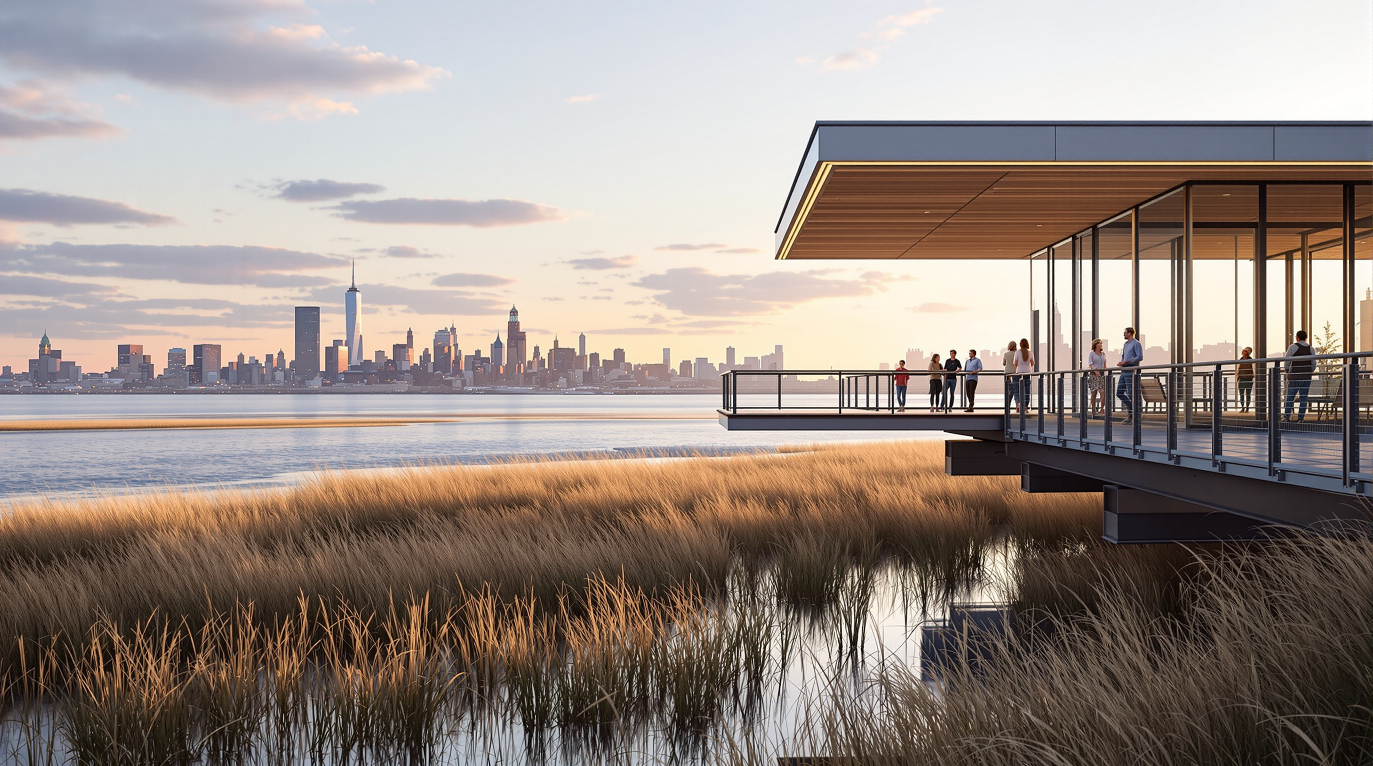
If the park's genius is mostly horizontal and hydraulic, Weiss/Manfredi gave it one vertical, architectural exclamation mark. At the southern tip, where Phase 2 completes the peninsula, a 40-foot-wide steel-and-wood platform cantilevers out over the wetland and water — a public belvedere that the architects describe as being poised like the bow of a ship, aligned on axis with the Empire State Building across the river. It is the moment where landscape becomes building: a piece of inhabitable structure that lifts visitors above the marsh and hands them the postcard view.
The overlook does real cultural work. A resilient waterfront that felt purely like defensive infrastructure would be a hard sell; this single dramatic gesture makes the park a destination, a place people photograph and return to. Resilience, the project argues, has to be desirable to be durable — a wall that only defends will be neglected, but a park people love will be maintained, funded and defended in its turn.
Tested by Sandy — and the honest caveats
The most cited claim about Hunter's Point South is that it proved itself against Superstorm Sandy in October 2012, when Phase 1 was under construction, and emerged with only minimal damage while its salt-tolerant planting and hardy materials shrugged off the inundation. That story is broadly supported by the design team and by the Landscape Performance study, and it is genuinely persuasive. But the third position — the one Studio Matrx tries to hold — asks for care on a few points.
First, dates. This canon lists the park at 2013, and that is right for the opening of Phase 1; but the park most people photograph, with the cantilevered overlook and the southern wetlands, is the 2018 Phase 2. Calling the project simply "2013" flattens a genuinely two-part, decade-long build, which is why its date is best given as a range. Second, scale of proof. Sandy tested a landscape that was young and, in places, still under construction; a soft edge is not the same as a solved problem, and the true stress test is a future surge on a mature, subsided, sea-level-raised shoreline — something no completed project has yet fully faced. A recent peer-reviewed study in Discover Cities (Simais and Korgavus, 2024) takes the park seriously precisely as a resilience case study rather than a finished verdict, which is the right register. Third, soft engineering is not free of trade-offs: constructed wetlands demand active stewardship, salt marshes can migrate or drown as water rises, and the approach buys time and reduces risk rather than guaranteeing a dry city.
None of this diminishes the achievement. It sharpens it. Hunter's Point South is valuable not because it claims to have beaten the water but because it demonstrates, at real scale and with real numbers, a credible alternative to the failed logic of the ever-higher wall.
Why it belongs in the canon
Chapter 13 of this canon is about the ground between buildings — the parks, plazas and cultural landscapes that increasingly carry as much design ambition as any monument. Hunter's Point South earns its place because it fuses that public-realm ambition with the century's hardest technical problem. It is a park, an ecosystem, a piece of civil infrastructure and an architectural landmark at once, and it refuses to let any of those readings cancel the others.
The building it most resembles is not a building at all. It is a piece of coastline that a city chose to keep — or, more accurately, to rebuild — as a shock absorber. Where the twentieth century met rising water with the bulkhead, Hunter's Point South offers the twenty-first a different verb. Not resist. Yield, hold, and recover.
References
- Balsley, T. (SWA/Balsley) — "Hunter's Point South Waterfront Park," official project page and description (design collaboration with Weiss/Manfredi; Arup as prime consultant). swagroup.com (primary source)
- Weiss/Manfredi Architecture/Landscape/Urbanism — "Hunter's Point South Waterfront Park," official project page (two-phase, ~30-acre neighbourhood; 40-foot cantilevered overlook; ~1.5-acre wetlands; awards). weissmanfredi.com (primary source)
- Landscape Architecture Foundation — "Hunter's Point South Waterfront Park, Phase 1," Landscape Performance Series case-study brief (measured performance: ~73% annual rainfall managed; ~557,800-gallon flood storage; ~6-ft surge accommodation; 37,000 kWh/yr solar; property-value and use data). landscapeperformance.org (primary / evaluated field data)
- Simais, N. & Korgavus, B. (2024). "Urban recreation areas and climate change resilience: Hunter's Point South Park, New York City." Discover Cities (Springer Nature). DOI: 10.1007/s44327-024-00022-6. (peer-reviewed; resilience case study)
- "Hunter's Point South Waterfront Park Phase II / SWA/Balsley + Weiss/Manfredi." ArchDaily (2018). archdaily.com (architectural press; project data mirror)
- "Former industrial site in Queens transformed into Hunter's Point South Park." Dezeen (2018). dezeen.com (architectural press)
Part of The Future of Architecture in 300 Buildings — Studio Matrx's canon of the buildings asking where architecture goes next. Chapter 13: Landscape, Public Realm & Cultural Ground.
Export this guide
Related Guides — Deep-dive reading
The Big U: The Flood Wall That Refused to Be a Wall
BIG and One Architecture answered Hurricane Sandy not with a barrier but with a ten-mile ribbon of raised parkland around Lower Manhattan — a 'string of pearls' where storm defence doubles as public space. This deep study reads the Big U as concept and provocation, its bridging-berm and flip-down-wall logic, and the hard gap between the visionary drawing and the East River Park it became.
The Future of ArchitectureThe Sponge City: How Kongjian Yu Taught China's Cities to Drink the Rain
Landscape architect Kongjian Yu and his firm Turenscape reframed the flood-prone city as a living sponge — a national programme, launched in 2013–14 across dozens of Chinese cities, that swaps concrete pipes for wetlands, rain gardens and terraces. A study of its ecological logic, its flagship parks, and the hard question of what a sponge can and cannot hold.
The Future of ArchitectureThe Big U: How BIG Turned a Flood Wall into a Ten-Mile Public Park
BIG and One Architecture answered Hurricane Sandy with a protective 'U' wrapping Lower Manhattan — a berm that is also a park, a bench that is also a barrier. A deep study of the 'string of pearls' concept, the compartments and deployable panels that make it work, and the hard gap between the drawing and what New York actually built.
The Future of ArchitectureRelated Tools — Try Free
Design Brief Generator
Answer 10 questions and generate a professional interior design brief PDF for your designer or architect.
Brief GeneratorRainwater Tank Sizer
How big should your rainwater tank be? Computes annual harvest, recommended tank capacity in litres, water-bill savings, and payback — for 10 Indian cities.
RWH CalculatorBefore & After Studio
Generate AI before-and-after renders to preview how your redesign could look.
DesignAI