
The Big U: How BIG Turned a Flood Wall into a Ten-Mile Public Park
BIG and One Architecture answered Hurricane Sandy with a protective 'U' wrapping Lower Manhattan — a berm that is also a park, a bench that is also a barrier. A deep study of the 'string of pearls' concept, the compartments and deployable panels that make it work, and the hard gap between the drawing and what New York actually built.
On the night of 29 October 2012, Hurricane Sandy pushed a wall of seawater into Lower Manhattan. The storm surge crested at around fourteen feet above the low-tide line, drowned the subway tunnels, blacked out everything south of Midtown, and killed dozens of people across the region. It was the moment the abstract phrase "sea-level rise" became a flooded hospital lobby and a family trapped in a public-housing tower with no power. The question that followed was blunt: how do you defend a dense, beloved, low-lying city from water without turning its edge into a concrete bunker?
The Big U is the most influential answer anyone drew. Proposed by the Danish-American practice BIG (Bjarke Ingels Group) with the Dutch firm One Architecture and a large supporting team, it won a share of the federal Rebuild by Design competition in 2014 and, with it, an initial award reported at around 335 million US dollars. Its central move is deceptively simple and genuinely radical: instead of a flood wall that says keep out, design a continuous protective landscape that says come in — a ten-mile ribbon of berms, raised parks and hidden barriers wrapping the bottom of the island in the shape of a U, from West 57th Street down around the Battery and back up the East Side.
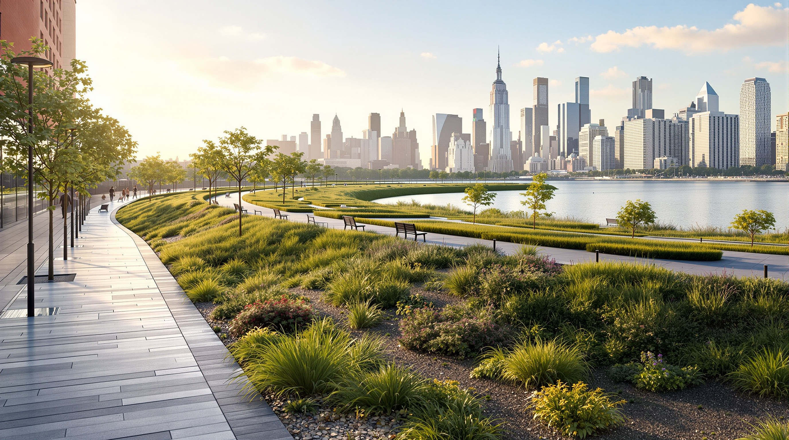
The Big U protects ten continuous miles of Lower Manhattan — not with a wall, but with a string of pearls of social and environmental amenities, each tailored to its neighbourhood, that also happens to hold back the sea.
The question it poses
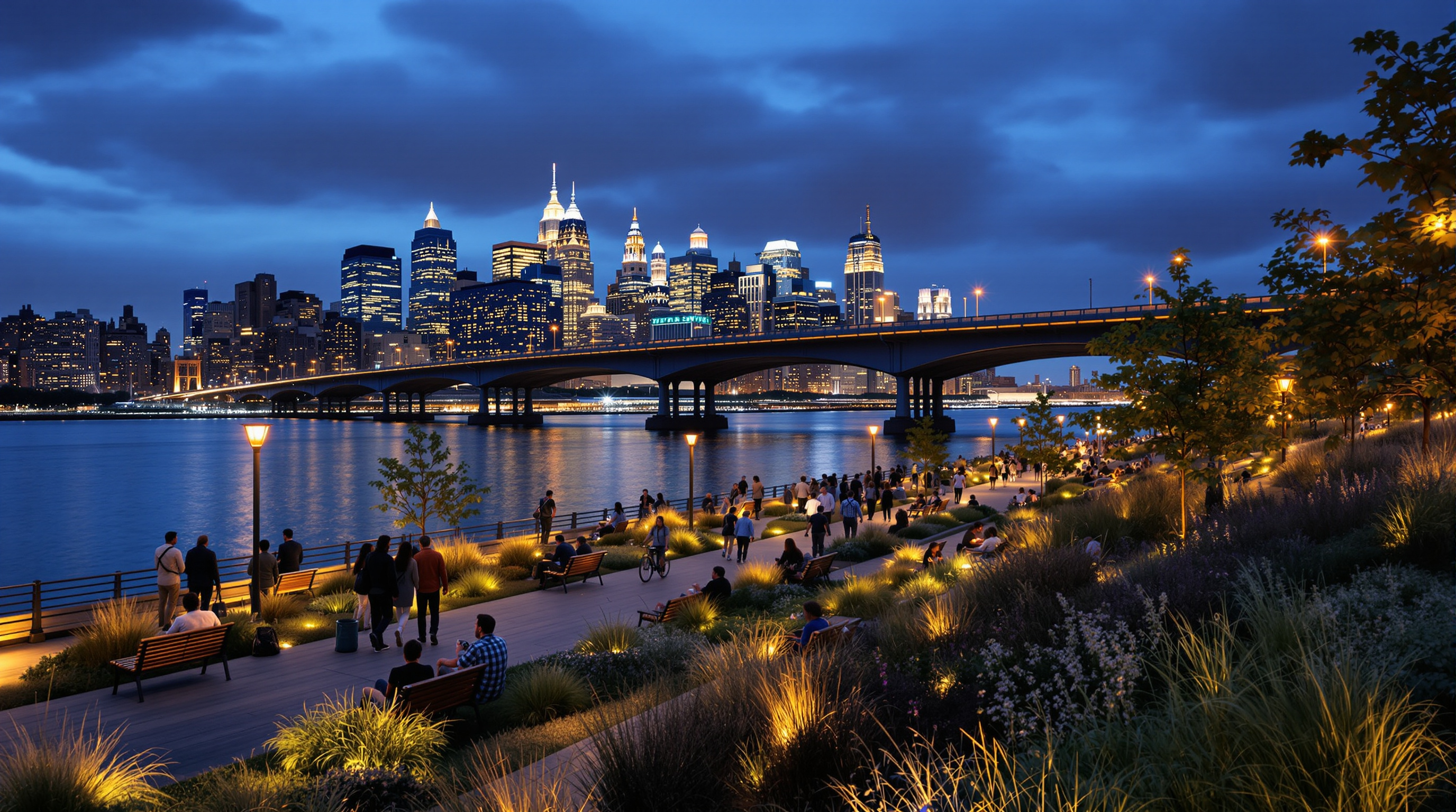
Every entry in this chapter asks how architecture behaves when the climate turns hostile. The Big U reframes the question at the scale of a whole city district. It refuses the false choice that had governed coastal defence for a century — either you build an ugly wall and lose the waterfront, or you keep the waterfront and stay exposed. BIG's argument is that flood protection can be social infrastructure in disguise: the same mound of engineered earth that stops a surge can be the hill children sled down, the amphitheatre where a neighbourhood gathers, the planted esplanade that finally connects a housing estate to its river.
This is the future-facing provocation. In a warming century, defensive infrastructure will be built everywhere, at enormous public expense. The Big U insists that this spending is also an urban-design opportunity — that resilience, done well, should leave a city not merely safer but better: greener, more connected, more public. The barrier is not a thing you tolerate. It is the park you wanted anyway.
The central move: a barrier you can sit on
The design's cleverness is that it hides the wall inside the ground. Along the Lower East Side, protection takes the form of the Bridging Berm — a wide, gently sloped mound of planted earth that rises from the park up toward the elevated FDR Drive. Walk the waterfront and you experience a hill, a meadow, a lookout. What you do not see is that the same mound is a continuous flood barrier engineered to a design storm level, its "wet" river face armoured against wave attack, its "dry" city face shaped as usable public space.
Where a berm cannot fit — under the FDR viaduct, across street crossings — the plan deploys flip-down panels and swinging gates: barriers that stay invisible in fair weather and are lowered or closed only when a storm is forecast. In the original scheme these panels double as a decorated ceiling for the esplanade and shelter for seasonal markets. The effect is a defence that is present exactly when needed and absent the rest of the time, so the waterfront is never walled off from daily life.
Compartments: designing for partial failure
A ten-mile continuous barrier is only as strong as its weakest joint, and no city builds ten miles of anything at once. So the Big U's second key idea is that the U is not one system but three physically independent compartments, each protecting a distinct reach of shoreline and each able to be designed, funded and built on its own timetable. If one compartment is overtopped or delayed, the others still stand. This is resilience thinking applied to the project itself, not just the storm: it accepts that adaptation will be incremental, contested and slow, and builds that reality into the geometry from the start. It is also what let the plan survive contact with the brutal politics of getting anything built in New York.
The team behind the diagram was unusually broad for an architecture credit. BIG and One Architecture led the design, with landscape architects Starr Whitehouse, engineers Buro Happold and Arcadis, and planning, ecology and community-engagement specialists rounding out the group. The Big U was never only a building; it was a piece of urban policy drawn as a landscape.
| Reach of the U | Neighbourhood served | Protective form |
|---|---|---|
| East Side (Compartment 1–2) | Lower East Side, East River waterfront | Bridging Berm — raised, planted parkland |
| The Battery (Compartment 2) | Battery Park, southern tip | Elevated "Battery Berm" and raised wharf |
| West Side (Compartment 3) | Battery Park City, Tribeca | Berms, flood walls and deployable barriers |
| Crossings & the FDR | Under-viaduct gaps, street ends | Flip-down panels and swing/slide gates |
Where it sits in "Shelter from the Storm"
Most of this chapter is about emergency architecture at the scale of a shelter, a school, a single flooded home — Shigeru Ban's paper structures, the Makoko floating school, incremental disaster housing. The Big U is the outlier that scales that instinct up to the size of a metropolis. It shares the chapter's core belief — that the best response to disaster is design that gives more than it takes, that a barrier can also be a gift to a community — but it tests whether that belief holds when the client is a federal housing agency, the budget runs to billions, and the "user" is half a million people who did not ask to live behind a levee.
The third position: the drawing and the dirt
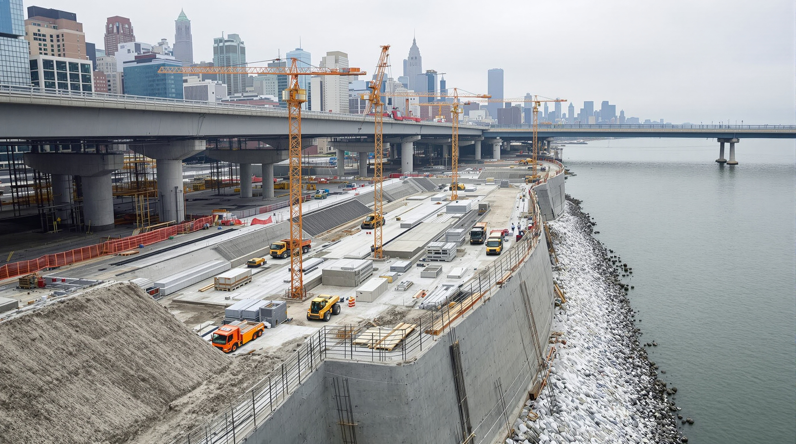
Here Studio Matrx has to be honest, because the Big U is as important a cautionary tale as it is a triumph — and its dates and attribution genuinely need care. What won the competition in 2014 was a vision: a seductive, continuous, community-shaped ribbon. What is being built is something considerably messier. The U fractured, more or less as its own compartment logic predicted, into a family of separately managed municipal projects — East Side Coastal Resiliency (ESCR), Brooklyn Bridge–Montgomery, Lower Manhattan Coastal Resilience, and the Battery Park City works — each with its own agency, budget and design team. Much of the graceful, continuous "Big U" as a single object does not, and may never, exist.
The flagship East Side section is where the gap became a public wound. BIG's original scheme kept the existing East River Park and bridged over it with gentle berms. In 2018, the de Blasio administration abruptly scrapped that approach for a fundamentally different engineering strategy: demolish the entire fifty-seven-acre park, bury it under roughly eight feet of landfill, and rebuild it higher — a design the city argued was more robust and buildable, but which meant felling close to a thousand mature trees. Residents were blindsided. A coalition, East River Park ACTION, formed in 2019 under the slogan "Bury the plan, not the park," and fought the project through hearings and courts. Demolition began in December 2021; the mature canopy came down.
The result is a painful irony sitting at the centre of a "social infrastructure" project: a resilience plan sold on community benefit was delivered, in its most visible stretch, over sustained community objection and at the cost of a living park the neighbourhood loved. The engineering case for the raised-park redesign is real — a bermed park may indeed protect better and last longer — but so is the democratic failure in how it was imposed. Both things are true, and an honest canon holds them together.
What it tells us about where architecture is going
By late 2024 the northern reach of ESCR had opened — its first completed section reportedly delivered around 163 million dollars, under budget and ahead of schedule — with the remainder targeted for completion around the end of 2026. Slowly, unevenly, a version of the U is rising. It will not look like the competition renders. It never could.
That is the lesson. The Big U proved that flood defence and public space can be the same gesture — and that idea has already migrated into resilience plans from Boston to Jakarta. But it also proved that the hardest part of climate adaptation is not the section drawing; it is the fifteen-year slog of funding, agencies, lawsuits and grief through which a beautiful diagram is dragged into the dirt. The future of architecture on a flooding coast belongs to practices that can hold both ends of that rope: the visionary line that reframes a wall as a park, and the patient, accountable, democratic labour of actually building it without steamrolling the people it claims to protect. The Big U is the essential case study precisely because it succeeds and fails at exactly that, in full public view.
References
- Rebuild by Design — "The Big U" project pages and 10-Year Update. Official competition and project record: concept, compartments, funding, and the evolution into ESCR, BMCR, LMCR and Battery Park City works. rebuildbydesign.org (primary source)
- BIG – Bjarke Ingels Group & One Architecture — "The BIG U / East Side Coastal Resiliency" project descriptions (design team, Bridging Berm, deployable panels, "string of pearls" concept). big.dk (primary source — architect)
- City of New York — "East Side Coastal Resiliency Project" documentation and Mayor's Office announcements (2015 design report; 2024 completion of first section; $1.45 billion budget; berms, floodwalls and flood gates). nyc.gov (primary source — client/government)
- "Lower Manhattan Coastal Resiliency" and "East River Park" — Wikipedia. Useful consolidated timeline and figures on Hurricane Sandy, the $335M award, the 2018 redesign, and tree-loss estimates; cross-check against primary sources. en.wikipedia.org (reference aggregator)
- East River Park ACTION — advocacy archive documenting community opposition, the "Bury the plan, not the park" campaign, and the 2021 demolition. eastriverparkaction.org (primary source — community/advocacy; partisan, read as testimony)
- "The BIG U: BIG's New York City Vision for Rebuild by Design." ArchDaily (2014). Detailed account of the original concept, compartments and Reverse Aquarium. archdaily.com (architectural press)
- "New York Showcases the Next Generation of Flood Resiliency." Metropolis; and "East Side Coastal Resiliency project is halfway done." The Architect's Newspaper (2024). Construction-status reporting. metropolismag.com (architectural press)
Part of The Future of Architecture in 300 Buildings — Studio Matrx's canon of the buildings asking where architecture goes next. Chapter 6: Shelter from the Storm.
Export this guide
Related Guides — Deep-dive reading
The Big U: The Flood Wall That Refused to Be a Wall
BIG and One Architecture answered Hurricane Sandy not with a barrier but with a ten-mile ribbon of raised parkland around Lower Manhattan — a 'string of pearls' where storm defence doubles as public space. This deep study reads the Big U as concept and provocation, its bridging-berm and flip-down-wall logic, and the hard gap between the visionary drawing and the East River Park it became.
The Future of ArchitectureHunter's Point South Park: The Waterfront That Was Designed to Flood
SWA/Balsley, Weiss/Manfredi and Arup turned an abandoned Queens shoreline into an 11-acre park that yields to the East River instead of walling it out — a working prototype for the 'soft', adaptive, resilient public realm that a warming, rising-water century now demands.
The Future of ArchitectureSabarmati Riverfront: How Ahmedabad Engineered a River into a Public Room
HCP Design and Bimal Patel narrowed a seasonal river to a uniform channel, walled it with diaphragm walls sunk into the bed, and reclaimed 200-plus hectares as a continuous two-level promenade. The result is India's most ambitious — and most contested — piece of public ground, a case study in what it costs to give a city its river back.
The Future of ArchitectureRelated Tools — Try Free
Healing View Impact Calculator
Evidence-Based Design dashboard quantifying the recovery impact of nature view + daylight factor on analgesic use, length of stay, and HCAHPS patient-experience uplift. Calibrated against Ulrich 1984 (Science), Park & Mattson 2008, and the CHD EBD evidence base.
EBD CalculatorConcept Generator
Get 3 AI-generated design concepts for any room with style, materials, and cost estimate.
DesignAIBefore vs After — Cost Reality Check
Compare what you expected to pay vs what you actually paid, category by category.
Reality Check