

FAR / FSI Calculator
How much can you actually build on your plot? Enter your plot area and get the permitted built-up area, ground footprint, number of floors, and which bylaw will bite first — for 12 Indian cities.
BBMP Building Bye-Laws 2003
≈ 2,400 sq.ft · 223 sq.m
Test your design against the FAR ceiling.
Wider roads usually unlock higher FAR.
What you can build
Bengaluru · Residential · FAR 1.75
Applied to a 2,400 sq.ft plot on a 12 – 18 m.
Building stack · Bengaluru · FAR 1.75
4 floors · Within FAR ceiling
0%
FAR utilisation
0 sq.ft
Natural max build of 4,200 sq.ft permissible.
You're using nearly every square metre the bylaw allows.
Max built-up area
4,200 sq.ft
390 sq.m
Ground footprint
1,560 sq.ft
65% coverage
Floors (estimate)
G + 3
4 floors
Max height
15 m
4 floors @ 3.2m
Net after setbacks
1,340 sq.ft
approx footprint
Setbacks (F / R / S)
3 / 1.5 / 1.5 m
Parking (min)
3 slots
1 per unit
Unused FAR
—
fully usable
Binding constraint
Your project is limited by FAR.
You use every square metre of built-up area the bylaw allows. To build more, you'd need premium FSI (where available) or a plot in a zone with higher base FAR.
Approximate plan view · assumes square plot
City note
Above 15m requires fire NOC. Setbacks increase for plots >360 sq.m or roads >12m.
What an FAR-compliant build looks like
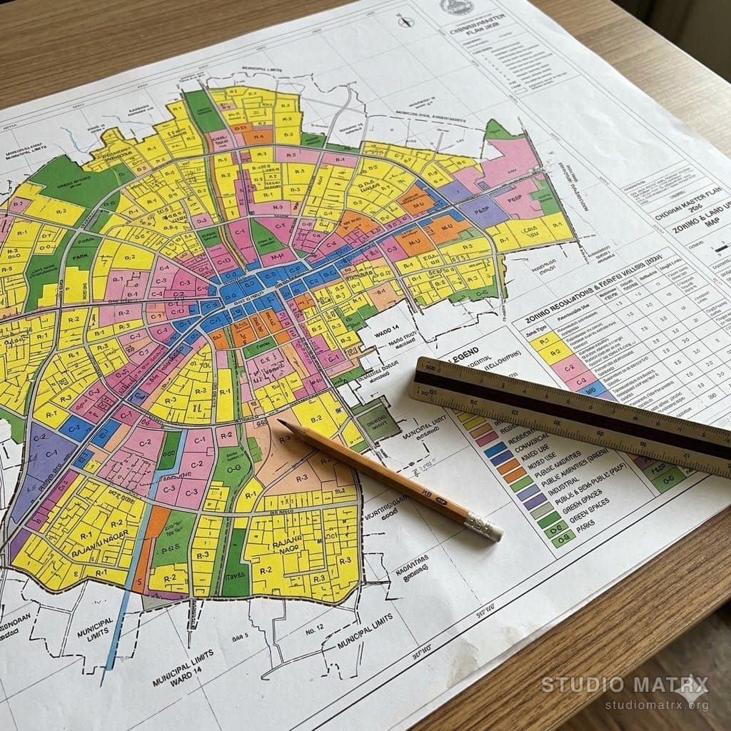


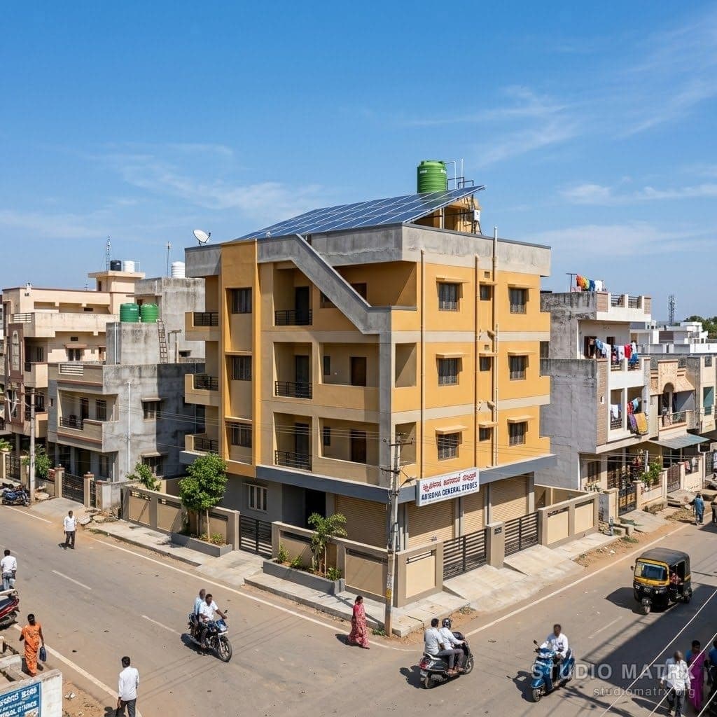
Built-up Area Known — Now Render the Building
Once you know what you can build, give DesignAI your plot dimensions and façade preference. Get three building elevations matched to your FAR and setbacks — share with your architect or builder.
Try DesignAI FreeThese numbers are a preliminary estimate based on published bylaws. Final permissions depend on site-specific conditions — zoning overlays, CRZ, airport funnels, heritage notifications, road widening plans and utility corridors. Always confirm with your municipal authority and a licensed architect before finalising a design.
FAR / FSI in Indian Cities — A Working Reference
Floor Area Ratio (FAR) — Floor Space Index (FSI) in Mumbai and Pune — is the multiplier that converts plot area into permitted total floor area. It is the single most important number in any city's building bylaw, but it is rarely the only number that limits a project. Ground coverage, height, and setbacks routinely cut FAR's headroom long before the multiplier itself is exhausted. The calculator above reads all four constraints together; this reference explains how they interact.
From Plot to Floors — A Worked Example
The FSI multiplier looks simple — plot area × FSI = permitted Built-Up Area. The complication is how that BUA gets stacked into floors, because each floor's footprint is itself capped by ground coverage. The diagram below traces a 200 m² Bengaluru residential plot through every step.
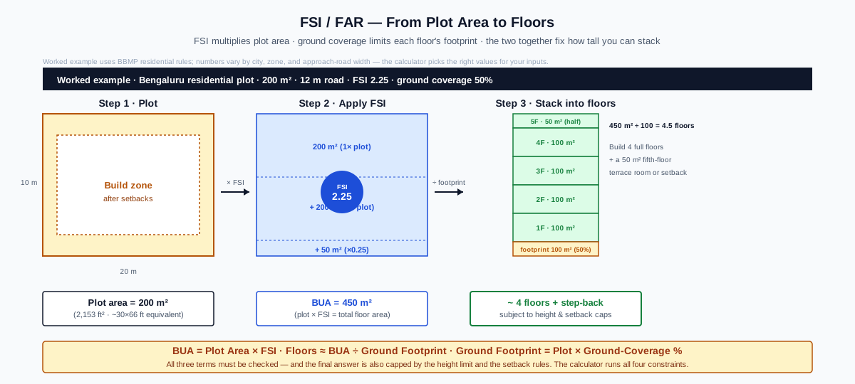
The arithmetic: plot 200 m² × FSI 2.25 = 450 m² permitted BUA. Ground coverage 50% caps each floor footprint at 100 m². 450 ÷ 100 ≈ 4.5 floors — meaning four full floors plus a setback fifth-floor terrace block, subject to the 15 m height cap.
Which Constraint Binds First?
FSI is rarely the binding constraint by itself. Ground coverage caps the per-floor footprint; height caps the total stack; setbacks shrink the buildable rectangle within the plot. The diagram below shows three scenarios on the same plot — each governed by a different binding constraint — to make the interaction visible.
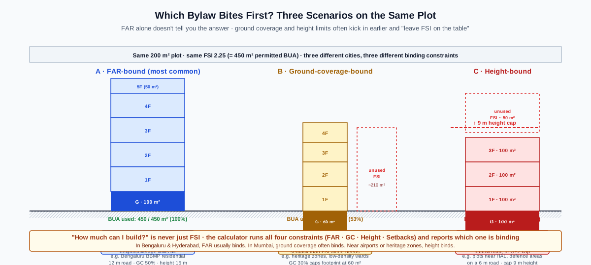
Typical patterns: Bengaluru and Hyderabad are usually FAR-bound — the multiplier exhausts before the other constraints. Mumbai is often ground-coverage-bound on small plots — the building footprint hits its cap and the only way to use more FSI is to go taller, which then runs into height limits. Plots near airports, in defence zones, and inside heritage precincts are usually height-bound — even a generous FSI cannot be fully used.
FAR Across Indian Cities
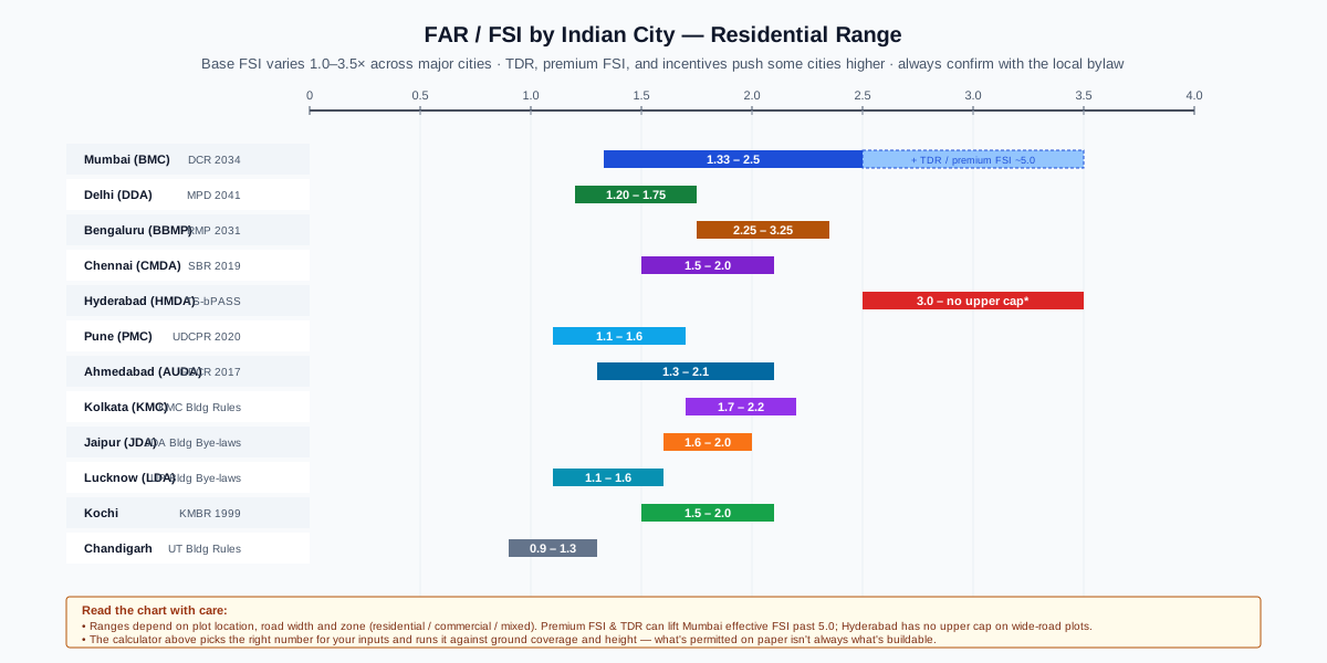
Base residential FAR varies dramatically across India — from ~0.9 in Chandigarh's low-density sectors to 3.0+ in Hyderabad's wide-road plots. The chart below compares the published residential ranges for 12 metros. Read it as the headline figure; the calculator picks the precise value for your inputs.
Practical Notes for Plot Buyers
- Confirm the road width with the master plan, not Google Maps. Setbacks and FAR brackets often shift at 6 m, 9 m, 12 m, 18 m and 24 m.
- Corner plots sometimes get ground-coverage relaxation in BBMP, CMDA, and HMDA. Worth checking before assuming the standard cap.
- Premium FSI / TDR is transactional. The base FAR is your default; anything above it requires a payment, a TDR purchase, or an incentive scheme — talk to a CA before pricing it into the project.
- Heritage, airport, defence, and CRZ overlays trump everything. Always cross-check with the city's heritage list and the AAI height NOC before sizing the project.
- The calculator's output is an envelope, not a design. Setbacks define the buildable rectangle; the architect designs within it.
Cross-References
- FSI/FAR Computation for Indian Architects — the deeper guide
- India Regulatory Atlas — city-wise setback & FSI references
- Bylaw Checker — broader compliance audit
- Approval Roadmap — what comes after FAR sizing
Disclaimer: Bylaws change. The calculator uses published rules as of the most recent revision shown in each city's entry; always confirm with the local authority before committing capital. This page is for informational purposes only and is not a substitute for licensed architectural advice.
Related Guides — Deep-dive reading
FAR vs FSI: Understanding Your Development Rights in India
What Floor Area Ratio and Floor Space Index mean, how they decide how much house you can build, and the traps every Indian homeowner should avoid
Building Regulations & ComplianceParkroyal Collection Pickering: How WOHA Grew a Hotel Out of a Garden
WOHA's hotel-in-a-garden on Upper Pickering Street stacks four-storey sky gardens onto a contoured concrete podium to return roughly twice its own footprint in greenery — the clearest built argument that a dense tropical high-rise can give more land back to nature than it takes.
The Future of ArchitecturePlot Utilization Efficiency
Squeezing the most usable area from a plot — the efficiency ratios, hunting dead space, using setback margins well, going vertical and multi-use, and the honest efficiency-versus-liveability balance
Site PlanningRelated Tools — You may also find these useful
Building Bylaw Checker
Check FAR, setbacks, and height limits for 12 Indian cities (BBMP, CMDA, BMC, DDA, and more).
ArchitectAIPlot Buildability Report
How much can you build? FSI, ground coverage, setbacks and height → buildable footprint, built-up area, floors, parking and area statement, with a PDF.
Feasibility ToolAccessibility Compliance Calculator
Check a planned lift against the CPWD and RPwD accessible-lift benchmarks for a score.
Lift Checker