
FSI / FAR Computation in India
A State-by-State Working Reference for Indian Architects
Floor Space Index — known as FSI in most Indian cities and FAR (Floor Area Ratio) in others — is the single most consequential statutory number in Indian building design. It dictates how much floor area can be built on a plot, what proportion of that area is "free" by way of statutory exemptions, what the architect can purchase as premium, what can be transferred via TDR, and what carries chargeable premium.
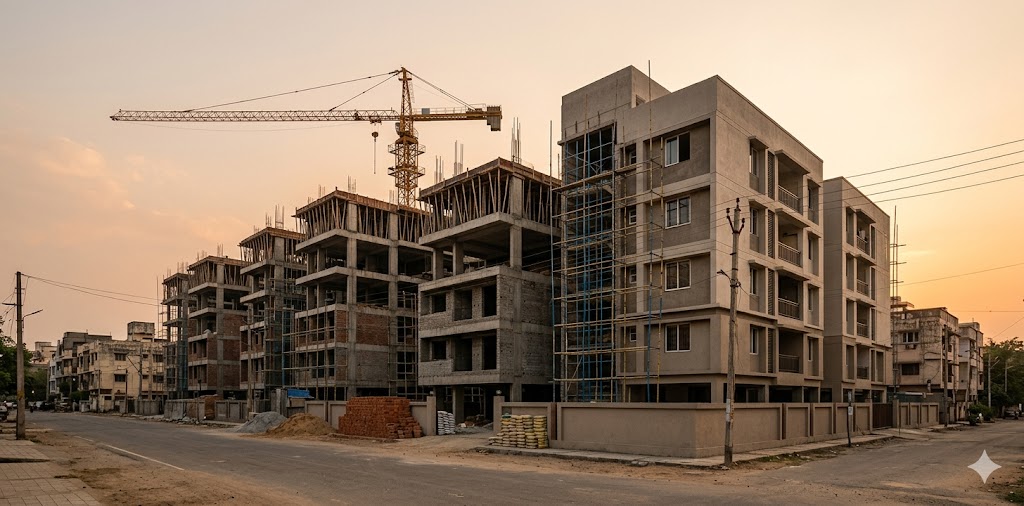
The number is also one of the most jurisdictionally inconsistent in Indian planning. The same 1500-square-yard plot yields 3000–3600 sqm of built-up area in Mumbai, 1800–2400 sqm in central Bengaluru, 2800–3500 sqm in Delhi (with all bonuses), and 1500–2200 sqm in Chennai. The architect who quotes "4 FSI" without specifying base / premium / fungible / TOD is making a meaningless statement.
This guide is the architect's working reference for FSI/FAR computation across the major Indian metro and Tier-1 jurisdictions. It is intended for use at Stage 1 of a project, when the architect must give the client a defensible upper-bound on what the plot can yield. It is not a substitute for the current published Development Control Regulation (DCR) of the relevant authority — those documents change annually and must be verified — but it captures the structural logic that underlies them all.
"In planning, the number that everyone agrees on is usually the one nobody has read carefully." — Aphorism widely attributed to urbanist circles in India
1. FSI vs FAR vs Ground Coverage — Terminology
The terminology varies by state and authority. The architect must know the local term used in the project's jurisdiction.
Terms in Indian Practice
| Term | Definition | Used In |
|---|---|---|
| FSI (Floor Space Index) | Ratio of total built-up floor area to plot area. FSI 2.0 means built-up = 2× plot area | Maharashtra (Mumbai, Pune), West Bengal (Kolkata) |
| FAR (Floor Area Ratio) | Identical concept, different name. Ratio of built-up to plot area | Delhi (DDA), Bengaluru (BBMP), Chennai (CMDA), Hyderabad (GHMC), most other states |
| Plot Ratio | British-era term, occasionally used | Older codes; superseded by FSI/FAR |
| Ground Coverage | Footprint of the building as a percentage of plot area (different metric — controls the "spread") | All jurisdictions, often paired with FSI/FAR limits |
| Built-up Area (BUA) | Total area of all floors covered by walls/columns | Computed for FSI; specific inclusions vary |
| Carpet Area | Net usable area inside walls | Sales metric (RERA-defined); not used for FSI |
| Chargeable Area / Saleable Area | Built-up + a share of common areas | Sales metric; not used for FSI |
Important: When the local code says "FSI 2.0," it means the maximum built-up area before exemptions. The actual constructible area may be larger (after exemptions are added) or smaller (after ground coverage limits constrain footprint). Both checks must be passed independently.

2. What Counts and What's Exempt
Every Indian DCR has a list of areas that do not count against the FSI calculation — typically because they serve a circulation, service, or amenity purpose. The exemption list is jurisdiction-specific and is the source of most FSI disputes during sanction.
Common FSI Exemption Categories (Direction-Indicative)
| Category | Typically Exempt | Often Counted |
|---|---|---|
| Stilt / parking | Stilt below building, basement-1 parking | Above-ground enclosed parking |
| Common circulation | Lift, lift overrun, mumty (stair-head room), service ducts | Internal corridors above a width threshold |
| Service areas | Mechanical floors, AHU rooms, transformer/DG enclosures | Service areas beyond stipulated % |
| Balconies and projections | First X% of balcony, chajja overhang, drying yard | Anything beyond X% counts |
| Open-to-sky areas | Terraces (uncovered), open-to-sky courtyards, OTS shafts | Covered terraces, attic with floor use |
| Sustainable features | Solar panel mounts, rainwater harvesting, swimming pool | Pool deck if covered |
| Lobby and reception | Often capped at 2–5% of FSI | Beyond cap counts |
The single most-overlooked exemption is balcony allowance. Mumbai's DCPR allows up to 10% of the FSI as fungible balconies/lobbies/voids (paid as premium); Bengaluru's BBMP allows balconies up to 2 metres deep to be excluded if open on at least two sides. Architects who don't read these clauses leave significant constructible area on the table.

"The most expensive square metre is the one you didn't claim." — Studio aphorism for Indian planning practice
3. Mumbai — DCPR 2034
The Development Control and Promotion Regulations 2034 is the single most complex FSI regime in India. Mumbai's logic stacks four FSI components: base, premium, fungible compensatory, and TOD/incentive. The architect must understand each layer.
Mumbai DCPR-2034 FSI Components
| Component | Indicative Value | What It Is | Cost to Architect's Client |
|---|---|---|---|
| Base FSI | 1.33 (island city), 1.0 (suburbs), variable | Free, per plot zone | None |
| Permissible Premium FSI | Up to ~2.0 above base | Purchased from BMC at Ready Reckoner Rate × percentage | Premium charge per sq m |
| TDR-loaded FSI | Variable, capped per zone | Transferable Development Rights bought from sending plots | Market rate of TDR |
| Fungible Compensatory FSI | Up to 35% of permissible | Compensates for what historically was "free" balconies, voids, lobbies | 60% of premium-FSI rate |
| TOD (Transit-Oriented Development) Bonus | Variable, near metro/rail | Incentive for plots within transit-influence zone | Reduced premium |
| Maximum Permissible FSI | 5.0 island city, 4.0 suburbs (with premiums) | Sum of above subject to zone cap | Sum of premiums |
Source: Brihanmumbai Municipal Corporation (BMC), Development Control and Promotion Regulations 2034.
Worked Example — South Mumbai Plot, 500 sqm:
- Base FSI 1.33 → 665 sqm built-up (free)
- Premium FSI to 2.5 → +585 sqm at premium charge
- Fungible at 35% of 2.5 FSI → +437 sqm at 60% of premium rate
- Final permissible BUA: 665 + 585 + 437 = 1687 sqm on a 500-sqm plot
- Effective FSI: 3.37
The architect's role at Stage 1 is to compute this stack, communicate the premium cost (which can run into crores for residential plots), and ensure the client's brief matches the after-premium yield, not the base.

"To know the law of a place is to know its limits; to know the bye-law is to know its possibilities." — Aphorism in Mumbai practice circles
4. Bengaluru — BBMP and BDA
Bengaluru operates under two regulatory regimes depending on jurisdiction: BBMP (Bruhat Bengaluru Mahanagara Palike) for areas within the BBMP corporation limits, and BDA (Bengaluru Development Authority) for outlying areas under BDA layouts.
Bengaluru FAR Slab — Indicative
| Plot Frontage on Road | Plot Size | Permissible FAR | Ground Coverage |
|---|---|---|---|
| Road width <12m | Any | 1.75 | 60% |
| Road width 12–18m | Any | 2.25 | 60% |
| Road width 18–24m | Any | 2.50 | 60% |
| Road width 24–30m | Any | 2.75 | 55% |
| Road width >30m | Any | 3.25 | 50% |
| TOD zone (Metro Phase 2/3) | Subject to micro-zoning | Up to 4.0 | Varies |
Source: Bruhat Bengaluru Mahanagara Palike, Building Bye-Laws (current edition); Bengaluru Development Authority — Revised Master Plan 2031.
Bengaluru's distinguishing features:
- FAR is road-width-based, not plot-zone-based — a plot facing a 30m road has substantially higher yield than the same plot facing a 9m road
- Balconies up to 2m projection are FSI-free if open on at least two sides
- Setback rules are strict — front setback typically 1.5–6m, side and rear 0.9–4m depending on plot size and floor count
- Lift overrun, mumty, common services are exempt with stipulated cap
- TDR is permissible but the market is thinner than Mumbai's
5. Delhi — DDA / Unified Building Bye-Laws 2016
The Unified Building Bye-Laws 2016 (UBBL 2016) is Delhi's controlling document, applicable to DDA, Municipal Corporation of Delhi (MCD), and NDMC areas. The 2016 unification consolidated previously divergent rules.
Delhi FAR by Plot Size — Residential
| Plot Size | Permissible FAR | Ground Coverage | Max Height |
|---|---|---|---|
| Up to 100 sqm | 350% (3.5) | 60% | 17.5 m |
| 100–250 sqm | 300% (3.0) | 50% | 17.5 m |
| 250–500 sqm | 240% (2.4) | 40% | 17.5 m |
| 500–1000 sqm | 200% (2.0) | 35% | 17.5 m |
| 1000–2000 sqm | 175% (1.75) | 30% | 17.5 m |
| 2000+ sqm | 150% (1.5) | 25% | Variable, requires special permission |
Source: Ministry of Housing and Urban Affairs (2016), Unified Building Bye-Laws for Delhi, with updates via DDA Master Plan 2021 / Draft 2041.
Delhi's distinguishing features:
- Smaller plots get higher FAR — the inverse-relationship means a 100-sqm plot effectively yields more per square metre than a 2000-sqm plot
- Mixed-use is FAR-incentivised along major roads and in designated mixed-use zones
- TOD policy 2015 allows higher FAR within 500m of metro stations — up to 4.0 in some cases
- Stilt parking is exempt up to 2.4m clear height; basement parking is exempt
- Service floors above the highest occupied floor are exempt within stipulated %
6. Chennai — CMDA
The Chennai Metropolitan Development Authority governs FSI in the CMDA area. Chennai's FSI regime is one of the most conservative among Indian metros, reflecting historic concerns about infrastructure carrying capacity.
Chennai FSI — Indicative
| Building Type / Zone | FSI | Ground Coverage |
|---|---|---|
| Residential — primary residential zone | 1.5 | 50% |
| Residential — institutional/mixed zone | 2.0 | 50% |
| Residential — high-density corridor | 2.5–3.0 | 40–45% |
| Commercial — commercial zone | 3.0 | 50% |
| Industrial — industrial zone | 1.5 | 60% |
| IT corridor / SEZ — special zones | Up to 3.5 | 40% |
Source: Chennai Metropolitan Development Authority, Second Master Plan (current edition); Tamil Nadu Combined Development and Building Rules 2019.
Chennai's distinguishing features:
- TNCDBR 2019 (Tamil Nadu Combined Development and Building Rules) rationalised what was previously a fragmented regime
- Premium FSI is purchasable but the maximum stack is lower than Mumbai
- Setback rules are strict, particularly with respect to rear and side
- Strict height limits in heritage zones (Mylapore, T. Nagar, parts of Egmore)
- Coastal Regulation Zone (CRZ) overlays can substantially reduce FSI on plots within 500m of high-tide line
7. Hyderabad, Pune, Ahmedabad — Quick Reference
Hyderabad — GHMC
| Plot Frontage | FAR | Notes |
|---|---|---|
| Road width <12m | 1.5 | |
| Road width 12–18m | 2.0 | |
| Road width 18–24m | 2.5 | |
| Road width 24–30m | 3.0 | |
| Road width >30m | 3.5 | Subject to fire NoC for height |
| HMDA TOD zones | Up to 4.0 | Near metro corridors |
Source: Greater Hyderabad Municipal Corporation, GHMC Building Rules; Hyderabad Metropolitan Development Authority Master Plan.
Pune — PMC and PCMC
| Plot Type | FSI (PMC) | FSI (PCMC) |
|---|---|---|
| Old/Congested area | 1.0 (1.5 with premium) | 1.0 |
| Developed area | 1.1 (1.65 with premium) | 1.1 |
| New area | 1.0 + premium (up to 2.5) | 1.0 + premium |
| TOD zone | Up to 4.0 | Up to 3.0 |
Source: Pune Municipal Corporation and Pimpri-Chinchwad Municipal Corporation, Development Control Rules; aligned with Maharashtra UDCPR 2020.
Ahmedabad — AUDA
| Zone | FSI | Notes |
|---|---|---|
| R1 (low-density residential) | 1.0–1.2 | Suburban detached |
| R2 (medium-density residential) | 1.8–2.4 | Apartment zones |
| R3 (high-density residential) | 2.7–3.6 | TOD-influence with premium |
| Commercial | 2.4–3.6 | Variable by road width |
| TOD zones | Up to 5.4 | Metro-corridor adjacencies |
Source: Ahmedabad Urban Development Authority, AUDA Development Plan 2021 (in continuing implementation).

8. Transferable Development Rights (TDR)
TDR is the mechanism that allows development potential from a "sending site" — typically a heritage building, a slum, or land reserved for a public purpose — to be transferred to a "receiving site" elsewhere in the city. The receiving site can then build above its base FSI by an amount equal to the TDR purchased.
TDR Markets — India 2026
| City | TDR Active? | Indicative Rate (₹/sqm) | Where It Works |
|---|---|---|---|
| Mumbai | Yes — most mature market | ₹3,000–₹15,000 (zone-dependent) | Suburb plots; constrained in island city |
| Pune | Yes | ₹1,500–₹5,000 | Suburban plots |
| Bengaluru | Yes — thinner market | ₹2,000–₹6,000 | Selective; not always available |
| Hyderabad | Yes — emerging | ₹1,500–₹4,000 | Around HMDA-master-planned roads |
| Chennai | Limited | Variable | Mostly heritage transfer |
| Delhi | Allowed but rarely transacted | NA | Policy-permitted, not market-active |
| Ahmedabad | Yes | ₹1,500–₹5,000 | AUDA TDR scheme operational |
Source: Composite from BMC, PMDA, BBMP, GHMC TDR notifications; market rates reflect 2025–2026 broker data and may shift substantially with policy changes.
The architect's role with TDR is to flag its availability at Stage 1 — many residential clients have not heard of it, and it can change project economics substantially when applied to a constrained plot.
9. Quick Reference — All States and Union Territories
Beyond the seven metros covered in detail above, every Indian state and Union Territory has its own Town & Country Planning Department (TCP) or Development Authority (DA) governing FSI/FAR within its urban areas. The figures below are indicative residential ranges — synthesised from the current published bye-laws of each jurisdiction's principal authority — and are intended as Stage-1 ballpark only. Project-specific verification against the relevant current local DCR is mandatory before sanction submission.
States — Indicative FSI/FAR Ranges (Residential)
| State | Principal Authority | Indicative FAR Range | Notes |
|---|---|---|---|
| Andhra Pradesh | APCRDA, GVMC, VMC, MAUD | 1.5–3.5 | Higher in TOD; Visakhapatnam CRZ-IV overlay |
| Arunachal Pradesh | State TCP, Itanagar Municipal | 1.0–2.0 | Hill-state seismic & slope rules dominate |
| Assam | GMDA (Guwahati), ASTCP | 1.5–3.0 | Brahmaputra flood-zone restrictions |
| Bihar | PRDA (Patna), MCDA, state TCP | 1.5–3.5 | Patna corridor zoning since 2020 |
| Chhattisgarh | RDA (Raipur), NRDA, state TCP | 1.5–3.0 | Naya Raipur capital zone up to 4.0 |
| Goa | GTCP, village panchayats | 0.6–1.5 | Tightest residential FSI in India; CRZ-IV widespread |
| Gujarat | AUDA, SUDA, VUDA, RUDA | 1.8–5.4 | TOD zones up to 5.4 (highest residential FAR in India) |
| Haryana | HUDA, MCG (Gurugram), DTCP | 1.5–3.5 | Gurugram Cyber City zone; commercial corridors higher |
| Himachal Pradesh | HPTCP, MCS (Shimla) | 1.0–2.5 | Hill rules; height capped 12–15m typical |
| Jharkhand | RRDA (Ranchi), state TCP | 1.5–3.0 | |
| Karnataka | BBMP, BDA, BMRDA, MUDA (Mysuru), HUDA (Hubballi-Dharwad) | 1.75–4.0 | Bengaluru detailed in Section 4 |
| Kerala | KMBR (state-wide), municipal | 2.5–4.0 | Coverage caps strict; CRZ on coastal plots; high typical FAR |
| Madhya Pradesh | IDA (Indore), BDA (Bhopal), state TCP | 1.5–3.5 | Indore Metro TOD up to 4.0 |
| Maharashtra | UDCPR 2020 + DCPR Mumbai 2034 + PMC/PCMC + NMMC + NAINA | 1.0–5.0 | Mumbai detailed in Section 3; UDCPR governs the rest of the state |
| Manipur | State TCP, IMC (Imphal) | 1.0–2.5 | |
| Meghalaya | SMB (Shillong), state TCP | 1.0–2.0 | Hill rules; slope-based |
| Mizoram | State TCP, AMC (Aizawl) | 1.0–2.0 | Slope and seismic rules dominant |
| Nagaland | State TCP, KMC (Kohima) | 1.0–2.0 | Tribal-area customary rules apply in some districts |
| Odisha | BDA (Bhubaneswar), CDA (Cuttack) | 1.5–3.0 | Bhubaneswar Master Plan 2030 |
| Punjab | PUDA, GMADA (Mohali), MCs | 1.5–3.5 | Chandigarh-influenced grid in Mohali |
| Rajasthan | JDA (Jaipur), AVVNL, JDA, UIT (Udaipur, Jodhpur, Kota) | 1.5–3.0 | Heritage zones in Jaipur, Udaipur, Jaisalmer cap height |
| Sikkim | State TCP, GMC (Gangtok) | 1.0–2.0 | Slope and seismic rules |
| Tamil Nadu | CMDA, DTCP, TNCDBR 2019 | 1.5–3.5 | Chennai detailed in Section 6; DTCP governs the rest |
| Telangana | GHMC, HMDA, MAUD | 1.5–4.0 | Hyderabad detailed in Section 7 |
| Tripura | State TCP, AMC (Agartala) | 1.0–2.5 | |
| Uttar Pradesh | LDA (Lucknow), NOIDA, GNIDA, YEIDA, GDA (Ghaziabad), KDA (Kanpur) | 1.5–3.5 | NOIDA / Yamuna Expressway zones often 2.5–3.5 |
| Uttarakhand | MDDA (Dehradun), state TCP | 1.5–2.5 | Hill rules in Mussoorie, Nainital, Almora districts |
| West Bengal | KMC, KMDA, HMC (Howrah) | 1.5–3.5 | Kolkata heritage corridors capped (esp. Park Street, BBD Bagh) |
Union Territories — Indicative FSI/FAR Ranges (Residential)
| UT | Principal Authority | Indicative FAR Range | Notes |
|---|---|---|---|
| Andaman & Nicobar Islands | A&N TCP, Port Blair Municipal | 1.0–1.5 | Earthquake / tsunami zone overlay |
| Chandigarh | Chandigarh Administration | 1.5–2.5 | Le Corbusier sectoral grid; Phase-I conservative; UNESCO heritage Capitol complex |
| Dadra & Nagar Haveli and Daman & Diu | DNHDD Administration TCP | 1.5–2.5 | Coastal CRZ on Daman / Diu |
| Delhi (NCT) | DDA / MCD / NDMC (UBBL 2016) | 1.5–3.5 (plot-size-based) | Detailed in Section 5 |
| Jammu & Kashmir | J&K Housing & Urban Development, JMC (Jammu), SMC (Srinagar) | 1.0–2.5 | Earthquake Zone V; height caps in Srinagar heritage |
| Ladakh | LADC (Leh, Kargil), state TCP | 1.0–1.5 | Cold-desert vernacular; height & slope rules; passive solar mandates emerging |
| Lakshadweep | UT TCP | 1.0–1.5 | CRZ-IV island restrictions; small plot sizes |
| Puducherry | PUDA, PDA | 1.5–2.5 | French Quarter heritage caps; CRZ overlay on Pondicherry coast |
Sources: Synthesised from each state's principal Town & Country Planning Department or Development Authority's published Building Bye-Laws / Development Control Rules (2024–2026 editions); Ministry of Housing and Urban Affairs (MoHUA) state-wise summary on the AMRUT 2.0 portal; National Institute of Urban Affairs (NIUA) digests; cross-referenced with IIA chapter practice notes. Figures are indicative residential ranges — premium FSI, TOD bonuses, heritage caps, and zonal variations may push actuals higher or lower in specific jurisdictions.
The structural patterns that hold across most Indian jurisdictions:
- TOD zones almost always permit higher FAR than the base regime — typically 25–60% above base within metro-corridor influence zones (500m–1km from station)
- Heritage zones almost always cap FAR or height below the surrounding zone — Mumbai Fort, Old Delhi, Pondicherry French quarter, Jaipur old city, Srinagar Dal-Lake periphery, Kolkata BBD Bagh are examples
- Hill states (HP, UK, Sikkim, Mizoram, Meghalaya, Arunachal, J&K, Ladakh, NE in general) have lower base FAR and stricter height limits, driven by slope and seismic considerations
- Coastal CRZ overlays apply to all coastal states/UTs and can substantially reduce permissible FSI within 500m of high-tide line — Goa, Kerala, Karnataka, Maharashtra, Gujarat, Tamil Nadu, AP, Odisha, WB, A&N, DNHDD, Lakshadweep, Puducherry are all affected
- Tier-2 and Tier-3 cities typically operate under their respective state TCP rules with municipal-level local variation; Master Plans get revised every 10–15 years and the architect must check whether the project sits in a 'plan period transition' phase
- Special Economic Zones (SEZ), industrial parks, and IT corridors often have separate, higher FSI regimes — verify zoning before assuming the residential default
"India is not one country for FSI — it is thirty-six." — Practitioner's aphorism that captures the lived experience of cross-state architects
10. Common Compliance Pitfalls
Across jurisdictions, certain FSI-related errors recur in residential practice:
| Pitfall | What Happens | Prevention |
|---|---|---|
| Chajja overhang counted | A chajja that exceeds the local exempt projection counts as FSI | Verify exempt projection for each jurisdiction; design within it |
| Parking podium counted | A podium parking deck that doesn't qualify as "stilt" counts | Stilt height must meet local definition (typically <2.4m clear) |
| Mumty / lift overrun counted | Service rooms above the top occupied floor sometimes count if they exceed area limits | Cap at the locally-stipulated % |
| Rear setback to natural feature | Setback to a nallah, river, or lake may be stricter than to a road | Verify with revenue records and CRZ/RDF zone |
| Heritage zone restrictions | Many cities (Chennai Mylapore, Mumbai Fort, Delhi Lutyens) have separate heritage rules that override the general FAR | Verify heritage zone designation at Stage 1 |
| Fire-NOC height limit | Above 15m, fire NOC required; above 70m, additional rules. Sometimes cuts FSI by limiting building height | Check fire department's height-versus-access requirements |
| Airport (AAI) height clearance | Plots near airports have height restrictions that may cap FSI implementation | AAI NoC required for plots within zone; check before design |
11. Practitioner's Closing Note
FSI computation is the architect's first technical move on a new project. The client's brief — "we want a 5000-sqft house" — must be reconciled with the plot's permissible yield in the first conversation, before concept sketches begin. Architects who skip this step deliver Stage 2 designs that exceed permissible FSI and must be redrawn at Stage 3 — a costly correction that the architect typically absorbs.
The discipline is to maintain a per-jurisdiction FSI worksheet in the studio, updated annually against the latest published DCR, and to compute every new project's permissible BUA using that worksheet at Day 1. The data in this guide is a starting point; the current published bye-laws of the project's authority are the authoritative source.
Mumbai stacks four FSI components; Bengaluru is road-width-based; Delhi is plot-size-based; Chennai is conservative; Hyderabad mirrors Bengaluru with looser rules. The structural logic of each jurisdiction is consistent within itself — the architect's job is to learn the structure, not memorise every number.
Cross-References Within Studio Matrx
- Building Setbacks Across India — the companion control to FSI/FAR
- Building Plan Approval Process in India — how the FSI-compliant drawings reach sanction
- The Architect's Scope of Services in India — Stage 3 deliverables that include FSI compliance certification
- RERA Guide for Homebuyers & Architects — how FSI ties to project registration
- Use the FAR / FSI Calculator to compute yield for a specific plot
- Use the Bylaw Checker to validate against jurisdiction rules
References
1. Brihanmumbai Municipal Corporation (2018, with updates) Development Control and Promotion Regulations 2034. Mumbai: BMC.
2. Government of NCT of Delhi (2016) Unified Building Bye-Laws for Delhi. New Delhi: Ministry of Housing and Urban Affairs.
3. Bruhat Bengaluru Mahanagara Palike BBMP Building Bye-Laws. Bengaluru: BBMP.
4. Bengaluru Development Authority (2017) Revised Master Plan 2031. Bengaluru: BDA.
5. Chennai Metropolitan Development Authority Second Master Plan for Chennai Metropolitan Area. Chennai: CMDA.
6. Government of Tamil Nadu (2019) Tamil Nadu Combined Development and Building Rules 2019. Chennai: GoTN.
7. Greater Hyderabad Municipal Corporation GHMC Building Rules. Hyderabad: GHMC.
8. Government of Maharashtra (2020) Unified Development Control and Promotion Regulations 2020. Mumbai: GoM.
9. Ahmedabad Urban Development Authority AUDA Development Plan 2021. Ahmedabad: AUDA.
10. Bureau of Indian Standards (2016) National Building Code of India 2016, Part 3 (Development Control Rules and General Building Requirements).
11. Ministry of Housing and Urban Affairs (2014) Model Building Bye-Laws. New Delhi: MoHUA.
12. RICS India and Knight Frank (2024) India FSI / TDR Markets Report. Annual industry report.
Author's Note: FSI is the most consequential single line in any Indian architectural sanction drawing. The data in this guide is current as of 2026 but development control regulations evolve continuously — every project must verify against the current published edition of the relevant authority's bye-laws. The Studio Matrx FAR/FSI Calculator and Bylaw Checker tools encode this logic for interactive use; this guide is the conceptual reference behind them.
Disclaimer: This article is for informational and educational purposes only. It does not constitute legal or planning advice. FSI/FAR figures, exemption rules, and TDR rates cited are indicative of 2026 published practice and may be superseded by subsequent notifications. Architects must verify all values against current municipal and state planning authority publications and consult qualified town-planning counsel before submitting sanction drawings. Studio Matrx, its authors, and contributors accept no liability for decisions based on this guide.
Interactive · FSI / FAR explorer
Bengaluru (BBMP) · FSI 1.75 · ₹4,200 sqft built-up potential
Buildable potential
4,200 sqft
Plot 2,400 sqft × FSI 1.75
Approx floors
2
@ 1440 sqft/floor
Indicative build cost
₹92.4 L
@ ₹2,200/sqft
Indicative land value
₹1.92 Cr
at ₹8,000/sqft (illustrative — varies wildly by micro-market)
Educational tool. Always confirm permissible FSI with your local body / SDP before purchase or design.
Export this guide
City × topic atlas
FAR / FSI — by city
This national-level guide is the umbrella; the city pages drill into the specific authority, matrix, and overrides for each metro.
Related Guides — Deep-dive reading
Building Setbacks Across India
A State-by-State Guide to Development Control Regulations, Plot Setbacks, Ground Coverage, and FAR — for Architects, Planners, and Developers
ConstructionFAR vs FSI: Understanding Your Development Rights in India
What Floor Area Ratio and Floor Space Index mean, how they decide how much house you can build, and the traps every Indian homeowner should avoid
Building Regulations & ComplianceHow Urban Regulations Shape Cities in India
How the abstract rulebook of FAR, setbacks, height, parking and zoning literally builds the streets, skylines and neighbourhoods you live in
Building Regulations & ComplianceRelated Tools — Try Free
Property Tax Calculator — 10 Indian Cities
Estimate annual municipal property tax across BBMP / MCD / MCGM / GHMC / GCC / KMC / PMC / AMC / TMC / PCMC — with self-occupied, tenanted, and age-rebate adjustments.
Property TaxBuilding Bylaw Checker
Check FAR, setbacks, and height limits for 12 Indian cities (BBMP, CMDA, BMC, DDA, and more).
ArchitectAIBrise-Soleil Visualizer
Interactive horizontal-louvre cut-off angle calculator — sun altitude, louvre depth, and spacing inputs with a live shadow preview. Computes θ = arctan(spacing/depth) for façade shading, ECBC envelope compliance, hospital daylight design, and tropical sun-control detailing.
Sun Shading Tool