
Urban Form, Massing & Form-Based Codes
The street wall, the enclosure ratio — and coding form, not use.
Once the strategy is set, urban design becomes three-dimensional. Learn how massing, density and FSI build urban form; the street wall, active frontages and the enclosure ratio; and the tool that holds a many-handed city together — the form-based code, which regulates building FORM rather than use, the inverse of conventional Euclidean zoning. Meet the rural-to-urban transect (T1–T6) and the SmartCode, and how sustainability (SDG 11) folds in. Try the street-enclosure explorer.
Learning objectives
By the end of this lesson, you will be able to — mapped to the course outcomes for Architectural Design IX:
Shape urban form through massing, density and the street wall.
Apply the enclosure ratio to design a street section that feels enclosed.
Distinguish a form-based code from use-based (Euclidean) zoning, and the transect.
Integrate sustainability (SDG 11) and smart technology into urban form.
Shaping urban form
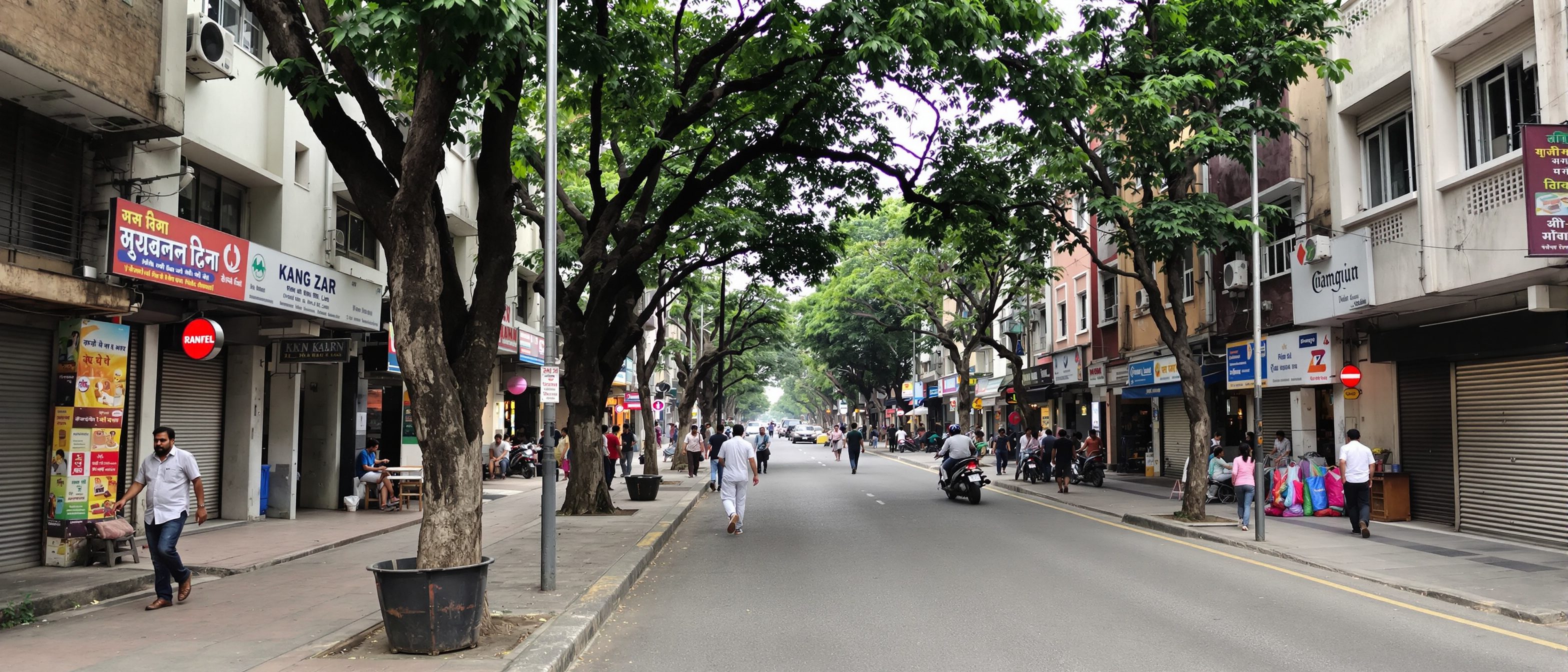
Urban form is massing, density and the way buildings meet the ground; a continuous street wall with active frontages makes a street a room, and the enclosure ratio tunes how strongly it is felt.[1, 2]
Building the third dimension
Urban FORM is built from MASSING (the three-dimensional bulk and shape of blocks), DENSITY and FSI/FAR (how much floor area per unit of land), and how buildings meet the ground. Density is a tool, not a verdict: MISCONCEPTION→correct: 'higher density means worse living' — WELL-DESIGNED density supports walkability and makes transit viable, while sprawl carries its own costs (car dependence, infrastructure cost, lost land). The studio's job is to make density GOOD — daylit, green, walkable — not merely to maximise or minimise it.[1]
Set the street section
Move the building-height and street-width sliders; the section redraws and the enclosure ratio reports whether the street feels like a room or dissolves into a gap.
Street-enclosure explorer · set the section
Roughly 1:1 (height ≈ width) feels strongly enclosed; by about 1:2 the street becomes a gap. A rule of thumb, not a law.
Coding form, not use
A form-based code produces a predictable public realm by coding the building-to-street relationship; the rural-to-urban transect gives form a disciplined edge-to-centre language, and good form is sustainable form.[3, 4]
Coding the right thing
A FORM-BASED CODE is a land-development regulation that produces a predictable built form and a high-quality public realm by using physical FORM — the building-to-street relationship, massing and frontage — as the organising principle. Conventional EUCLIDEAN (use-based) zoning does the opposite: it separates USES first and treats form as incidental, which tends to produce single-use, car-dependent sprawl. MISCONCEPTION→correct: 'form-based codes regulate use' — they regulate FORM, not use; that is exactly how they differ from Euclidean zoning.[3]
At a glance
| Aspect | Form-based code | Euclidean zoning |
|---|---|---|
| Organising principle | Form-based code: physical form | Euclidean zoning: separation of use |
| Public realm | Predictable, high-quality | Often incidental |
| Tends to produce | Walkable, mixed-use places | Single-use, car-dependent sprawl |
| Regulates | Building-to-street, massing, frontage | Permitted uses first |
| Companion | The transect (T1–T6) / SmartCode | Use-zones and FSI limits |
Key terms
The 3D bulk of building / the floor area allowed per unit of land.
The continuous building frontage that defines a street as a space.
Building height to street width; ~1:1 feels strongly enclosed.
A regulation organising development by physical form, not use.
Conventional zoning that separates uses; form is incidental.
Six zones from natural to urban core, each with a coherent character.
Studio task
Design one street in your scheme. Use the explorer to choose a building height and street width that give a comfortable enclosure (aim near 1:1 to 1:2) and draw the section with active frontages and street trees. Then write three lines of a form-based code for it — frontage line, height, and ground-floor use — and note which transect zone (T3–T6) it belongs to.
Self-assessment
1. A street roughly 1:1 in height-to-width will feel —
2. A form-based code primarily regulates —
3. The rural-to-urban transect runs from —
Recap
References & further reading
- [1]Carmona et al., Public Places — Urban Spaces — urban form, the morphological and visual dimensions, enclosure.
- [2]Bentley, Alcock, Murrain, McGlynn & Smith, Responsive Environments (1985) — enclosure, frontage, robustness.
- [3]Duany & Plater-Zyberk / Form-Based Codes Institute — form-based codes, the transect, the SmartCode (2003), CNU 1993.
- [4]UN SDG 11 (Sustainable Cities and Communities), Target 11.7 — inclusive, accessible green and public space.
Further reading
- Carmona et al. — Public Places Urban Spaces.
- Bentley et al. — Responsive Environments.
- Form-Based Codes Institute — Form-Based Codes (Parolek et al.).
Sources gathered and fact-checked June 2026. Published values vary by source, sample and method — treat as indicative and confirm against the cited standard before structural use.
The author
Amogh N P
Architect, interior designer, and creative polymath. Studio Matrx began in his notebooks — his vision of design made honest, useful, and open to everyone. Its Academy is written and taught in his memory, and free, forever.
More about Amogh →