
 Lesson 5.3
Lesson 5.3 · Seeing the Site
Reality Capture & the Model
A design model says how the building should be; reality capture - laser scanning and photogrammetry - measures how it actually is, and overlaying the two reveals every deviation between as-designed and as-built, catching errors while they are still cheap to fix, provided you stay honest about what the accuracy really is
The model says the wall is here. Reality capture measures where the wall actually is - and the gap between them is where the money and the risk live.
A building is designed twice: once in the model, perfectly, and once on site, imperfectly, by hundreds of people working fast in mud and weather. The two are never identical. A wall creeps a few centimetres off its gridline; a slab pours a little thick or a little out of level; an opening lands where it was not meant to; a pipe run clashes with a beam that the model said was clear. Individually these deviations are small and normal - construction has tolerances for exactly this reason. Collectively, and especially when they go unnoticed, they are one of the great sources of rework, delay and dispute: the cladding that will not fit the frame that drifted, the kitchen designed to a dimension the room did not achieve, the clash discovered only when two trades arrive at the same spot.
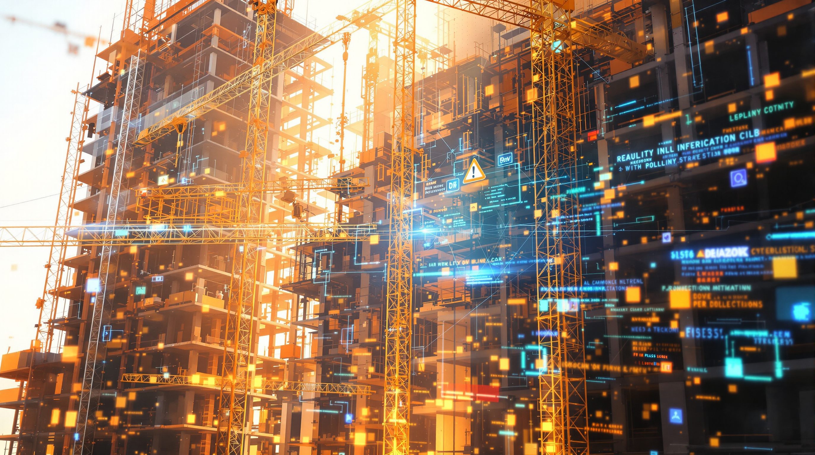
Reality capture is how a project measures the second building - the one that actually got built. Using laser scanning and photogrammetry, it records the physical site as dense 3D data (a *point cloud*), a measured snapshot of what exists to within millimetres. Overlay that captured reality on the design model and the project can see, directly and quantitatively, where as-built departs from as-designed - a comparison that used to depend on a surveyor with a tape and a good eye, done in spots, and now can be done comprehensively. This lesson is about using that comparison as a management instrument: catching deviations early, where AI genuinely helps and where it does not, and - in the honest spirit of the course - being clear-eyed about accuracy, because a scan is a measurement with error, a tolerance is an engineering judgement, and the decision about whether a deviation matters belongs to a qualified professional, not to the software that coloured it red. (The how of capture itself is the subject of the Reality Capture and Scan-to-BIM course; here we use it.)
As-designed model (intent) + as-built point cloud (fact) -> overlay -> measured deviation map. AI classifies + flags, doesn't decide. Scans have error; tolerance is an engineer's call, not the colour map's.
What reality capture is - measuring the building that exists
Reality capture is the family of techniques that turn a physical space into accurate 3D data. Two dominate on construction sites. Laser scanning (LiDAR) sweeps a space with a laser and measures the distance to millions of points on every surface, building a dense, dimensionally accurate *point cloud* - literally a cloud of measured points, each with a position in space, that together describe the walls, floors, columns, pipes and everything else exactly as they physically are. Photogrammetry achieves something similar from ordinary photographs: take many overlapping photos of a space or a building (often from a drone) and software reconstructs 3D geometry from the parallax between them, producing a point cloud or a textured mesh. Laser scanning is generally more accurate and works in poor light; photogrammetry is cheaper, needs only a camera, and gives colour and texture, but is more sensitive to lighting and surfaces. Both answer the same question: what is physically here, and where exactly?
The key idea for this lesson is that reality capture produces a *measured snapshot of reality* - not a drawing of what should exist, but a record of what does, to a stated accuracy. That snapshot has many uses across a building's life: capturing an existing building before a refurbishment, recording hidden services before they are covered, documenting the true as-built for the owner, feeding a digital twin. But its most powerful use during construction is comparison. A design model is a statement of intent - the building as it should be. A point cloud is a statement of fact - the building as it is. Because both are 3D and can be brought into the same coordinate space, they can be laid directly on top of each other, and the difference between them measured. That overlay is the heart of this lesson. It is worth being precise that reality capture is a *sensing and measuring* activity - the detailed how of scanning, registering scans together and turning them into usable models (scan-to-BIM) is a substantial craft covered in its own Studio Matrx course. Here we take the captured reality as given and focus on the management value: what the comparison against the model reveals, where AI speeds it up, and how honest you must be about the accuracy of both the scan and the judgement built on it.
Reality capture = measure what physically exists as 3D data. Laser scan (LiDAR) or photogrammetry -> a point cloud = a measured snapshot of reality (not a drawing of intent).
As-built versus as-designed - the deviation comparison
The central move is to bring two 3D things into the same coordinate space and measure their difference: the as-designed model (intent) and the as-built point cloud (fact). Register the scan to the model's coordinates, overlay them, and the software can compute, surface by surface and element by element, how far reality departs from design - often shown as a colour map where green means within tolerance and hotter colours mean larger deviation. Suddenly the questions that used to be answered by spot-checks with a tape become comprehensive and quantitative. Is the slab level, and if not, by how much and where? Did the wall get built on its gridline? Is that column plumb? Has an opening ended up in the right place? Is there enough clear space above the ceiling for the ducts that have not been installed yet? Was a clash that the model flagged actually built as a clash?
The value of catching these early is enormous, because deviations compound. A frame that drifts thirty millimetres is trivial in isolation, but the facade fabricated to the model's dimensions will not fit it, and that is discovered at installation, on the critical path, at maximum cost. A slab poured out of level is cheap to shim before the raised floor goes down and expensive to discover after. A clash built in is a fraction of the cost to fix when the scan catches it this week versus when the pipe has to be rerouted around finished work next month. Reality capture against the model turns the expensive late surprise into a cheap early correction - the same early-warning economics as progress monitoring, but at the level of geometry and quality rather than schedule. It also creates an objective as-built record: what was actually built, measured and dated, which is invaluable for the next trade's setting-out, for the owner's facility model, and for the dispute where the question is whether the works conform. The essential discipline, returned to below, is that the comparison reveals a *measured difference*; whether that difference *matters* - whether it is within tolerance, whether it is acceptable, whether it must be corrected - is an engineering and contractual judgement, not something the colour map decides.
Where AI helps - and where it does not
Reality capture existed before modern AI, but AI is making the comparison faster, cheaper and more automatic, which is what moves it from an occasional specialist exercise to something a project can do routinely. A raw point cloud is just millions of undifferentiated points; the laborious part has always been making sense of it - deciding which points are a wall, which a pipe, which scaffolding to ignore - and aligning it to the model. AI helps in several places. Classification and segmentation (the computer vision of Lesson 5.1, applied to 3D) can label the point cloud into elements - this cluster of points is a column, this a duct, this a floor - automating the tedious first step of scan-to-BIM. Registration and alignment of the scan to the model, and of multiple scans to each other, can be assisted or automated. Deviation detection can be run automatically and flagged by severity, so a human is pointed at the twenty places that matter rather than scrolling a whole floor. And generative and vision tools can help turn a validated point cloud into an as-built model.
What AI does not do is decide. It can measure that a wall is forty millimetres off and colour it red; it cannot tell you whether forty millimetres is within the specified tolerance for that element, whether it compromises anything structural or functional, or what to do about it - those are determinations for the engineer, the surveyor and the specification. It also inherits every limit of computer vision: it misclassifies points (calling scaffolding a permanent element, missing a partly-occluded duct), it is confused by clutter, reflective and glazed surfaces and moving objects, and it states its mistakes with the same quiet confidence as its correct answers. Automated deviation flags therefore carry false positives (flagging temporary works, or a deviation that is actually within tolerance) and false negatives (missing a real one behind an obstruction). So AI is a genuine accelerator of a valuable comparison - it makes routine what was once rare - but it accelerates the *measurement and the flagging*, not the *judgement*. The point cloud plus AI gets a qualified professional to the right twenty questions far faster; answering those questions, and owning the answers, stays firmly human.
Honest about accuracy - and who owns the tolerance
Everything in this lesson rests on measurements, and measurements have error, so the honest user treats a scan comparison as precise-looking but bounded, not as ground truth beyond question. A point cloud has an accuracy - millimetres for a good laser scan at close range, more for photogrammetry or long range - and that accuracy degrades with distance, poor light, reflective or dark or wet surfaces, and movement during capture. Bringing scans together (registration) introduces its own error, and aligning the scan to the model introduces more; a small registration error can smear across a whole floor and make good work look deviant or hide a real problem. The design model may itself be imperfect or out of date. So a deviation reported as "forty-two millimetres" is really "about forty millimetres, plus or minus the combined error of the scan, the registration and the model" - close enough to be extremely useful, but not a number to wield without understanding its uncertainty. Reading a coloured deviation map as exact truth is its own automation-bias trap.
The deeper point is about tolerance, and it is where accountability lands. Construction is not built to be perfect; it is built to tolerances - allowable deviations set by codes, standards, the specification and engineering judgement, because some deviation is normal, safe and acceptable and some is not. Reality capture measures the deviation; it does not set the tolerance and it cannot decide whether a given deviation is acceptable. That decision - is this within tolerance, does it matter structurally or functionally, must it be corrected, is a waiver appropriate - belongs to the qualified engineer, surveyor and the professionals bound by the specification and the governing codes (in India, the National Building Code, the relevant IS standards, and the contract). The software's red patch is a prompt to investigate, never a verdict. Used with that discipline, reality capture against the model is one of the most valuable quality and coordination instruments a modern project has: it catches real errors early and cheaply and leaves an objective as-built record. Used naively - trusting the colour map, ignoring the error bars, letting the scan "decide" conformance - it produces confident, precise-looking, wrong conclusions about a physical building people will occupy. In India, where reality capture is spreading on large and complex projects but scanning discipline and current models are uneven, the same rule holds: measure comprehensively, understand the accuracy, and keep the tolerance and conformance decisions with the accountable professionals and the codes.
A point cloud is a measurement with error
Accuracy is bounded, not exact
Scan accuracy degrades with distance, poor light and reflective or wet surfaces; registration and model error add more. A precise-looking deviation figure carries uncertainty and must be read with it. Reality Capture & Scan-to-BIM course.
Deviation is not the same as non-conformance
Tolerance is an engineering judgement
Construction is built to tolerances set by codes, standards and the specification. The scan measures the deviation; whether it is acceptable is decided by the engineer, surveyor and the governing codes (NBC India, IS), not the colour map. Module 6.3.
AI accelerates measurement, not judgement
Where AI helps in the comparison
AI classifies the point cloud, assists registration and flags deviations by severity, making the comparison routine - but it inherits computer vision's false positives and negatives and never decides conformance. Lesson 5.1.
An objective, dated as-built record
Value beyond the immediate check
Measured, dated as-built data supports the next trade's setting-out, the owner's facility model and conformance disputes better than memory - provided its accuracy is understood. Module 7.2.
Workshop - reason through an as-built versus as-designed comparison
This workshop walks a real or imagined deviation from capture to decision, to make concrete both the value of the comparison and the line between measuring a deviation and judging whether it matters.
Just an element you understand and a notebook. No scanning software - this workshop is about the logic of the as-built comparison and the boundary between measurement and conformance judgement; the capture craft is its own course, and tolerance and conformance decisions always stay with the qualified professionals and the codes.
Goal: understand the as-built comparison and the measurement-versus-judgement boundary on a concrete case
Inputs: a building or element you know (or a plausible example) + this lesson + a notebook
Time: ~40 minutes
- 1Pick an element where deviation matters - a slab that must be level for a raised floor, a wall a facade will fix to, a shaft ducts must pass through. Note what as-designed says it should be.
- 2Describe the capture: how would you scan it (laser or photogrammetry), and what would degrade the accuracy here (distance, light, reflective or wet surfaces, occlusion, movement)?
- 3Imagine the overlay result: a measured deviation, say a wall 35 millimetres off gridline. List what you would need to know before acting - the specified tolerance, the error in the scan and registration, whether the model is current.
- 4Separate measurement from judgement: write who measures the deviation (the scan and AI) and who decides whether it is acceptable, must be corrected, or can be waived (the engineer, surveyor, specification, codes).
- 5Write a one-paragraph reflection: how the comparison catches the problem early and cheaply, why the deviation figure is precise-looking but bounded, and why the conformance decision stays with the accountable professionals - flagged as reasoning.
You’ll walk away with
A one-page walk-through: an element, its capture and accuracy risks, an imagined deviation, the information needed to judge it, and a clear split between what the scan measures and what a professional decides. Keep it with your Lesson 5.2 readiness check.
Three altitudes on the same idea
Read the band that fits you — or all three.
For the architect or project manager, reality capture against the model gives you a comprehensive, quantitative check of as-built against as-designed that used to be a surveyor's spot-check - and its discipline is respecting the error bars and keeping tolerance and conformance judgements with the qualified professionals. Overlaying a point cloud on the model catches drifted walls, out-of-level slabs, misplaced openings and built clashes early, where correction is cheap, and leaves an objective, dated as-built record for setting-out, the owner's model and disputes. AI increasingly makes this routine - classifying the cloud, aligning it, flagging deviations by severity - but it accelerates the measurement, not the decision, and it inherits computer vision's false positives and negatives. Remember that scans, registration and the model all carry error, so a deviation figure is precise-looking but bounded; and remember that construction is built to tolerances the software neither sets nor interprets. Use it to point the engineer and surveyor at the deviations that matter; keep the conformance, tolerance and correction decisions with them and the governing codes (NBC India, IS, the specification).
For the contractor or site team, reality capture is the tool that catches the dimensional problem before it becomes an installation crisis - and it is most dangerous when a clean colour map is trusted over the survey and the spec. A weekly scan overlaid on the model shows you the wall that drifted, the slab that is out of level and the clash that got built while it is still cheap to fix, and it gives you a measured as-built for setting out the next trade and for defending your work if conformance is disputed. But a point cloud is a measurement with error - distance, poor light, reflective and wet surfaces and registration all degrade it - and the AI that labels and flags it makes confident mistakes, calling temporary works permanent or missing a hidden duct. So use the scan to find where to look, then verify on site, and never let a red patch or a green one substitute for the surveyor's check and the specified tolerance. Whether a deviation is acceptable is an engineering and contract call, not the software's; that decision stays with the qualified people.
Reality capture against the model is the sharpest example of AI turning the physical building into checkable data - and of why measurement is not the same as judgement. The idea: a design model states how the building should be (as-designed), reality capture - laser scanning and photogrammetry - measures how it actually is as a 3D point cloud (as-built), and overlaying the two reveals every deviation, comprehensively and quantitatively, catching errors while they are cheap to fix. Learn what a point cloud is, the as-built-versus-as-designed comparison and its early-correction value, where AI genuinely helps (classifying and segmenting the cloud, registration, automated deviation flagging, scan-to-BIM) and where it does not (deciding whether a deviation matters). Then learn the two honesty points that define professional use: scans, registration and models all carry error, so a precise-looking deviation figure is bounded, not exact; and construction is built to tolerances that codes, specifications and engineers set and interpret, so the software measures the deviation but a qualified professional decides whether it matters. The detailed craft of capturing and processing scans is its own course; here the skill is using the comparison as honest management intelligence.
“Scan the building, overlay it on the BIM model, and the software tells you exactly what is wrong - every deviation, precisely measured - so you can rely on the coloured deviation map to know whether the building was built correctly and to sign off conformance.”
Do it yourself
No tools needed - reason it through.
- 1What is a point cloud, and how do laser scanning and photogrammetry each produce one?
- 2Explain the as-built versus as-designed comparison and why catching a deviation early is so much cheaper than catching it late.
- 3Where does AI genuinely help in the scan-to-model comparison, and where does it stop?
- 4Why is a deviation figure like '42 millimetres' precise-looking but bounded? Name three sources of error.
- 5Distinguish measuring a deviation from judging non-conformance, and say who owns each.
The one line to carry out
Peer-reviewed journals & authoritative standards
- 01Laser scanning — Wikipedia - Laser scanning, 2026.
- 02Photogrammetry — Wikipedia - Photogrammetry, 2026.
- 03Building information modeling — Wikipedia - Building information modeling, 2026.
- 04Digital twin — Wikipedia - Digital twin, 2026.
Reality capture and progress monitoring both depend on getting good imagery and scans off the site in the first place. That capture comes from a growing layer of eyes and instruments - drones, cameras, wearables and sensors. Next, the sensing layer itself.
The author
Amogh N P
Architect, interior designer, and creative polymath. Studio Matrx began in his notebooks — his vision of design made honest, useful, and open to everyone. Its Academy is written and taught in his memory, and free, forever.
More about Amogh →