
Techniques for Various Scales
Data vs documentation — and the technique spectrum.
A folder of photographs is not documentation. Learn the distinction between data (raw capture) and documentation (data organised, interpreted, metadata-tagged and archived); the spectrum of techniques from hand survey to HBIM, and what each is good for; Historic England's four levels of survey, chosen to suit purpose and significance; and documenting at object, building, site and landscape scales. Try the documentation-technique explorer.
Learning objectives
By the end of this lesson, you will be able to — mapped to the course outcomes for Advanced Practice & Technique in Conservation:
Distinguish data from documentation and explain why it matters.
Match a documentation technique to a subject and a purpose.
Choose a Historic England survey level for a given need.
Document at object, building, site and landscape scales.
Data vs documentation
Data is raw capture; documentation is data interpreted, given metadata and archived — and the technique must match the scale, from an object to a landscape.[1, 2]
Raw vs meaningful
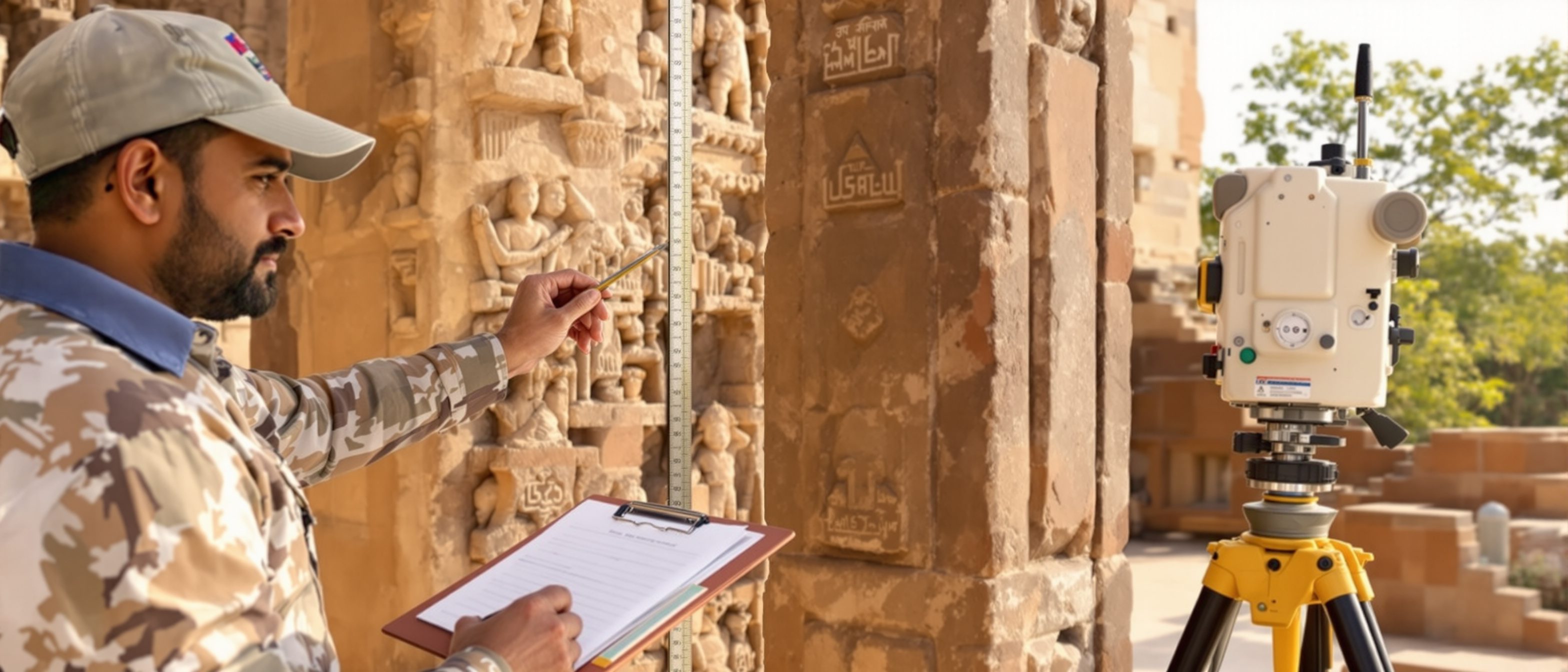
DATA is the raw, unprocessed capture — tape measurements, total-station coordinates, photographs, a laser-scan POINT CLOUD, drone imagery. It is quantity without context. DOCUMENTATION is data SELECTED, organised, interpreted, structured and communicated for a purpose — measured drawings, condition reports, an indexed archive with metadata. MISCONCEPTION→correct: 'a photograph is documentation' — a photo is DATA; it becomes documentation only when measured/scaled where needed, interpreted, given metadata and ARCHIVED. Capturing more data does not by itself produce better documentation.[1, 2]
The technique spectrum & levels
The spectrum runs hand survey → rectified photo → photogrammetry → laser scanning → drone → HBIM; and the four survey levels match effort to purpose — a point cloud is raw data, not a finished drawing.[2, 4]
Hand to digital
Documentation techniques run a spectrum: HAND/measured survey (cheap, simple, observer-dependent); RECTIFIED PHOTOGRAPHY (flat surfaces only); PHOTOGRAMMETRY (3D from overlapping photos); TERRESTRIAL LASER SCANNING (dense point clouds, fast, costly); TOTAL STATION/GNSS (precise control, georeferencing); UAV/DRONE (aerial, regulated); and HBIM (a data-rich model). MISCONCEPTION→correct: 'laser scanning replaces drawing' — a point cloud is RAW DATA; you still interpret it into measured drawings and models. Scanning replaces manual MEASURING, not interpretation.[2, 4]
Explore the techniques
Pick a documentation technique and read what it is, what it is best for, and where it falls short — so you can match the method to the subject and the purpose.
Documentation techniques · pick one
Hand / measured survey
What it is: Tape, plumb-bob, offsets and running dimensions turned into hand-drawn measured drawings.
Best for: Small, simple elements; low cost; training the eye to read a building.
Limit: Slow, observer-dependent and least accurate on complex or curved geometry.
A point cloud or a folder of photos is data — it becomes documentation only when interpreted and archived.
At a glance
| Aspect | Detail | Note |
|---|---|---|
| Nature | Data: raw capture | Documentation: interpreted + archived |
| Example | A point cloud, a photo | A measured drawing, a record |
| Level 1 | Basic visual/photographic record | Many buildings, rapid |
| Level 4 | Comprehensive analytical record | Special importance + documentary sources |
| Choose the level by | Purpose and significance | Not 'as much as possible' |
Key terms
Raw, unprocessed capture — measurements, points, images — quantity without context.
Data organised, interpreted, metadata-tagged and archived for a purpose.
A dense set of x, y, z points captured by laser scanning or photogrammetry — raw data.
A photo geometrically corrected to remove perspective, for flat surfaces.
Historic England's Level 1 (basic) to Level 4 (comprehensive analytical).
Historic Building Information Modelling — a data-rich model of a heritage building.
Studio task
For a heritage site you know, choose the right documentation technique for THREE scales — a carved object, a façade, and the whole site — and justify each using the explorer. Then decide which Historic England survey level (1–4) the building warrants and why, and explain in one line why a laser-scan point cloud is data, not documentation.
Self-assessment
1. The difference between data and documentation is that documentation is —
2. Historic England's survey levels run from —
3. A laser-scan point cloud is —
Recap
References & further reading
- [1]ICOMOS Recording Principles (1996) — the purpose and content of recording (data vs documentation).
- [2]Historic England, Understanding Historic Buildings: A Guide to Good Recording Practice — the four levels of survey.
- [3]Swallow, Watt & Ashton, Measurement and Recording of Historic Buildings (Donhead) — measured survey techniques.
- [4]Historic England, 3D Laser Scanning for Heritage / Metric Survey Specifications — the technique spectrum.
Further reading
- Historic England — Understanding Historic Buildings (recording levels).
- Swallow, Watt & Ashton — Measurement and Recording of Historic Buildings.
- Andrews, Bedford & Bryan / Historic England — Metric Survey for Cultural Heritage.
Sources gathered and fact-checked June 2026. Published values vary by source, sample and method — treat as indicative and confirm against the cited standard before structural use.
The author
Amogh N P
Architect, interior designer, and creative polymath. Studio Matrx began in his notebooks — his vision of design made honest, useful, and open to everyone. Its Academy is written and taught in his memory, and free, forever.
More about Amogh →